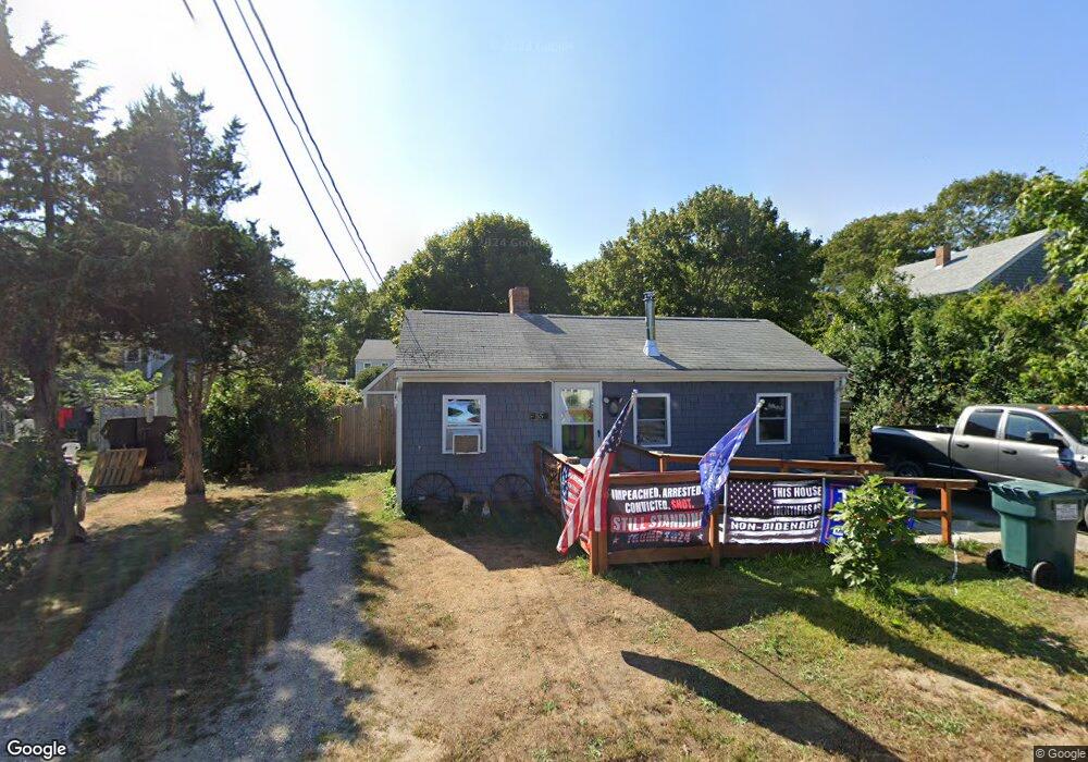
55 Pine Grove Ave Hyannis, MA 02601
Hyannis NeighborhoodEstimated Value: $434,759 - $507,000
3
Beds
1
Bath
780
Sq Ft
$611/Sq Ft
Est. Value
About This Home
This home is located at 55 Pine Grove Ave, Hyannis, MA 02601 and is currently estimated at $476,940, approximately $611 per square foot. 55 Pine Grove Ave is a home located in Barnstable County with nearby schools including Hyannis West Elementary School, Barnstable United Elementary School, and Barnstable Intermediate School.
Ownership History
Date
Name
Owned For
Owner Type
Purchase Details
Closed on
Jun 17, 2024
Sold by
Peters Nicole I
Bought by
Ricci-Peters Nicole I and Lynch Randall F
Current Estimated Value
Purchase Details
Closed on
Jul 28, 2023
Sold by
Peters Everett Est and Peters
Bought by
Peters Nicole
Purchase Details
Closed on
Jun 13, 2017
Sold by
Peters Pauline L
Bought by
Peters Everett and Peters Rebecca
Create a Home Valuation Report for This Property
The Home Valuation Report is an in-depth analysis detailing your home's value as well as a comparison with similar homes in the area
Home Values in the Area
Average Home Value in this Area
Purchase History
We collect this data history from publicly available records. To have your information removed, we recommend requesting removal directly through your county’s website.
| Date | Buyer | Sale Price | Title Company |
|---|---|---|---|
| Ricci-Peters Nicole I | -- | None Available | |
| Ricci-Peters Nicole I | -- | None Available | |
| Peters Nicole | -- | None Available | |
| Peters Nicole | -- | None Available | |
| Peters Everett | -- | -- | |
| Peters Pauline L | -- | -- | |
| Peters Everett | -- | -- |
Source: Public Records
Mortgage History
We collect this data history from publicly available records. To have your information removed, we recommend requesting removal directly through your county’s website.
| Date | Status | Borrower | Loan Amount |
|---|---|---|---|
| Previous Owner | Peters Everett | $7,735 |
Source: Public Records
Tax History
| Year | Tax Paid | Tax Assessment Tax Assessment Total Assessment is a certain percentage of the fair market value that is determined by local assessors to be the total taxable value of land and additions on the property. | Land | Improvement |
|---|---|---|---|---|
| 2025 | $3,048 | $328,800 | $125,600 | $203,200 |
| 2024 | $2,937 | $324,500 | $125,600 | $198,900 |
| 2023 | $2,351 | $245,700 | $120,500 | $125,200 |
| 2022 | $1,985 | $171,600 | $89,300 | $82,300 |
| 2021 | $2,001 | $168,000 | $84,600 | $83,400 |
| 2020 | $2,123 | $172,200 | $84,600 | $87,600 |
| 2019 | $1,781 | $141,600 | $79,900 | $61,700 |
| 2018 | $1,910 | $155,300 | $84,100 | $71,200 |
| 2017 | $1,619 | $135,000 | $64,300 | $70,700 |
| 2016 | $1,625 | $138,500 | $67,800 | $70,700 |
| 2015 | $1,690 | $146,100 | $63,200 | $82,900 |
Source: Public Records
Map
Nearby Homes
- 24 Bettys Pond Rd Unit K
- 24 Betty's Pond Rd Unit 1K
- 26 Bettys Pond Rd Unit 9
- 49 Orrs Ave
- 147 Bristol Ave
- 64 Pitchers Way
- 98 Wagon Ln
- 28 Janice Ln
- 97 Bassett Ln
- 125 Sea St
- 57 Suffolk Ave
- 120 Bearses Way
- 3 Bristol Ave
- 84 Bearses Way
- 50 Redwood Ln
- 62 Pine Ave
- 54 Melbourne Rd
- 54 Murphy Rd
- 157 Compass Cir
- 14 Marston Ave
- 53 Pine Grove Ave
- 65 Pine Grove Ave
- 45 Pine Grove Ave
- 110 W Main St Unit 29
- 110 W Main St Unit 28
- 110 W Main St Unit 27
- 110 W Main St Unit 26
- 110 W Main St Unit 25
- 110 W Main St Unit 24
- 110 W Main St Unit 23
- 110 W Main St Unit 22
- 110 W Main St Unit 21
- 110 W Main St Unit 20
- 110 W Main St Unit 19
- 110 W Main St Unit 18
- 110 W Main St Unit 17
- 110 W Main St Unit 16
- 110 W Main St Unit 15
- 110 W Main St Unit 14
- 110 W Main St Unit 13
Your Personal Tour Guide
Ask me questions while you tour the home.