55 Range Rd Southport, CT 06890
Estimated Value: $2,025,000 - $2,302,735
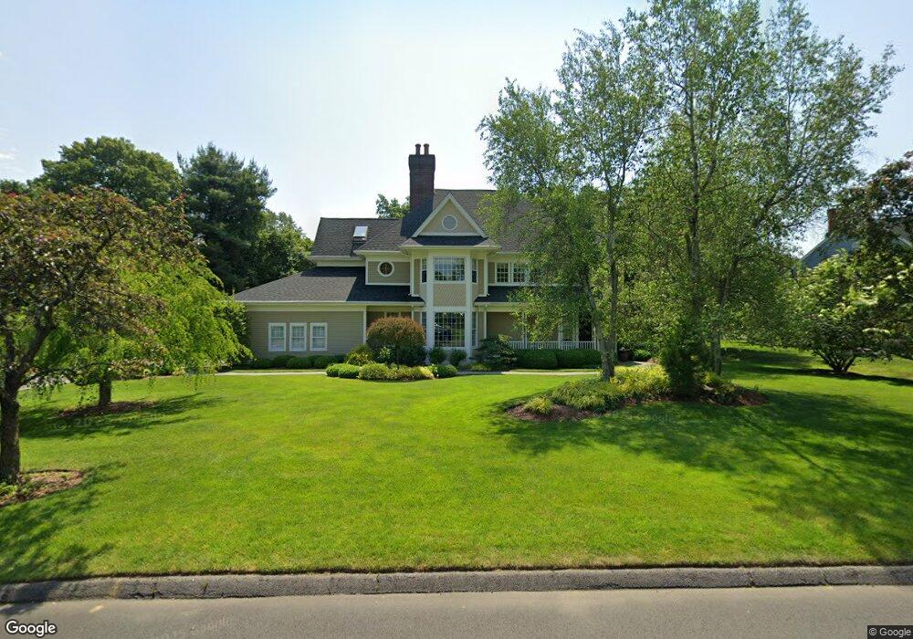
About This Home
This home is located at 55 Range Rd, Southport, CT 06890 and is currently estimated at $2,109,184, approximately $526 per square foot. 55 Range Rd is a home located in Fairfield County with nearby schools including Dwight Elementary School, Roger Ludlowe Middle School, and Fairfield Ludlowe High School.
Ownership History
We collect this data history from publicly available records. To have your information removed, we recommend requesting removal directly through your county’s website.
Purchase Details
Home Financials for this Owner
Home Financials are based on the most recent Mortgage that was taken out on this home.Purchase History
We collect this data history from publicly available records. To have your information removed, we recommend requesting removal directly through your county’s website.
| Date | Buyer | Sale Price | Title Company |
|---|---|---|---|
| $600,000 | -- |
Mortgage History
We collect this data history from publicly available records. To have your information removed, we recommend requesting removal directly through your county’s website.
| Date | Status | Borrower | Loan Amount |
|---|---|---|---|
| Closed | $620,000 | ||
| Closed | $410,000 | ||
| Closed | $187,450 |
Tax History
We collect this data history from publicly available records. To have your information removed, we recommend requesting removal directly through your county’s website.
| Year | Tax Paid | Tax Assessment Tax Assessment Total Assessment is a certain percentage of the fair market value that is determined by local assessors to be the total taxable value of land and additions on the property. | Land | Improvement |
|---|---|---|---|---|
| 2025 | $20,431 | $719,670 | $335,930 | $383,740 |
| 2024 | $20,063 | $719,110 | $335,930 | $383,180 |
| 2023 | $19,783 | $719,110 | $335,930 | $383,180 |
| 2022 | $19,589 | $719,110 | $335,930 | $383,180 |
| 2021 | $19,402 | $719,110 | $335,930 | $383,180 |
| 2020 | $19,106 | $713,160 | $332,290 | $380,870 |
| 2019 | $19,106 | $713,160 | $332,290 | $380,870 |
| 2018 | $18,799 | $713,160 | $332,290 | $380,870 |
| 2017 | $18,414 | $713,160 | $332,290 | $380,870 |
| 2016 | $18,150 | $713,160 | $332,290 | $380,870 |
| 2015 | $17,619 | $710,710 | $350,980 | $359,730 |
| 2014 | $17,145 | $702,660 | $350,980 | $351,680 |
Map
- 42 Anvill Rd
- 10 Grist Mill Ln
- 264 Half Mile Rd
- 28 Bulkley Ave N
- 157 Hulls Hwy
- 790 Cedar Brook Ln
- 9 Sturges Hwy
- 1 Coastal Ct
- 12 Hulls Hwy Unit 12
- 49 Southport Woods Dr
- 18 Southport Woods Dr
- 688 Hulls Farm Rd
- 70 Southport Place
- 844 Mill Hill Terrace
- 71 Aberdeen Way Unit 71
- 10 Sprucewood Ln
- 127 Spruce St
- 280 Mill Hill Rd
- 2 Elmwood Dr Unit 2
- 7 High Gate Rd
Ask me questions while you tour the home.