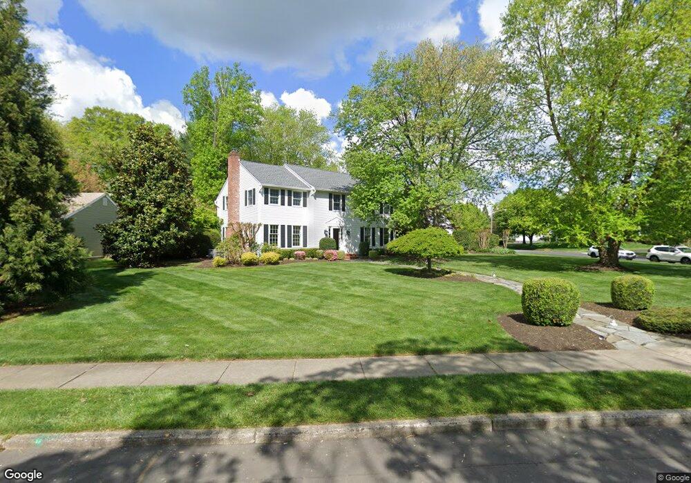
551 Sentinel Rd Moorestown, NJ 08057
Estimated Value: $894,052 - $1,188,000
Studio
--
Bath
2,833
Sq Ft
$363/Sq Ft
Est. Value
About This Home
This home is located at 551 Sentinel Rd, Moorestown, NJ 08057 and is currently estimated at $1,029,013, approximately $363 per square foot. 551 Sentinel Rd is a home located in Burlington County with nearby schools including George C. Baker Elementary School, Moorestown Upper Elementary School, and William Allen Middle School.
Ownership History
Date
Name
Owned For
Owner Type
Purchase Details
Closed on
Sep 27, 2005
Sold by
Glenz Harry W and Glenz Jacqueline J
Bought by
Sides Charles and Mchugh Claire
Current Estimated Value
Home Financials for this Owner
Home Financials are based on the most recent Mortgage that was taken out on this home.
Original Mortgage
$120,350
Outstanding Balance
$94,394
Interest Rate
6.5%
Mortgage Type
Credit Line Revolving
Estimated Equity
$934,619
Create a Home Valuation Report for This Property
The Home Valuation Report is an in-depth analysis detailing your home's value as well as a comparison with similar homes in the area
Home Values in the Area
Average Home Value in this Area
Purchase History
| Date | Buyer | Sale Price | Title Company |
|---|---|---|---|
| Sides Charles | $600,000 | Integrity Title Agency Inc |
Source: Public Records
Mortgage History
| Date | Status | Borrower | Loan Amount |
|---|---|---|---|
| Open | Sides Charles | $120,350 | |
| Open | Sides Charles | $359,650 |
Source: Public Records
Tax History
| Year | Tax Paid | Tax Assessment Tax Assessment Total Assessment is a certain percentage of the fair market value that is determined by local assessors to be the total taxable value of land and additions on the property. | Land | Improvement |
|---|---|---|---|---|
| 2025 | $15,572 | $548,900 | $236,400 | $312,500 |
| 2024 | $15,100 | $548,900 | $236,400 | $312,500 |
| 2023 | $15,100 | $548,900 | $236,400 | $312,500 |
| 2022 | $14,947 | $548,900 | $236,400 | $312,500 |
| 2021 | $14,749 | $548,900 | $236,400 | $312,500 |
| 2020 | $14,656 | $548,900 | $236,400 | $312,500 |
| 2019 | $13,343 | $548,900 | $236,400 | $312,500 |
| 2018 | $13,447 | $548,900 | $236,400 | $312,500 |
| 2017 | $13,642 | $548,900 | $236,400 | $312,500 |
| 2016 | $13,595 | $548,900 | $236,400 | $312,500 |
| 2015 | $13,909 | $534,400 | $236,400 | $298,000 |
| 2014 | $12,858 | $534,400 | $236,400 | $298,000 |
Source: Public Records
Map
Nearby Homes
- 628 Windsock Way
- 807 Westfield Rd
- 106 Ashley Ct
- 744 Signal Light Rd
- 745 N Stanwick Rd
- 863 Golf View Rd
- 408 N Stanwick Rd
- 697 Garwood Rd
- 315 Linden St
- 347 Tom Brown Rd
- 4327 Bridgeboro Rd
- 343 Tom Brown Rd
- 201 E Oak Ave
- 396 E Linden St
- 119 Linda Ave
- 740 Garwood Rd
- 210 E Oak Ave
- 16 Windermere Dr
- 205 E Central Ave
- 109 Congressional Ct
- 547 Sentinel Rd
- 600 Windsock Way
- 550 Sentinel Rd
- 604 Windsock Way
- 543 Sentinel Rd
- 554 Sentinel Rd
- 559 Sentinel Rd
- 608 Windsock Way
- 1 Sheldon Place
- 558 Sentinel Rd
- 7 Sheldon Place
- 2 Tyndale Ct
- 539 Sentinel Rd
- 2 Sheldon Place
- 563 Sentinel Rd
- 555 Eaglebrook Dr
- 1 Tyndale Ct
- 536 Sentinel Rd
- 6 Sheldon Place
- 3 Tyndale Ct
Your Personal Tour Guide
Ask me questions while you tour the home.