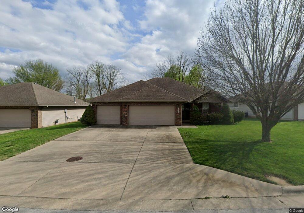
5512 W Bayberry Dr Springfield, MO 65802
Estimated Value: $250,769 - $287,000
3
Beds
2
Baths
1,530
Sq Ft
$172/Sq Ft
Est. Value
About This Home
This home is located at 5512 W Bayberry Dr, Springfield, MO 65802 and is currently estimated at $263,192, approximately $172 per square foot. 5512 W Bayberry Dr is a home located in Greene County with nearby schools including Price Elementary School, Republic Middle School, and Republic High School.
Ownership History
Date
Name
Owned For
Owner Type
Purchase Details
Closed on
Mar 25, 2010
Sold by
Stubblefield Kory D and Stubblefield Erin C
Bought by
Glad Gary
Current Estimated Value
Purchase Details
Closed on
May 18, 2007
Sold by
Mcbride Properties Llc
Bought by
Stubblefield Kory D
Home Financials for this Owner
Home Financials are based on the most recent Mortgage that was taken out on this home.
Original Mortgage
$30,800
Interest Rate
5.92%
Mortgage Type
Stand Alone Second
Create a Home Valuation Report for This Property
The Home Valuation Report is an in-depth analysis detailing your home's value as well as a comparison with similar homes in the area
Home Values in the Area
Average Home Value in this Area
Purchase History
| Date | Buyer | Sale Price | Title Company |
|---|---|---|---|
| Glad Gary | -- | None Available | |
| Stubblefield Kory D | -- | None Available |
Source: Public Records
Mortgage History
| Date | Status | Borrower | Loan Amount |
|---|---|---|---|
| Previous Owner | Stubblefield Kory D | $30,800 | |
| Previous Owner | Stubblefield Kory D | $123,200 |
Source: Public Records
Tax History
| Year | Tax Paid | Tax Assessment Tax Assessment Total Assessment is a certain percentage of the fair market value that is determined by local assessors to be the total taxable value of land and additions on the property. | Land | Improvement |
|---|---|---|---|---|
| 2025 | $1,914 | $38,820 | $8,550 | $30,270 |
| 2024 | $1,914 | $34,140 | $4,750 | $29,390 |
| 2023 | $1,905 | $34,140 | $4,750 | $29,390 |
| 2022 | $1,588 | $28,200 | $4,750 | $23,450 |
| 2021 | $1,589 | $28,200 | $4,750 | $23,450 |
| 2020 | $1,226 | $23,640 | $4,750 | $18,890 |
| 2019 | $1,222 | $23,640 | $4,750 | $18,890 |
| 2018 | $1,111 | $21,380 | $4,750 | $16,630 |
| 2017 | $1,102 | $20,730 | $4,750 | $15,980 |
| 2016 | $1,063 | $20,730 | $4,750 | $15,980 |
| 2015 | $1,055 | $20,730 | $4,750 | $15,980 |
| 2014 | $1,039 | $20,270 | $4,750 | $15,520 |
Source: Public Records
Map
Nearby Homes
- 5601 W Pecan St
- 5565 W Pine St
- 5607 W Pine St
- 1343 S Mulberry Ave
- 5462 W Lombard St
- 987 S Natalie Ave
- 795 S Natalie Ave
- 5163 W Sunstruck St
- 768 S Long Dr
- 5004 W Skyler Dr
- 5817 W Alexa Ln
- 000 W Farm Road 148
- 1261 S Erika Ave
- 000 W Independence Dr
- 4905 W Kingsbury St
- 1883 S Farm Road 107
- 431 S Bernier Ave
- 4881 W Washita St
- Tbd W Farm Road 148
- 4800 W Mount Vernon St
- 5520 W Bayberry Dr
- 5504 W Bayberry Dr
- 5492 W Bayberry Dr
- 1104 S Red Cedar Ave
- 1101 S Red Cedar Ave
- 5528 Bayberry Dr W
- 5484 W Bayberry Dr
- 1093 S Red Cedar Ave
- 1096 S Red Cedar Ave
- 5536 Bayberry Dr W
- 5477 Basswood Ct
- 1110 S Tanner Dr
- 1110 S Tanner Ave
- 5477 Basswood Ct W
- 1132 S Tanner Dr
- 5476 W Bayberry Dr
- 1085 S Red Cedar Ave
- 1102 S Tanner Dr
- 1140 S Tanner Dr
- 1132 S Tanner Ave
Your Personal Tour Guide
Ask me questions while you tour the home.