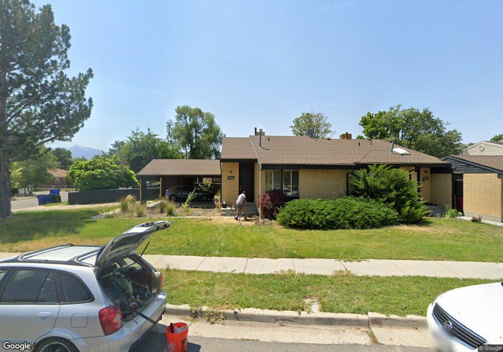
552 E Delno Cir Millcreek, UT 84107
Estimated Value: $667,154 - $825,000
6
Beds
4
Baths
2,823
Sq Ft
$252/Sq Ft
Est. Value
About This Home
This home is located at 552 E Delno Cir, Millcreek, UT 84107 and is currently estimated at $710,539, approximately $251 per square foot. 552 E Delno Cir is a home located in Salt Lake County with nearby schools including James E Moss Elementary School, Bonneville Junior High School, and Cottonwood High School.
Ownership History
Date
Name
Owned For
Owner Type
Purchase Details
Closed on
Nov 25, 2003
Sold by
Freeman Tammy S and Decker Tammy S
Bought by
Blumenthal Brad W and Blumenthal Tasha M
Current Estimated Value
Home Financials for this Owner
Home Financials are based on the most recent Mortgage that was taken out on this home.
Original Mortgage
$196,200
Outstanding Balance
$91,677
Interest Rate
6%
Mortgage Type
Unknown
Estimated Equity
$618,862
Purchase Details
Closed on
Mar 27, 1999
Sold by
Palmer C Brent and Palmer Laurie
Bought by
Decker Tammy S
Home Financials for this Owner
Home Financials are based on the most recent Mortgage that was taken out on this home.
Original Mortgage
$184,200
Interest Rate
6.73%
Create a Home Valuation Report for This Property
The Home Valuation Report is an in-depth analysis detailing your home's value as well as a comparison with similar homes in the area
Home Values in the Area
Average Home Value in this Area
Purchase History
| Date | Buyer | Sale Price | Title Company |
|---|---|---|---|
| Blumenthal Brad W | -- | Integrated Title Ins Svcs | |
| Decker Tammy S | -- | Associated Title |
Source: Public Records
Mortgage History
| Date | Status | Borrower | Loan Amount |
|---|---|---|---|
| Open | Blumenthal Brad W | $196,200 | |
| Previous Owner | Decker Tammy S | $184,200 |
Source: Public Records
Tax History
| Year | Tax Paid | Tax Assessment Tax Assessment Total Assessment is a certain percentage of the fair market value that is determined by local assessors to be the total taxable value of land and additions on the property. | Land | Improvement |
|---|---|---|---|---|
| 2025 | $3,439 | $616,100 | $179,300 | $436,800 |
| 2024 | $3,439 | $535,400 | $169,700 | $365,700 |
| 2023 | $3,331 | $500,300 | $163,200 | $337,100 |
| 2022 | $3,360 | $508,100 | $160,000 | $348,100 |
| 2021 | $3,292 | $431,600 | $123,200 | $308,400 |
| 2020 | $3,174 | $393,500 | $110,000 | $283,500 |
| 2019 | $3,054 | $369,600 | $102,800 | $266,800 |
| 2017 | $2,887 | $352,000 | $102,800 | $249,200 |
| 2016 | $2,596 | $320,100 | $86,400 | $233,700 |
Source: Public Records
Map
Nearby Homes
- 3964 S 565 E
- 532 E 3955 S Unit 6
- 522 E 3955 S
- 600 E 3990 S
- 3981 S 500 E
- 612 E Eleanor Cove Unit 32
- 596 E Savvy Cove Unit 46
- 596 E Savvy Cove Unit 41
- 616 E Eleanor Cove Cove S Unit 30
- 618 E Eleanor Cove Unit 29
- 594 E Savvy Cove Unit 40
- 594 E Savvy Cove Unit 39
- 598 E Savvy Cove Unit 42
- 621 E Eleanor Cove Unit 36
- 617 E Eleanor Cove Unit 35
- 588 E Savvy Cove Unit 38
- 588 E Savvy Cove Unit 48
- 611 E Eleanor Cove Unit 33
- 611 E Eleanor Cove Unit 47
- 623 E Eleanor Cove Unit 37
- 550 E Delno Cir
- 550 Delno Cir Unit 552
- 526 E Delno Cir
- 528 E Delno Cir
- 542 Delno Cir Unit 544
- 536 Delno Cir Unit 538
- 864 E 3955 S Unit 66
- 864 E 3955 S
- 3961 S 565 E
- 543 E Delno Dr
- 555 Delno Dr Unit 557
- 543 Delno Dr
- 549 E Delno Cir
- 549 Delno Cir Unit 551
- 3945 S 565 E
- 561 Delno Cir Unit 563
- 3943 S 565 E Unit 3945
- 537 E Delno Dr
- 537 Delno Dr
- 528 E 3955 S Unit 5
Your Personal Tour Guide
Ask me questions while you tour the home.