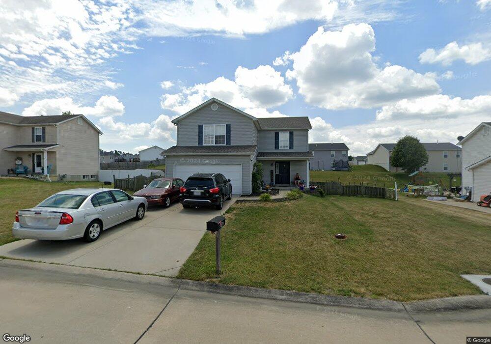
552 Falcons Flight Unit FLIGHT Wright City, MO 63390
Estimated Value: $295,629 - $419,000
Studio
3
Baths
1,680
Sq Ft
$201/Sq Ft
Est. Value
About This Home
This home is located at 552 Falcons Flight Unit FLIGHT, Wright City, MO 63390 and is currently estimated at $337,907, approximately $201 per square foot. 552 Falcons Flight Unit FLIGHT is a home located in Warren County with nearby schools including Wright City West Elementary School, Wright City East Elementary School, and Wright City Middle School.
Ownership History
Date
Name
Owned For
Owner Type
Purchase Details
Closed on
May 12, 2010
Sold by
Merrell Denise M and Merrell James H
Bought by
552 Falcons Flight Trust
Current Estimated Value
Purchase Details
Closed on
Dec 21, 2009
Sold by
Budget Homes Llc
Bought by
552 Falcons Flight Trust
Home Financials for this Owner
Home Financials are based on the most recent Mortgage that was taken out on this home.
Original Mortgage
$132,000
Interest Rate
4.82%
Mortgage Type
Construction
Create a Home Valuation Report for This Property
The Home Valuation Report is an in-depth analysis detailing your home's value as well as a comparison with similar homes in the area
Home Values in the Area
Average Home Value in this Area
Purchase History
| Date | Buyer | Sale Price | Title Company |
|---|---|---|---|
| 552 Falcons Flight Trust | -- | None Available | |
| 552 Falcons Flight Trust | -- | None Available |
Source: Public Records
Mortgage History
| Date | Status | Borrower | Loan Amount |
|---|---|---|---|
| Previous Owner | 552 Falcons Flight Trust | $132,000 |
Source: Public Records
Tax History
| Year | Tax Paid | Tax Assessment Tax Assessment Total Assessment is a certain percentage of the fair market value that is determined by local assessors to be the total taxable value of land and additions on the property. | Land | Improvement |
|---|---|---|---|---|
| 2025 | $2,362 | $33,182 | $5,565 | $27,617 |
| 2024 | $2,362 | $29,364 | $4,925 | $24,439 |
| 2023 | $2,052 | $29,364 | $4,925 | $24,439 |
| 2022 | $1,915 | $27,189 | $4,560 | $22,629 |
| 2021 | $1,915 | $27,189 | $4,560 | $22,629 |
| 2020 | $1,942 | $27,189 | $4,560 | $22,629 |
| 2019 | $1,936 | $27,189 | $0 | $0 |
| 2017 | $1,869 | $27,136 | $0 | $0 |
| 2016 | $1,879 | $27,136 | $0 | $0 |
| 2015 | -- | $24,856 | $0 | $0 |
| 2011 | -- | $24,140 | $0 | $0 |
Source: Public Records
Map
Nearby Homes
- 709 Talon Dr
- 707 Talon Dr
- 235 Winter Wheat Dr
- 327 Late Harvest Dr
- lot 16 Pine Crest Estates
- 16310 Sugar Pine Ct
- 1021 Samwise St
- 1019 Samwise St
- 1017 Samwise St
- 1015 Samwise St
- 1013 Samwise St
- 1011 Samwise St
- 416 Fredricksburg Way
- 305 Stonewall Ave
- 26950 Trembley Ln
- 7 Bridle Spur Ct
- 120 Peruque Creek Manor
- 111 Peruque Creek Manor
- 122 Peruque Creek Manor
- 121 Peruque Creek Manor
- 552 Falcons Flight
- 554 Falcons Flight Unit FLIGHT
- 554 Falcons Flight
- 550 Falcons Flight Unit FLIGHT
- 550 Falcons Flight
- 521 Falcons Flight
- 521 Falcons Flight
- 521 Falcons Flight
- 551Lot 37 Falcons Flight
- 551 Falcons Flight Lot 37
- 553Lot 36 Falcons Flight
- 523 Falcons Flight
- 548 Falcons Flight
- 556 Falcons Flight Unit FLIGHT
- 556 Falcons Flight
- 706Lot 30 Talon Dr
- 706 Talon Lot 30 Dr
- 551 Falcons Flight
- 510Lot 75 Falcons Flight
- 510 Falcons Flight Lot 75
Your Personal Tour Guide
Ask me questions while you tour the home.