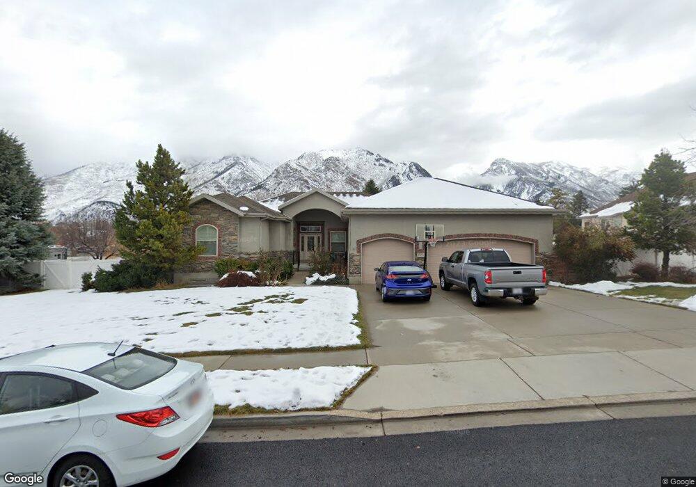
557 Cascade Ave Alpine, UT 84004
Estimated Value: $1,232,000 - $1,458,000
4
Beds
4
Baths
5,516
Sq Ft
$242/Sq Ft
Est. Value
About This Home
This home is located at 557 Cascade Ave, Alpine, UT 84004 and is currently estimated at $1,336,841, approximately $242 per square foot. 557 Cascade Ave is a home located in Utah County with nearby schools including Westfield School, Timberline Middle School, and Lone Peak High School.
Ownership History
Date
Name
Owned For
Owner Type
Purchase Details
Closed on
Jan 19, 2023
Sold by
Reed Colvin David and Dunn Kathryn
Bought by
David And Kathryn Colvin Living Trust
Current Estimated Value
Purchase Details
Closed on
Sep 10, 2015
Sold by
Colvin David Reed and Colvin Kathryn Dunn
Bought by
Colvin David Reed and Colvin Kathryn Dunn
Home Financials for this Owner
Home Financials are based on the most recent Mortgage that was taken out on this home.
Original Mortgage
$351,500
Interest Rate
3.12%
Mortgage Type
Adjustable Rate Mortgage/ARM
Purchase Details
Closed on
Aug 10, 2004
Sold by
Larson Brent H and Larson Cindy L
Bought by
Colvin David Reed and Colvin Kathryn Dunn
Home Financials for this Owner
Home Financials are based on the most recent Mortgage that was taken out on this home.
Original Mortgage
$379,900
Interest Rate
6.17%
Mortgage Type
Credit Line Revolving
Purchase Details
Closed on
Jul 10, 2003
Sold by
Larson Cindy L and Larson Brent H
Bought by
Larson Brent H and Larson Cindy L
Home Financials for this Owner
Home Financials are based on the most recent Mortgage that was taken out on this home.
Original Mortgage
$300,000
Interest Rate
5.22%
Mortgage Type
Purchase Money Mortgage
Purchase Details
Closed on
Jan 9, 2001
Sold by
Berrett Jennifer Dawn
Bought by
Abel Wayne E and Abel Natalie A
Purchase Details
Closed on
May 12, 2000
Sold by
Gray Gary R and Davis Kevin J
Bought by
Berrett Jennifer Dawn
Purchase Details
Closed on
Sep 6, 1999
Sold by
The Park At South Pointe Lc
Bought by
Gray Gary R and Davis Kevin J
Create a Home Valuation Report for This Property
The Home Valuation Report is an in-depth analysis detailing your home's value as well as a comparison with similar homes in the area
Home Values in the Area
Average Home Value in this Area
Purchase History
| Date | Buyer | Sale Price | Title Company |
|---|---|---|---|
| David And Kathryn Colvin Living Trust | -- | -- | |
| Colvin David Reed | -- | Old Republic Title | |
| Colvin David Reed | -- | Equity Title Agency Inc | |
| Larson Brent H | -- | Precision Title Company | |
| Larson Cindy L | -- | Precision Title Company | |
| Abel Wayne E | -- | Signature Title | |
| Berrett Jennifer Dawn | -- | Signature Title | |
| Gray Gary R | -- | Signature Title |
Source: Public Records
Mortgage History
| Date | Status | Borrower | Loan Amount |
|---|---|---|---|
| Previous Owner | Colvin David Reed | $351,500 | |
| Previous Owner | Colvin David Reed | $379,900 | |
| Previous Owner | Larson Brent H | $300,000 |
Source: Public Records
Tax History
| Year | Tax Paid | Tax Assessment Tax Assessment Total Assessment is a certain percentage of the fair market value that is determined by local assessors to be the total taxable value of land and additions on the property. | Land | Improvement |
|---|---|---|---|---|
| 2025 | $4,849 | $613,305 | -- | -- |
| 2024 | $4,849 | $565,125 | $0 | $0 |
| 2023 | $4,527 | $566,445 | $0 | $0 |
| 2022 | $4,367 | $530,695 | $0 | $0 |
| 2021 | $3,923 | $740,500 | $284,800 | $455,700 |
| 2020 | $3,820 | $705,700 | $258,900 | $446,800 |
| 2019 | $3,394 | $654,500 | $258,900 | $395,600 |
| 2018 | $3,284 | $625,700 | $230,100 | $395,600 |
| 2017 | $3,291 | $333,740 | $0 | $0 |
| 2016 | $3,427 | $323,950 | $0 | $0 |
| 2015 | $3,395 | $303,600 | $0 | $0 |
| 2014 | $3,304 | $292,325 | $0 | $0 |
Source: Public Records
Map
Nearby Homes
- 596 S Cascade Ct
- 875 S Blue Ridge Ln
- 250 S Main St Unit 25
- 250 S Main St Unit 9
- 250 S Main St Unit 7
- 868 S Braddock Ln
- 5046 W Jonathon Rd Unit 10
- 243 W Conrad Ct
- 259 Twin River Loop
- 682 Healey Blvd
- 30 S Main St
- 366 River Rd
- 48 N 100 E
- 202 E Alpine Dr
- 887 E Village Way
- 11056 N Manor Dr
- 11107 Manor Dr Unit 1
- 5246 W 11200 N Unit 1
- 5984 W 11200 N Unit 1
- 1063 E Alpine Dr
- 581 Cascade Ave
- 576 Cascade Ave
- 221 E Sierra Ave
- 535 Cascade Ave
- 544 Cascade Ave
- 598 Cascade Ave
- 569 Cascade Ct
- 191 Cascade Ave
- 613 Sierra Cir
- 611 S Canyon Crest Rd
- 547 Cascade Ct
- 286 Maple Dr
- 591 Cascade Ct
- 179 Cascade Ave
- 179 Cascade Ave Unit 901
- 513 S Canyon Crest Rd
- 298 Maple Dr
- 304 Maple Dr
- 630 S Sierra Cir
- 630 Sierra Cir Unit 909
Your Personal Tour Guide
Ask me questions while you tour the home.