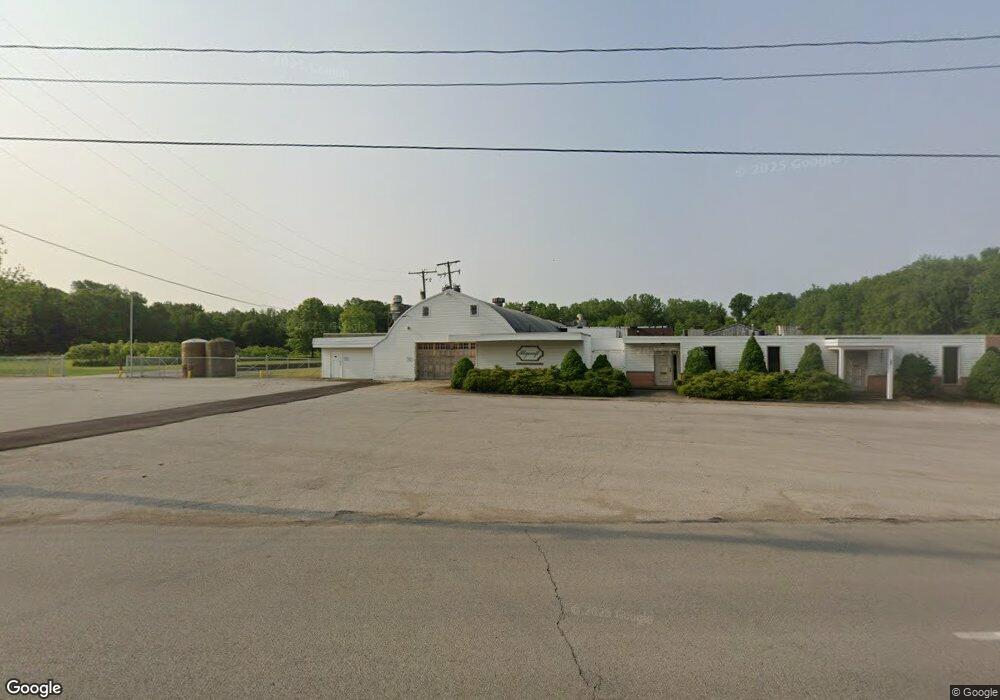
557 W Main Rd Conneaut, OH 44030
Kingsville NeighborhoodEstimated Value: $620,392
Studio
--
Bath
88,891
Sq Ft
$7/Sq Ft
Est. Value
About This Home
This home is located at 557 W Main Rd, Conneaut, OH 44030 and is currently estimated at $620,392, approximately $6 per square foot. 557 W Main Rd is a home located in Ashtabula County with nearby schools including Lakeshore Primary Elementary School, Gateway Elementary School, and Conneaut Middle School.
Ownership History
Date
Name
Owned For
Owner Type
Purchase Details
Closed on
Jan 29, 2021
Sold by
557 West Main Ltd
Bought by
800 West Main Llc
Current Estimated Value
Home Financials for this Owner
Home Financials are based on the most recent Mortgage that was taken out on this home.
Original Mortgage
$340,000
Outstanding Balance
$303,935
Interest Rate
2.67%
Mortgage Type
Purchase Money Mortgage
Estimated Equity
$316,457
Purchase Details
Closed on
Dec 29, 1995
Sold by
Fabricating Plycraft
Bought by
557 W Main Ltd
Home Financials for this Owner
Home Financials are based on the most recent Mortgage that was taken out on this home.
Original Mortgage
$358,112
Interest Rate
7.42%
Mortgage Type
New Conventional
Create a Home Valuation Report for This Property
The Home Valuation Report is an in-depth analysis detailing your home's value as well as a comparison with similar homes in the area
Home Values in the Area
Average Home Value in this Area
Purchase History
| Date | Buyer | Sale Price | Title Company |
|---|---|---|---|
| 800 West Main Llc | $415,000 | Franklin Blair Title Agency | |
| 557 W Main Ltd | $200,000 | -- |
Source: Public Records
Mortgage History
| Date | Status | Borrower | Loan Amount |
|---|---|---|---|
| Open | 800 West Main Llc | $340,000 | |
| Previous Owner | 557 W Main Ltd | $358,112 |
Source: Public Records
Tax History
| Year | Tax Paid | Tax Assessment Tax Assessment Total Assessment is a certain percentage of the fair market value that is determined by local assessors to be the total taxable value of land and additions on the property. | Land | Improvement |
|---|---|---|---|---|
| 2024 | $10,626 | $145,260 | $37,630 | $107,630 |
| 2023 | $9,022 | $145,260 | $37,630 | $107,630 |
| 2022 | $9,262 | $145,260 | $37,630 | $107,630 |
| 2021 | $9,416 | $145,260 | $37,630 | $107,630 |
| 2020 | $22,491 | $346,300 | $37,630 | $308,670 |
| 2019 | $18,826 | $293,090 | $28,210 | $264,880 |
| 2018 | $18,071 | $293,090 | $28,210 | $264,880 |
| 2017 | $8,442 | $293,090 | $28,210 | $264,880 |
| 2016 | $16,751 | $293,090 | $28,210 | $264,880 |
| 2015 | $16,885 | $293,090 | $28,210 | $264,880 |
| 2014 | $15,428 | $293,090 | $28,210 | $264,880 |
| 2013 | $14,998 | $305,520 | $41,690 | $263,830 |
Source: Public Records
Map
Nearby Homes
- 436 Keefus Rd
- 1381 Robb Rd
- 220 Daniels Ave
- 7296 Poore Rd
- 7032 Reed Rd
- 7002 Reed Rd
- 202 W Main Rd Unit 132
- 202 W Main Rd Unit 93
- 202 W Main Rd Unit 139
- 4017 Lake Rd Unit 17
- 210 W Main Rd
- 7011 Richwood Dr
- 28 Lake Park Dr
- 2663 Lake Rd
- 1145 Lake Rd
- 1150 Lake Rd
- 7527 Tamkrist Trail
- 805 Main St Unit 807
- 7630 Darling Ave
- VL Center Rd
Your Personal Tour Guide
Ask me questions while you tour the home.