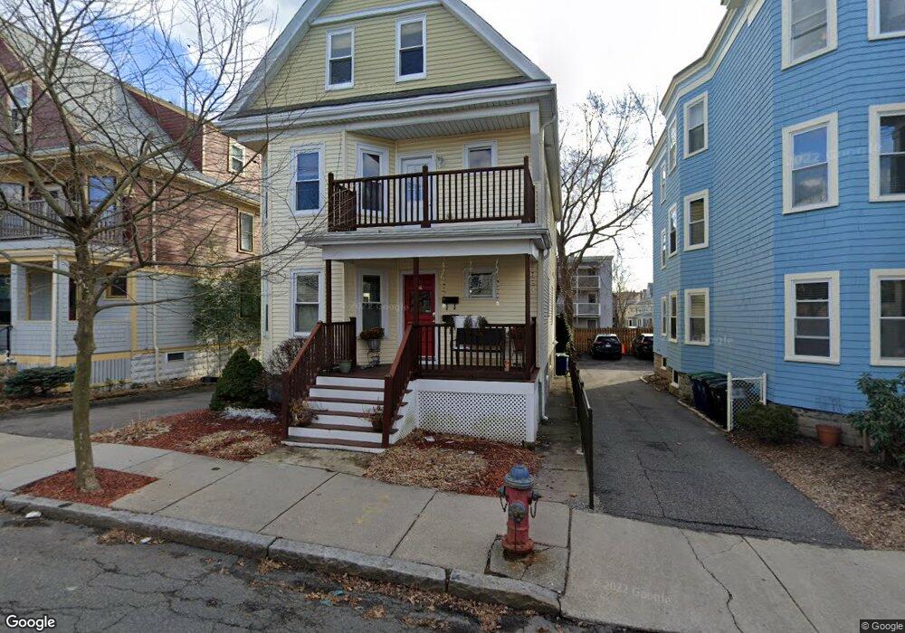
56 Conwell Ave Unit 1 Somerville, MA 02144
West Somerville NeighborhoodEstimated Value: $731,000 - $845,959
2
Beds
2
Baths
1,100
Sq Ft
$708/Sq Ft
Est. Value
About This Home
This home is located at 56 Conwell Ave Unit 1, Somerville, MA 02144 and is currently estimated at $778,490, approximately $707 per square foot. 56 Conwell Ave Unit 1 is a home located in Middlesex County with nearby schools including Somerville High School, International School of Boston, and Lesley Ellis School.
Ownership History
Date
Name
Owned For
Owner Type
Purchase Details
Closed on
Feb 2, 2006
Sold by
J Lan Realty Co Llc
Bought by
Sheldon Heidsha and Sheldon Joshua P
Current Estimated Value
Home Financials for this Owner
Home Financials are based on the most recent Mortgage that was taken out on this home.
Original Mortgage
$402,800
Interest Rate
6.31%
Mortgage Type
Purchase Money Mortgage
Create a Home Valuation Report for This Property
The Home Valuation Report is an in-depth analysis detailing your home's value as well as a comparison with similar homes in the area
Home Values in the Area
Average Home Value in this Area
Purchase History
We collect this data history from publicly available records. To have your information removed, we recommend requesting removal directly through your county’s website.
| Date | Buyer | Sale Price | Title Company |
|---|---|---|---|
| Sheldon Heidsha | $409,000 | -- | |
| Sheldon Heidsha | $409,000 | -- |
Source: Public Records
Mortgage History
We collect this data history from publicly available records. To have your information removed, we recommend requesting removal directly through your county’s website.
| Date | Status | Borrower | Loan Amount |
|---|---|---|---|
| Open | Sheldon Heidsha | $351,000 | |
| Closed | Sheldon Heidsha | $402,800 |
Source: Public Records
Tax History
| Year | Tax Paid | Tax Assessment Tax Assessment Total Assessment is a certain percentage of the fair market value that is determined by local assessors to be the total taxable value of land and additions on the property. | Land | Improvement |
|---|---|---|---|---|
| 2025 | $7,394 | $677,700 | $0 | $677,700 |
| 2024 | $6,988 | $664,300 | $0 | $664,300 |
| 2023 | $7,120 | $688,600 | $0 | $688,600 |
| 2022 | $6,750 | $663,100 | $0 | $663,100 |
| 2021 | $6,614 | $649,100 | $0 | $649,100 |
| 2020 | $6,344 | $628,700 | $0 | $628,700 |
| 2019 | $6,559 | $609,600 | $0 | $609,600 |
| 2018 | $6,226 | $550,500 | $0 | $550,500 |
| 2017 | $5,991 | $513,400 | $0 | $513,400 |
| 2016 | $5,898 | $470,700 | $0 | $470,700 |
| 2015 | $5,422 | $430,000 | $0 | $430,000 |
Source: Public Records
Map
Nearby Homes
- 202 Powder House Blvd Unit 2
- 23 College Hill Rd Unit 1
- 248 Powder House Blvd
- 48 Whitfield Rd Unit 48
- 150 North St Unit 150
- 11 Sterling St
- 1246 Broadway Unit 3
- 65 Hillsdale Rd Unit 1
- 7 Farragut Ave Unit 1
- 1328 Broadway Unit 3
- 14 Farragut Ave Unit 1
- 59A High St Unit A
- 325A Alewife Brook Pkwy Unit A
- 52 Sterling St
- 29 Victoria St
- 32 Farragut Ave Unit 3
- 29 Weston Ave
- 30 Clarendon Ave
- 33 Newbury St Unit 1
- 39 Whitman St
- 56 Conwell Ave Unit 2
- 56 Conwell Ave
- 58 Conwell Ave
- 58 Conwell Ave Unit 1
- 58 Conwell Ave Unit 2
- 58 Conwell Ave Unit 3
- 54 Conwell Ave
- 54 Conwell Ave Unit 1
- 64 Conwell Ave
- 64 Conwell Ave Unit 3
- 64 Conwell Ave Unit 2
- 50 Conwell Ave Unit 1
- 50 Conwell Ave
- 50 Conwell Ave Unit 1,50
- 50 Conwell Ave
- 50 Conwell Ave Unit 2
- 57 Conwell Ave
- 57 Raymond Ave
- 53 Raymond Ave
- 66 Conwell Ave
Your Personal Tour Guide
Ask me questions while you tour the home.