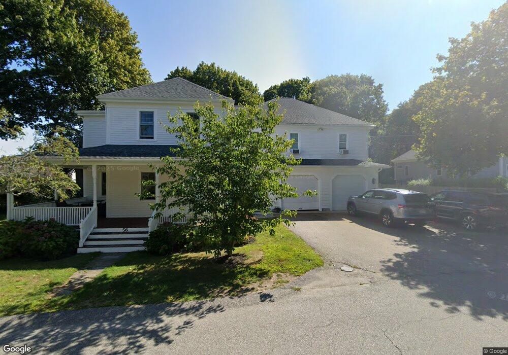
56 Hazel Ave Scituate, MA 02066
Estimated Value: $891,000 - $1,316,000
4
Beds
3
Baths
3,219
Sq Ft
$346/Sq Ft
Est. Value
About This Home
This home is located at 56 Hazel Ave, Scituate, MA 02066 and is currently estimated at $1,114,947, approximately $346 per square foot. 56 Hazel Ave is a home located in Plymouth County with nearby schools including Jenkins Elementary School, Lester J. Gates Middle School, and Scituate High School.
Ownership History
Date
Name
Owned For
Owner Type
Purchase Details
Closed on
Dec 10, 2024
Sold by
Sorensen Neil H and Sorensen Marie T
Bought by
15 Sea Street Llc
Current Estimated Value
Home Financials for this Owner
Home Financials are based on the most recent Mortgage that was taken out on this home.
Original Mortgage
$550,000
Outstanding Balance
$421,028
Interest Rate
6.79%
Mortgage Type
New Conventional
Estimated Equity
$693,919
Purchase Details
Closed on
Mar 6, 2024
Sold by
Dauphinee Heather C
Bought by
Sorensen Neil H and Sorensen Marie T
Purchase Details
Closed on
Sep 29, 1986
Bought by
Sorensen Neil H and Sorensen Marie T
Create a Home Valuation Report for This Property
The Home Valuation Report is an in-depth analysis detailing your home's value as well as a comparison with similar homes in the area
Home Values in the Area
Average Home Value in this Area
Purchase History
| Date | Buyer | Sale Price | Title Company |
|---|---|---|---|
| 15 Sea Street Llc | $850,000 | None Available | |
| 15 Sea Street Llc | $850,000 | None Available | |
| Sorensen Neil H | $45,000 | None Available | |
| Sorensen Neil | $45,000 | None Available | |
| Sorensen Neil H | $80,000 | -- |
Source: Public Records
Mortgage History
| Date | Status | Borrower | Loan Amount |
|---|---|---|---|
| Open | 15 Sea Street Llc | $550,000 | |
| Closed | 15 Sea Street Llc | $550,000 | |
| Previous Owner | Sorensen Neil H | $120,000 | |
| Previous Owner | Sorensen Neil H | $20,410 | |
| Previous Owner | Sorensen Neil H | $82,300 |
Source: Public Records
Tax History
| Year | Tax Paid | Tax Assessment Tax Assessment Total Assessment is a certain percentage of the fair market value that is determined by local assessors to be the total taxable value of land and additions on the property. | Land | Improvement |
|---|---|---|---|---|
| 2025 | $8,574 | $858,300 | $471,900 | $386,400 |
| 2024 | $8,370 | $807,900 | $429,000 | $378,900 |
| 2023 | $6,892 | $629,100 | $390,000 | $239,100 |
| 2022 | $6,892 | $546,100 | $333,000 | $213,100 |
| 2021 | $6,792 | $509,500 | $317,100 | $192,400 |
| 2020 | $6,730 | $498,500 | $304,900 | $193,600 |
| 2019 | $6,570 | $478,200 | $285,900 | $192,300 |
| 2018 | $6,950 | $498,200 | $293,500 | $204,700 |
| 2017 | $6,712 | $476,400 | $271,700 | $204,700 |
| 2016 | $6,162 | $435,800 | $239,100 | $196,700 |
| 2015 | $5,568 | $425,000 | $228,300 | $196,700 |
Source: Public Records
Map
Nearby Homes
- 76 A Brook St
- 76 A Brook St Unit 1
- 32 Barker Rd Unit 3
- 0 Sunset Rd
- 55 Crescent Ave
- 23 Oceanside Dr
- 59 Greenfield Ln
- 5 Brand Blvd Unit 5
- 49 Jackson Rd
- 57 Oceanside Dr
- 31 Thelma Way Unit 31
- 20 Grace Way Unit 20
- 1 Grace Way Unit 1
- 25 Grace Way
- 41 Irving Rd
- 74 Branch St Unit 15
- 12 Hawley Rd
- 63 Seaside Rd
- 334 Chief Justice Cushing Hwy
- 5 Michael Ave
- 55 Beaver Dam Rd
- 53 Beaver Dam Rd
- 50 Hazel Ave
- 55 Hazel Ave
- 59 Hazel Ave
- 85 Humarock Beach
- 49 Beaver Dam Rd
- 49 Beaver Dam Rd Unit Single
- 50 Beaver Dam Rd
- 58 Beaver Dam Rd
- 4 Apple Tree Ln
- 4 Apple Tree Ln Unit A
- 45 Beaver Dam Rd
- 46 Hazel Ave
- 18 Walnut Ave
- 44 Beaver Dam Rd
- 22 Walnut Ave
- 8 Claymore Terrace
- 14 Walnut Ave
- 3 Apple Tree Ln
Your Personal Tour Guide
Ask me questions while you tour the home.