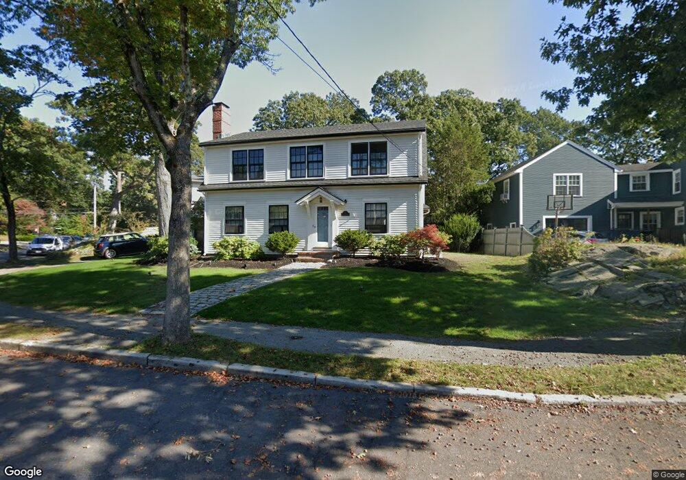
56 White Pine Rd Newton Upper Falls, MA 02464
Newton Upper Falls NeighborhoodEstimated Value: $1,265,000 - $1,493,338
3
Beds
2
Baths
1,994
Sq Ft
$688/Sq Ft
Est. Value
About This Home
This home is located at 56 White Pine Rd, Newton Upper Falls, MA 02464 and is currently estimated at $1,372,085, approximately $688 per square foot. 56 White Pine Rd is a home located in Middlesex County with nearby schools including Zervas Elementary School, Angier Elementary School, and Charles E Brown Middle School.
Ownership History
Date
Name
Owned For
Owner Type
Purchase Details
Closed on
Oct 27, 1994
Sold by
Est Brodil Hazel B and Brown E Ralph
Bought by
Rubin Marc A and Torres-Rubin Lourdes
Current Estimated Value
Home Financials for this Owner
Home Financials are based on the most recent Mortgage that was taken out on this home.
Original Mortgage
$189,000
Interest Rate
8.65%
Mortgage Type
Purchase Money Mortgage
Create a Home Valuation Report for This Property
The Home Valuation Report is an in-depth analysis detailing your home's value as well as a comparison with similar homes in the area
Home Values in the Area
Average Home Value in this Area
Purchase History
| Date | Buyer | Sale Price | Title Company |
|---|---|---|---|
| Rubin Marc A | $210,000 | -- |
Source: Public Records
Mortgage History
| Date | Status | Borrower | Loan Amount |
|---|---|---|---|
| Open | Rubin Marc A | $220,000 | |
| Closed | Rubin Marc A | $189,000 |
Source: Public Records
Tax History
| Year | Tax Paid | Tax Assessment Tax Assessment Total Assessment is a certain percentage of the fair market value that is determined by local assessors to be the total taxable value of land and additions on the property. | Land | Improvement |
|---|---|---|---|---|
| 2025 | $12,451 | $1,270,500 | $895,200 | $375,300 |
| 2024 | $12,039 | $1,233,500 | $869,100 | $364,400 |
| 2023 | $11,404 | $1,120,200 | $664,200 | $456,000 |
| 2022 | $10,911 | $1,037,200 | $615,000 | $422,200 |
| 2021 | $10,529 | $978,500 | $580,200 | $398,300 |
| 2020 | $10,216 | $978,500 | $580,200 | $398,300 |
| 2019 | $9,928 | $950,000 | $563,300 | $386,700 |
| 2018 | $8,640 | $798,500 | $507,500 | $291,000 |
| 2017 | $5,408 | $486,300 | $478,800 | $7,500 |
| 2016 | $5,172 | $454,500 | $447,500 | $7,000 |
| 2015 | $4,932 | $424,800 | $418,200 | $6,600 |
Source: Public Records
Map
Nearby Homes
- 29 Cottage St Unit 29
- 30 Circuit Ave Unit 30
- 51 Pettee St Unit 31
- 5 Summer St
- 1077 Boylston St Unit 1
- 302 Elliot St Carriage House N Unit 3
- 304 Elliot St Carriage House S Unit 4
- 18 Josselyn Place Unit 18
- 16-18 Josselyn Place Unit 16
- 16-18 Josselyn Place Unit 18
- 300 Elliot St Unit 2
- 1003 Chestnut St
- 12 Bemuth Rd
- 10 Pennsylvania Ave Unit 1
- 20 Pennsylvania Ave
- 20 Pennsylvania Ave Unit 20
- 873 Chestnut St
- 54 Indiana Terrace
- 27 Hamilton Place
- 27 High St Unit 27
- 140 Roundwood Rd
- 60 White Pine Rd
- 46 White Pine Rd
- 45 Hickory Cliff Rd
- 55 White Pine Rd
- 61 White Pine Rd
- 47 White Pine Rd
- 87 Thurston Rd Unit 87
- 85 Thurston Rd
- 85 Thurston Rd Unit 85
- 128 Roundwood Rd
- 40 White Pine Rd
- 39 Hickory Cliff Rd
- 39 White Pine Rd
- 75 Thurston Rd
- 46 Hickory Cliff Rd
- 122 Roundwood Rd
- 34 White Pine Rd
- 33 Hickory Cliff Rd
- 12 Tamarac Rd
Your Personal Tour Guide
Ask me questions while you tour the home.