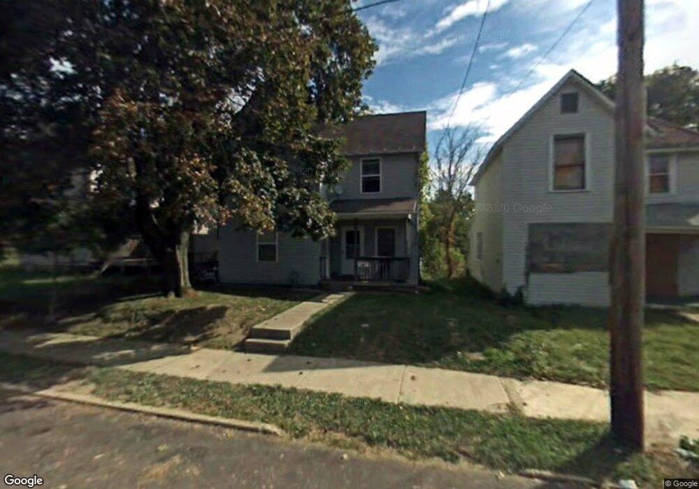
560 Daisy St Mansfield, OH 44903
Estimated Value: $71,000 - $114,000
3
Beds
1
Bath
1,118
Sq Ft
$74/Sq Ft
Est. Value
About This Home
This home is located at 560 Daisy St, Mansfield, OH 44903 and is currently estimated at $83,000, approximately $74 per square foot. 560 Daisy St is a home located in Richland County with nearby schools including Goal Digital Academy, St. Peter's Elementary/Montessori School, and St. Peter's Junior High / High School.
Ownership History
Date
Name
Owned For
Owner Type
Purchase Details
Closed on
May 13, 2013
Sold by
Central City Economic Development Counci
Bought by
Marshall Salatha
Current Estimated Value
Purchase Details
Closed on
Mar 8, 1994
Sold by
Hilson Robert
Bought by
Central City Economic
Purchase Details
Closed on
Jun 24, 1992
Sold by
Hilson Thomas
Bought by
Hilson Robert
Create a Home Valuation Report for This Property
The Home Valuation Report is an in-depth analysis detailing your home's value as well as a comparison with similar homes in the area
Home Values in the Area
Average Home Value in this Area
Purchase History
| Date | Buyer | Sale Price | Title Company |
|---|---|---|---|
| Marshall Salatha | $2,000 | Attorney | |
| Central City Economic | -- | -- | |
| Hilson Robert | -- | -- |
Source: Public Records
Tax History
| Year | Tax Paid | Tax Assessment Tax Assessment Total Assessment is a certain percentage of the fair market value that is determined by local assessors to be the total taxable value of land and additions on the property. | Land | Improvement |
|---|---|---|---|---|
| 2025 | $1,284 | $14,930 | $990 | $13,940 |
| 2024 | $1,284 | $14,930 | $990 | $13,940 |
| 2023 | $715 | $14,930 | $990 | $13,940 |
| 2022 | $224 | $3,920 | $900 | $3,020 |
| 2021 | $226 | $3,920 | $900 | $3,020 |
| 2020 | $231 | $3,920 | $900 | $3,020 |
| 2019 | $256 | $3,920 | $900 | $3,020 |
| 2018 | $252 | $3,920 | $900 | $3,020 |
| 2017 | $203 | $3,920 | $900 | $3,020 |
| 2016 | $161 | $2,490 | $1,510 | $980 |
| 2015 | $161 | $2,490 | $1,510 | $980 |
| 2014 | $152 | $2,490 | $1,510 | $980 |
| 2012 | $116 | $2,490 | $1,510 | $980 |
Source: Public Records
Map
Nearby Homes
- 580 N Mulberry St
- 118 Raymond Ave
- 524 Lida St
- 0 Grant Rd Unit 5190994
- 0 Voegele Ave Unit Lot 6048, 6049, 6
- 701 Springmill St
- 346 Newman St
- 0 Highway 30
- 219 W 5th St
- 368 W 6th St
- 344 W 5th St
- 447 Spayer Ln
- 411 Grace St
- 572 France St
- 245 W 4th St
- 224 Atcheson Ave
- 382 Orange St
- 0 Lot #23128 Unit 9069815
- 0 State Route 314 Unit 9069650
- 688 Mcpherson St
Your Personal Tour Guide
Ask me questions while you tour the home.