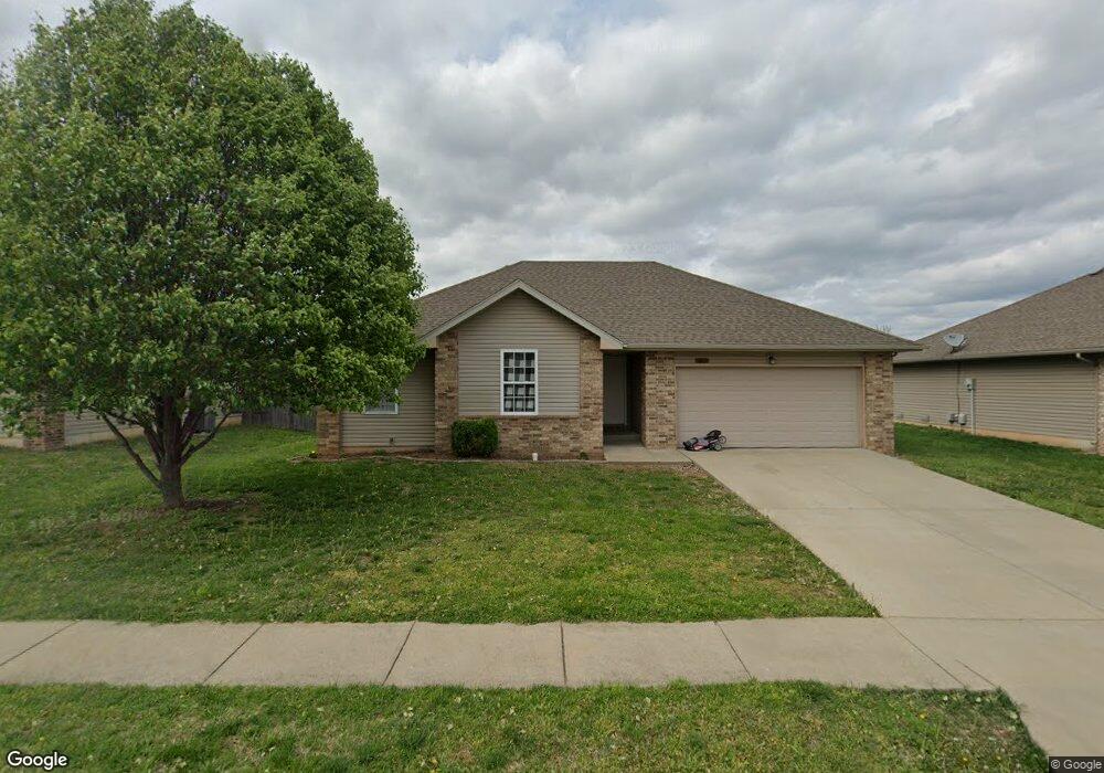
5605 W Longleaf Dr Springfield, MO 65802
Estimated Value: $225,872 - $242,000
About This Home
This home is located at 5605 W Longleaf Dr, Springfield, MO 65802 and is currently estimated at $233,968, approximately $194 per square foot. 5605 W Longleaf Dr is a home located in Greene County with nearby schools including Price Elementary School, Republic Middle School, and Republic High School.
Ownership History
We collect this data history from publicly available records. To have your information removed, we recommend requesting removal directly through your county’s website.
Purchase Details
Purchase Details
Home Financials for this Owner
Home Financials are based on the most recent Mortgage that was taken out on this home.Home Values in the Area
Average Home Value in this Area
Purchase History
We collect this data history from publicly available records. To have your information removed, we recommend requesting removal directly through your county’s website.
| Date | Buyer | Sale Price | Title Company |
|---|---|---|---|
| -- | None Available | ||
| -- | None Available |
Mortgage History
We collect this data history from publicly available records. To have your information removed, we recommend requesting removal directly through your county’s website.
| Date | Status | Borrower | Loan Amount |
|---|---|---|---|
| Previous Owner | $81,059 |
Tax History
We collect this data history from publicly available records. To have your information removed, we recommend requesting removal directly through your county’s website.
| Year | Tax Paid | Tax Assessment Tax Assessment Total Assessment is a certain percentage of the fair market value that is determined by local assessors to be the total taxable value of land and additions on the property. | Land | Improvement |
|---|---|---|---|---|
| 2025 | $1,773 | $31,940 | $8,550 | $23,390 |
| 2024 | $1,398 | $24,570 | $4,750 | $19,820 |
| 2023 | $1,371 | $24,570 | $4,750 | $19,820 |
| 2022 | $1,173 | $20,840 | $4,750 | $16,090 |
| 2021 | $1,173 | $20,840 | $4,750 | $16,090 |
| 2020 | $923 | $17,710 | $4,750 | $12,960 |
| 2019 | $920 | $17,710 | $4,750 | $12,960 |
| 2018 | $873 | $16,300 | $4,750 | $11,550 |
| 2017 | $866 | $15,870 | $4,750 | $11,120 |
| 2016 | $851 | $15,870 | $4,750 | $11,120 |
| 2015 | $851 | $15,870 | $4,750 | $11,120 |
| 2014 | $842 | $15,540 | $4,750 | $10,790 |
Map
- 1071 S Tanner Dr
- 5585 W Pecan St
- 1047 S Tanner Dr
- 1054 S Tanner Ave
- 5627 W Mangrove St
- 5543 W Mangrove St
- 5664 W Mangrove St
- 5423 Basswood Ct W
- 5612 W Lombard St
- 5574 W David St
- 5551 W David St
- 835 S Natalie Ave
- 5451 W Harrison St
- 840 S Somerset Dr
- 5163 W Sunstruck St
- 5175 W Sunstruck St
- 857 S Orchard Crest Ave
- 850 S Orchard Way
- 838 S Orchard Way
- 000 W Independence Dr
- 5610 Sugarpine Dr W
- 5602 Sugarpine Dr W
- 5618 Sugarpine Dr W
- 5613 W Longleaf Dr
- 5597 W Longleaf Dr
- 5611 Sugarpine Dr W
- 5621 W Longleaf Dr
- 5603 W Sugar Pine Dr
- 5594 Sugarpine Dr W
- 5626 W Sugar Pine Dr
- 5619 W Sugar Pine Dr
- 5589 W Longleaf Dr
- 5595 W Sugar Pine Dr
- 5629 W Longleaf Dr
- 5631 W Sugar Pine Dr
- 5608 W Longleaf Dr
- 5634 Sugarpine Dr W
- 5606 W Sunflower Dr
- 5616 W Longleaf Dr
- 5586 Sugarpine Dr W
Ask me questions while you tour the home.