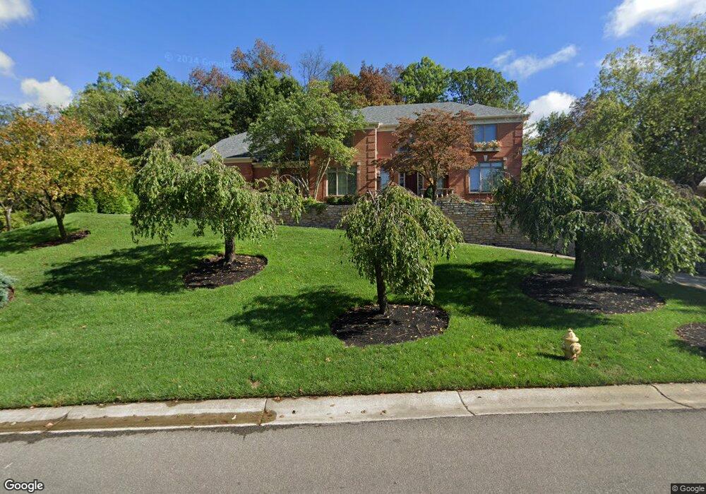
5606 Brookstone Dr Cincinnati, OH 45230
Salem Heights NeighborhoodEstimated Value: $843,000 - $976,000
About This Home
This home is located at 5606 Brookstone Dr, Cincinnati, OH 45230 and is currently estimated at $896,696, approximately $217 per square foot. 5606 Brookstone Dr is a home located in Hamilton County with nearby schools including Sherwood Elementary School, Nagel Middle School, and Anderson High School.
Ownership History
We collect this data history from publicly available records. To have your information removed, we recommend requesting removal directly through your county’s website.
Purchase Details
Home Financials for this Owner
Home Financials are based on the most recent Mortgage that was taken out on this home.Home Values in the Area
Average Home Value in this Area
Purchase History
We collect this data history from publicly available records. To have your information removed, we recommend requesting removal directly through your county’s website.
| Date | Buyer | Sale Price | Title Company |
|---|---|---|---|
| -- | -- |
Mortgage History
We collect this data history from publicly available records. To have your information removed, we recommend requesting removal directly through your county’s website.
| Date | Status | Borrower | Loan Amount |
|---|---|---|---|
| Closed | $160,000 |
Tax History
We collect this data history from publicly available records. To have your information removed, we recommend requesting removal directly through your county’s website.
| Year | Tax Paid | Tax Assessment Tax Assessment Total Assessment is a certain percentage of the fair market value that is determined by local assessors to be the total taxable value of land and additions on the property. | Land | Improvement |
|---|---|---|---|---|
| 2025 | $16,026 | $251,132 | $41,426 | $209,706 |
| 2024 | $15,915 | $251,132 | $41,426 | $209,706 |
| 2023 | $14,936 | $251,132 | $41,426 | $209,706 |
| 2022 | $13,220 | $197,737 | $42,557 | $155,180 |
| 2021 | $13,145 | $197,737 | $42,557 | $155,180 |
| 2020 | $12,998 | $197,737 | $42,557 | $155,180 |
| 2019 | $12,724 | $174,986 | $37,660 | $137,326 |
| 2018 | $11,935 | $174,986 | $37,660 | $137,326 |
| 2017 | $11,405 | $174,986 | $37,660 | $137,326 |
| 2016 | $12,577 | $186,649 | $38,308 | $148,341 |
| 2015 | $12,104 | $186,649 | $38,308 | $148,341 |
| 2014 | $12,092 | $186,649 | $38,308 | $148,341 |
| 2013 | $10,930 | $177,762 | $36,484 | $141,278 |
Map
- 1262 Mistymeadow Ln
- 1300 Mistymeadow Ln
- 5776 Kensington Ridge Dr
- 1200 Eversole Rd
- 3 Salem Rd
- 2 Salem Rd
- 4 Salem Rd
- 1190 Linden Hill Ln
- 5661 Wayside Ave
- 1173 Hawkstone Dr
- 1 Salem Rd
- 5315 Eaglesview Ct
- 949 Yarger Dr
- 1508 Beth Ln
- 1730 Bloomingdale Ave
- 6984 Shadow Ridge Rd
- 820 Laverty Ln
- 824 Laverty Ln
- 1639 Sutton Ave
- 6193 Dawes Ln
- 5620 Brookstone Dr
- 5607 Brookstone Dr
- 1260 Apple Hill Rd
- 1256 Coventry Woods Dr
- 5619 Brookstone Dr
- 5630 Brookstone Dr
- 1254 Coventry Woods Dr
- 5675 Salem Rd
- 5629 Brookstone Dr
- 1196 Apple Hill Rd
- 1252 Coventry Woods Dr
- 1258 Coventry Woods Dr
- 5650 Brookstone Dr
- 1 Apple Farm Ln
- 2 Apple Farm Ln
- 1404 Apple Farm Ln
- 1209 Apple Hill Rd
- 1250 Coventry Woods Dr
- 1250 Coventry Woods Dr Unit 25
- 1110 Coventry Woods Dr
Ask me questions while you tour the home.