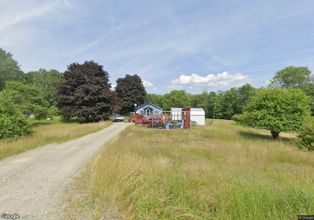
561 Millvale Rd Bucksport, ME 04416
Estimated Value: $119,000 - $238,000
Studio
--
Bath
494
Sq Ft
$358/Sq Ft
Est. Value
About This Home
This home is located at 561 Millvale Rd, Bucksport, ME 04416 and is currently estimated at $177,084, approximately $358 per square foot. 561 Millvale Rd is a home with nearby schools including G. Herbert Jewett School, Miles Lane School, and Bucksport Middle School.
Ownership History
Date
Name
Owned For
Owner Type
Purchase Details
Closed on
Apr 2, 2025
Sold by
Smith Sue E
Bought by
Getchell Cereeta R
Current Estimated Value
Purchase Details
Closed on
Jan 10, 2019
Sold by
Bucksport Town Of
Bought by
Smith Sandra R
Purchase Details
Closed on
Jan 31, 2018
Sold by
Smith Sandra L
Bought by
Smith Douglas C
Create a Home Valuation Report for This Property
The Home Valuation Report is an in-depth analysis detailing your home's value as well as a comparison with similar homes in the area
Home Values in the Area
Average Home Value in this Area
Purchase History
| Date | Buyer | Sale Price | Title Company |
|---|---|---|---|
| Getchell Cereeta R | -- | None Available | |
| Getchell Cereeta R | -- | None Available | |
| Getchell Cereeta R | -- | None Available | |
| Smith Sandra R | -- | -- | |
| Smith Sandra R | -- | -- | |
| Smith Sandra R | -- | -- | |
| Smith Douglas C | -- | -- | |
| Smith Douglas C | -- | -- | |
| Smith Douglas C | -- | -- |
Source: Public Records
Tax History
| Year | Tax Paid | Tax Assessment Tax Assessment Total Assessment is a certain percentage of the fair market value that is determined by local assessors to be the total taxable value of land and additions on the property. | Land | Improvement |
|---|---|---|---|---|
| 2025 | $1,666 | $107,460 | $53,710 | $53,750 |
| 2024 | $1,241 | $93,650 | $53,710 | $39,940 |
| 2023 | $1,194 | $93,650 | $53,710 | $39,940 |
| 2022 | $1,065 | $62,830 | $35,540 | $27,290 |
| 2021 | $1,021 | $62,830 | $35,540 | $27,290 |
| 2020 | $997 | $61,370 | $35,540 | $25,830 |
| 2019 | $1,000 | $61,370 | $35,540 | $25,830 |
| 2018 | $678 | $61,570 | $35,540 | $26,030 |
| 2017 | $990 | $60,340 | $36,280 | $24,060 |
| 2016 | $1,037 | $62,870 | $38,810 | $24,060 |
| 2015 | $1,146 | $67,000 | $47,000 | $20,000 |
| 2014 | $972 | $68,893 | $48,938 | $19,955 |
| 2013 | $934 | $68,900 | $48,940 | $19,960 |
Source: Public Records
Map
Nearby Homes
- 0 Millvale Rd
- 684 Millvale Rd
- 1130 Silver Lake Rd
- 724 Millvale Rd
- 817 Millvale Rd
- 182 Turkey Path
- 130 Town Farm Rd
- 47 & 48 Arrow Dr
- 362 Bucksmills Rd
- 41-1 Town Farm Rd
- 1026 Bucks Mills Rd
- 89 Millvale Rd
- 0 Town Farm Rd Unit 1656715
- 21 Robin Hood Dr
- 23 Millvale Rd
- 25 Bucksmills Rd
- Lot #11 Russell Hill Rd
- Lot #5 Russell Hill Rd
- Lot #2 Russell Hill Rd
- Lot #10 Russell Hill Rd
- 565 Millvale Rd
- 562 Millvale Rd
- 550 Millvale Rd
- 574 Millvale Rd
- 10 Coleman Ln
- 579 Millvale Rd
- 537 Millvale Rd
- 573 Millvale Rd
- 540 Millvale Rd
- 590 Millvale Hinks Rd
- 546 Millvale Rd
- 529 Millvale Rd
- 593 Millvale Rd
- 528 Millvale Rd
- 18 Coleman Ln
- 586 Millvale Rd
- 00 Millvale Rd
- 598 Millvale Rd
- 524 Millvale Rd
- 44 Power Line Rd
Your Personal Tour Guide
Ask me questions while you tour the home.