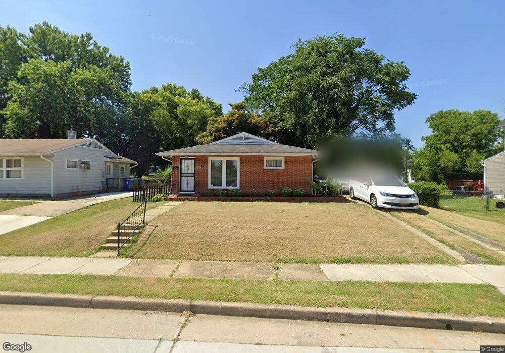
5612 Anthony Ave Baltimore, MD 21206
Frankford NeighborhoodEstimated Value: $247,179 - $280,000
Studio
2
Baths
1,120
Sq Ft
$235/Sq Ft
Est. Value
About This Home
This home is located at 5612 Anthony Ave, Baltimore, MD 21206 and is currently estimated at $263,590, approximately $235 per square foot. 5612 Anthony Ave is a home located in Baltimore City with nearby schools including Hazelwood Elementary/Middle School, Booker T. Washington Middle School, and Paul Laurence Dunbar High School.
Ownership History
Date
Name
Owned For
Owner Type
Purchase Details
Closed on
Dec 23, 2021
Sold by
Rajendra Prasad P V
Bought by
Dawson Carolyn
Current Estimated Value
Home Financials for this Owner
Home Financials are based on the most recent Mortgage that was taken out on this home.
Original Mortgage
$195,395
Interest Rate
3.12%
Mortgage Type
FHA
Purchase Details
Closed on
Sep 3, 1997
Sold by
Prasad P V Rajendra
Bought by
Prasad P V Rajendra P and Prasad Subhashini R
Create a Home Valuation Report for This Property
The Home Valuation Report is an in-depth analysis detailing your home's value as well as a comparison with similar homes in the area
Home Values in the Area
Average Home Value in this Area
Purchase History
| Date | Buyer | Sale Price | Title Company |
|---|---|---|---|
| Dawson Carolyn | $199,000 | Goldstar Title | |
| Prasad P V Rajendra P | -- | -- |
Source: Public Records
Mortgage History
| Date | Status | Borrower | Loan Amount |
|---|---|---|---|
| Previous Owner | Dawson Carolyn | $195,395 |
Source: Public Records
Tax History
| Year | Tax Paid | Tax Assessment Tax Assessment Total Assessment is a certain percentage of the fair market value that is determined by local assessors to be the total taxable value of land and additions on the property. | Land | Improvement |
|---|---|---|---|---|
| 2025 | $3,263 | $168,000 | -- | -- |
| 2024 | $3,263 | $150,300 | $46,900 | $103,400 |
| 2023 | $3,495 | $148,800 | $0 | $0 |
| 2022 | $3,476 | $147,300 | $0 | $0 |
| 2021 | $3,441 | $145,800 | $46,900 | $98,900 |
| 2020 | $3,431 | $145,400 | $0 | $0 |
| 2019 | $3,406 | $145,000 | $0 | $0 |
| 2018 | $3,413 | $144,600 | $46,900 | $97,700 |
| 2017 | $3,343 | $141,667 | $0 | $0 |
| 2016 | $3,515 | $138,733 | $0 | $0 |
| 2015 | $3,515 | $135,800 | $0 | $0 |
| 2014 | $3,515 | $135,800 | $0 | $0 |
Source: Public Records
Map
Nearby Homes
- 5629 Greenhill Ave
- 4220 Hamilton Ave
- 5709 Anthony Ave
- 4300 Berger Ave
- 4207 Arizona Ave
- 5503 Greenhill Ave
- 4319 Bayonne Ave
- 4605 Anntana Ave
- 4212 Lasalle Ave
- 5608 Todd Ave
- 5817 1/2 Belair Rd
- 5819 Belair Rd
- 4002 Hamilton Ave
- 5429 Belle Vista Ave
- 4705 Bayonne Ave
- 5300 Greenhill Ave
- 5412 Summerfield Ave
- 5923 Belair Rd
- 4804 Anntana Ave
- 5421 Remmell Ave
- 5620 Anthony Ave
- 4404 Arizona Ave
- 5607 Anthony Ave
- 5605 Anthony Ave
- 4402 Arizona Ave
- 5624 Anthony Ave
- 5603 Anthony Ave
- 5621 Anthony Ave
- 4400 Arizona Ave
- 5601 Anthony Ave
- 5619 Greenhill Ave
- 5621 Greenhill Ave
- 5626 Anthony Ave
- 5623 Anthony Ave
- 4500 Arizona Ave
- 5617 Greenhill Ave
- 5623 Greenhill Ave
- 5615 Greenhill Ave
- 5613 Greenhill Ave
- 5625 Anthony Ave
Your Personal Tour Guide
Ask me questions while you tour the home.