Estimated Value: $255,277 - $325,000
3
Beds
2
Baths
1,216
Sq Ft
$232/Sq Ft
Est. Value
About This Home
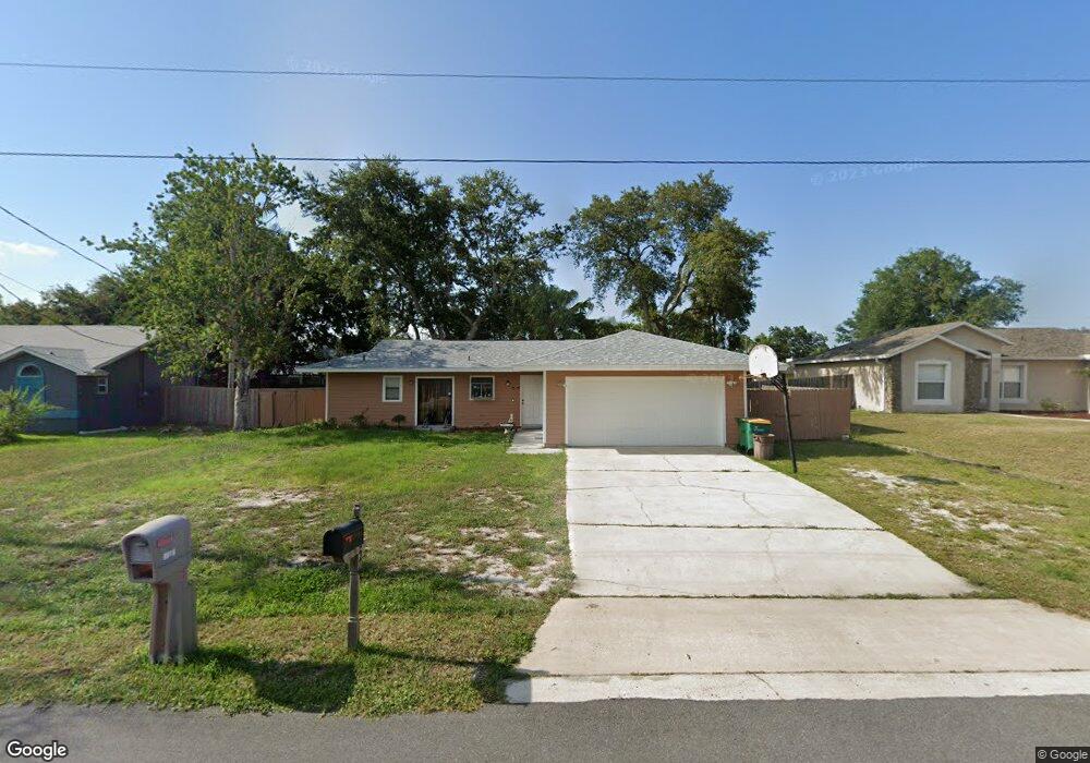
This home is located at 5626 Ada St, Cocoa, FL 32927 and is currently estimated at $281,569, approximately $231 per square foot. 5626 Ada St is a home located in Brevard County with nearby schools including Enterprise Elementary School, Space Coast Junior/Senior High School, and East Atlantic Prep of Brevard County.
Ownership History
Date
Name
Owned For
Owner Type
Purchase Details
Closed on
Nov 22, 2005
Sold by
Stevens David R and Stevens Vicki C
Bought by
Hafizi Hamid
Current Estimated Value
Home Financials for this Owner
Home Financials are based on the most recent Mortgage that was taken out on this home.
Original Mortgage
$124,100
Outstanding Balance
$71,400
Interest Rate
6.87%
Estimated Equity
$210,169
Purchase Details
Closed on
Aug 3, 2000
Sold by
Stevens Renee A
Bought by
Stevens David R
Create a Home Valuation Report for This Property
The Home Valuation Report is an in-depth analysis detailing your home's value as well as a comparison with similar homes in the area
Home Values in the Area
Average Home Value in this Area
Purchase History
| Date | Buyer | Sale Price | Title Company |
|---|---|---|---|
| Hafizi Hamid | $155,200 | Southern Title Hldg Co Llc | |
| Stevens David R | -- | -- |
Source: Public Records
Mortgage History
| Date | Status | Borrower | Loan Amount |
|---|---|---|---|
| Open | Hafizi Hamid | $124,100 |
Source: Public Records
Tax History
| Year | Tax Paid | Tax Assessment Tax Assessment Total Assessment is a certain percentage of the fair market value that is determined by local assessors to be the total taxable value of land and additions on the property. | Land | Improvement |
|---|---|---|---|---|
| 2025 | $2,874 | $204,130 | -- | -- |
| 2024 | $2,806 | $207,980 | -- | -- |
| 2023 | $2,806 | $205,960 | $0 | $0 |
| 2022 | $2,529 | $195,400 | $0 | $0 |
| 2021 | $2,287 | $146,820 | $42,000 | $104,820 |
| 2020 | $2,104 | $131,340 | $40,000 | $91,340 |
| 2019 | $1,988 | $126,280 | $35,000 | $91,280 |
| 2018 | $1,885 | $114,780 | $27,000 | $87,780 |
| 2017 | $1,786 | $101,980 | $24,000 | $77,980 |
| 2016 | $1,671 | $86,670 | $18,000 | $68,670 |
| 2015 | $1,588 | $67,820 | $15,000 | $52,820 |
| 2014 | $1,452 | $61,660 | $11,000 | $50,660 |
Source: Public Records
Map
Nearby Homes
- 5680 Banos Ave
- 6481 La Brea Ave
- 5721 Beaverbrook St
- 6438 Hudson Rd
- 5601 Banos Ave
- 6581 Bancroft Ave
- 6643 Emil Ave
- 6460 Ainsworth Rd
- 0 Aruin St Unit 1222557
- 6615 Dock Ave
- 6450 Ember Ave
- 6250 Ainsworth Rd
- 23-35-21-JX-B-2 Aruin St
- 6460 Homestead Ave
- 6545 Addie Ave
- 00 Unknown
- 5220 Holden Rd
- 6760 Cairo Rd
- 5215 Holden Rd
- 6815 Bryant Rd
- 5614 Ada St
- 5638 Ada St
- 5625 Beaverbrook St
- 5613 Beaverbrook St
- 5637 Beaverbrook St
- 5602 Ada St
- 5650 Ada St
- 5601 Beaverbrook St
- 5627 Ada St
- 5639 Ada St
- 5649 Beaverbrook St
- 5603 Ada St
- 5651 Ada St
- 5662 Ada St
- 5661 Beaverbrook St
- 5624 Beaverbrook St
- 5670 Banos Ave
- 5663 Ada St
- 5636 Beaverbrook St
- 5612 Beaverbrook St
Your Personal Tour Guide
Ask me questions while you tour the home.