Estimated Value: $344,755 - $347,000
2
Beds
1
Bath
1,266
Sq Ft
$273/Sq Ft
Est. Value
About This Home
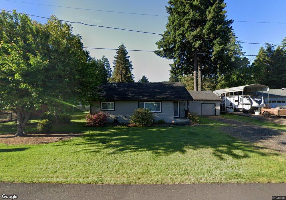
This home is located at 566 Elm St, Lyons, OR 97358 and is currently estimated at $345,878, approximately $273 per square foot. 566 Elm St is a home located in Linn County with nearby schools including Mari-Linn Elementary School and Stayton High School.
Ownership History
Date
Name
Owned For
Owner Type
Purchase Details
Closed on
Jul 10, 2023
Sold by
Repucci Edward T and Repucci Margaret G
Bought by
Repucci Family Trust and Repucci
Current Estimated Value
Purchase Details
Closed on
Sep 29, 2011
Sold by
Pacific Northwest Investments Llc
Bought by
Repucci Edward T and Repucci Margaret G
Purchase Details
Closed on
Apr 21, 2011
Sold by
Wilson Lonnie J
Bought by
Pacific Northwest Investments Llc
Create a Home Valuation Report for This Property
The Home Valuation Report is an in-depth analysis detailing your home's value as well as a comparison with similar homes in the area
Purchase History
| Date | Buyer | Sale Price | Title Company |
|---|---|---|---|
| Repucci Family Trust | -- | None Listed On Document | |
| Repucci Edward T | $116,500 | First American Title | |
| Pacific Northwest Investments Llc | $28,931 | None Available |
Source: Public Records
Tax History
| Year | Tax Paid | Tax Assessment Tax Assessment Total Assessment is a certain percentage of the fair market value that is determined by local assessors to be the total taxable value of land and additions on the property. | Land | Improvement |
|---|---|---|---|---|
| 2025 | $1,968 | $133,620 | -- | -- |
| 2024 | $1,904 | $129,730 | -- | -- |
| 2023 | $1,862 | $125,960 | $0 | $0 |
| 2022 | $1,792 | $122,300 | $0 | $0 |
| 2021 | $1,722 | $118,740 | $0 | $0 |
| 2020 | $1,687 | $115,290 | $0 | $0 |
| 2019 | $1,647 | $111,940 | $0 | $0 |
| 2018 | $1,617 | $108,680 | $0 | $0 |
| 2017 | $1,574 | $105,520 | $0 | $0 |
| 2016 | $1,529 | $102,450 | $0 | $0 |
Source: Public Records
Map
Nearby Homes
- 442 Cedar St
- 534 Birch St
- 636 Birch St
- 247 Cedar St
- 950 6th St
- 817 Main St
- 628 N 13th St
- 0002317 E Dogwood Dr (Next To)
- E Dogwood Dr (Next To) St
- 1611 Main St
- 11294 Mehama Heights
- 40850 16th St
- 21991 Fern Ridge Rd SE
- 11133 Riverwood Dr SE
- 11193 Kathy Ln SE
- 22986 N Fork Rd SE
- 11177 Stockpile Ln SE
- 2240 Apple Loop
- 45849 River Loop
- 2426 Oak St
Your Personal Tour Guide
Ask me questions while you tour the home.