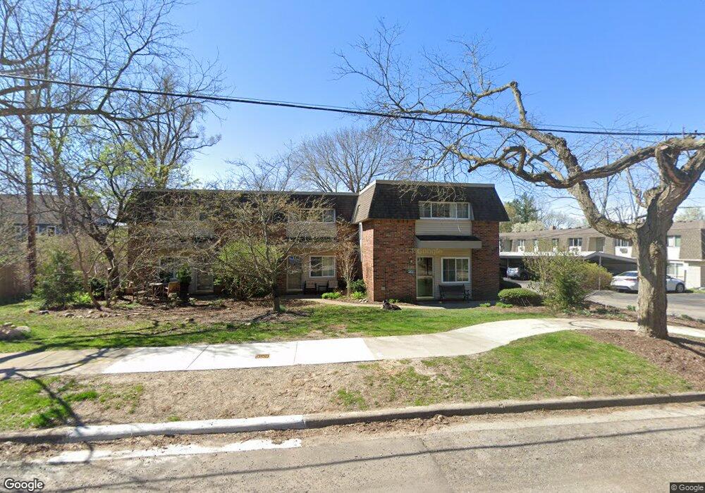
566 Kellogg St Unit B Ann Arbor, MI 48105
Northern Ann Arbor NeighborhoodEstimated Value: $265,074 - $348,000
About This Home
This home is located at 566 Kellogg St Unit B, Ann Arbor, MI 48105 and is currently estimated at $301,519, approximately $376 per square foot. 566 Kellogg St Unit B is a home located in Washtenaw County with nearby schools including Ann Arbor STEAM at Northside, Clague Middle School, and Skyline High School.
Ownership History
We collect this data history from publicly available records. To have your information removed, we recommend requesting removal directly through your county’s website.
Purchase Details
Purchase Details
Purchase Details
Purchase Details
Purchase Details
Home Values in the Area
Average Home Value in this Area
Purchase History
We collect this data history from publicly available records. To have your information removed, we recommend requesting removal directly through your county’s website.
| Date | Buyer | Sale Price | Title Company |
|---|---|---|---|
| -- | None Available | ||
| -- | None Listed On Document | ||
| -- | None Available | ||
| -- | Liberty Title Agency | ||
| $115,000 | -- | ||
| $71,960 | -- |
Tax History
We collect this data history from publicly available records. To have your information removed, we recommend requesting removal directly through your county’s website.
| Year | Tax Paid | Tax Assessment Tax Assessment Total Assessment is a certain percentage of the fair market value that is determined by local assessors to be the total taxable value of land and additions on the property. | Land | Improvement |
|---|---|---|---|---|
| 2025 | $2,766 | $109,300 | $0 | $0 |
| 2024 | $2,698 | $107,300 | $0 | $0 |
| 2023 | $2,488 | $102,400 | $0 | $0 |
| 2022 | $2,711 | $97,600 | $0 | $0 |
| 2021 | $2,647 | $93,200 | $0 | $0 |
| 2020 | $2,594 | $91,300 | $0 | $0 |
| 2019 | $2,469 | $81,300 | $81,300 | $0 |
| 2018 | $2,434 | $76,200 | $0 | $0 |
| 2017 | $2,368 | $65,100 | $0 | $0 |
| 2016 | $2,284 | $47,344 | $0 | $0 |
| 2015 | $2,175 | $47,203 | $0 | $0 |
| 2014 | $2,175 | $45,729 | $0 | $0 |
| 2013 | -- | $45,729 | $0 | $0 |
Map
- 519 Longshore Dr Unit A
- 515 Longshore Dr
- 1136 Longshore Dr Unit 1
- 1128 Longshore Dr Unit 1
- 1128 Longshore Dr Unit 2
- 703 Moore St
- 1308 Traver Rd
- 1326 Traver St
- 709 Indianola Ave
- 325 E Summit St Unit 101
- 209 Sunset Rd
- 811 N Main St
- 857 Wildt St Unit 2
- 709 N 5th Ave
- 651 N 5th Ave
- 118 W Summit St
- 530 N Division St Unit C
- 530 N Division St Unit A
- 530 N Division St Unit D
- 1050 Wall St Unit 3B
- 535 Longshore Dr Unit A
- 535 Longshore Dr Unit B
- 535 Longshore Dr Unit : B
- 535 Longshore Dr
- 535 Longshore Dr
- 533 Longshore Dr Unit A
- 533 Longshore Dr Unit B
- 533 Longshore Dr
- 537 Longshore Dr Unit 41
- 537 Longshore Dr Unit A
- 539 Longshore Dr Unit 9
- 533 Longshore Dr
- 527 Longshore Dr Unit B
- 527 Longshore Dr Unit 38
- 527 Longshore Dr Unit A
- 527 Longshore Dr Unit B
- 529 Longshore Dr Unit B
- 529 Longshore Dr Unit A
- 529 Longshore Dr Unit A
- 529 Longshore Dr Unit B
Ask me questions while you tour the home.