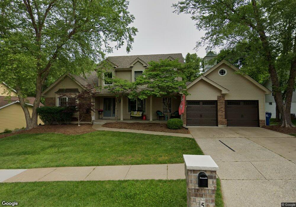
566 McBride Pointe Dr Ballwin, MO 63011
Wildwood AreaEstimated Value: $529,368 - $621,000
About This Home
This home is located at 566 McBride Pointe Dr, Ballwin, MO 63011 and is currently estimated at $572,342, approximately $199 per square foot. 566 McBride Pointe Dr is a home located in St. Louis County with nearby schools including Babler Elementary School, Rockwood Valley Middle School, and Lafayette High School.
Ownership History
We collect this data history from publicly available records. To have your information removed, we recommend requesting removal directly through your county’s website.
Purchase Details
Home Financials for this Owner
Home Financials are based on the most recent Mortgage that was taken out on this home.Purchase Details
Home Financials for this Owner
Home Financials are based on the most recent Mortgage that was taken out on this home.Purchase Details
Home Financials for this Owner
Home Financials are based on the most recent Mortgage that was taken out on this home.Home Values in the Area
Average Home Value in this Area
Purchase History
We collect this data history from publicly available records. To have your information removed, we recommend requesting removal directly through your county’s website.
| Date | Buyer | Sale Price | Title Company |
|---|---|---|---|
| $311,333 | Netco | ||
| $286,000 | None Available | ||
| -- | -- |
Mortgage History
We collect this data history from publicly available records. To have your information removed, we recommend requesting removal directly through your county’s website.
| Date | Status | Borrower | Loan Amount |
|---|---|---|---|
| Open | $100,000 | ||
| Open | $295,766 | ||
| Previous Owner | $228,800 | ||
| Previous Owner | $65,000 |
Tax History
We collect this data history from publicly available records. To have your information removed, we recommend requesting removal directly through your county’s website.
| Year | Tax Paid | Tax Assessment Tax Assessment Total Assessment is a certain percentage of the fair market value that is determined by local assessors to be the total taxable value of land and additions on the property. | Land | Improvement |
|---|---|---|---|---|
| 2025 | $5,555 | $81,740 | $25,610 | $56,130 |
| 2024 | $5,555 | $79,890 | $23,160 | $56,730 |
| 2023 | $5,551 | $79,890 | $23,160 | $56,730 |
| 2022 | $5,002 | $66,860 | $15,450 | $51,410 |
| 2021 | $4,965 | $66,860 | $15,450 | $51,410 |
| 2020 | $5,166 | $66,330 | $15,350 | $50,980 |
| 2019 | $5,186 | $66,330 | $15,350 | $50,980 |
| 2018 | $4,531 | $54,640 | $15,350 | $39,290 |
| 2017 | $4,423 | $54,640 | $15,350 | $39,290 |
| 2016 | $4,839 | $57,490 | $15,350 | $42,140 |
| 2015 | $4,740 | $57,490 | $15,350 | $42,140 |
| 2014 | $4,144 | $49,020 | $11,820 | $37,200 |
Map
- 546 McBride Pointe Dr
- 531 Strecker Rd
- 18024 Cider Mill Dr
- 16426 Prestwick Place Ln
- 1706 Big Horn Basin Dr
- 542 Eagles Nest Ct
- 16404 Clayton Rd
- 16404 Clayton Rd
- 18005 Indian Tree Run
- 436 Shadowridge Ct
- 212 Turnberry Place Dr
- 261 Turnberry Place Dr
- 724 Oaksdale Summit Ct
- 1504 Englebrook Dr
- 310 Berry Bush Ct
- 2087 Woodmoor Ridge Dr
- 1432 Shepard Rd
- 1559 Englebrook Dr
- 1909 Shepard Rd
- 1617 W Field Ave
- 570 McBride Pointe Dr
- 574 McBride Pointe Dr
- 562 McBride Pointe Dr
- 571 McBride Pointe Dr
- 567 McBride Pointe Dr
- 1856 Sullivan Pointe Dr
- 563 McBride Pointe Dr
- 1860 Sullivan Pointe Dr
- 1852 Sullivan Pointe Dr
- 579 McBride Pointe Dr
- 558 McBride Pointe Dr
- 621 Taylor Pointe Ct
- 559 McBride Pointe Dr
- 1933 Gastorf Pointe Ct
- 590 McBride Pointe Dr
- 1927 Gastorf Pointe Ct
- 1921 Gastorf Pointe Ct
- 617 Taylor Pointe Ct
- 1915 Gastorf Pointe Ct
- 1855 Sullivan Pointe Dr
Ask me questions while you tour the home.