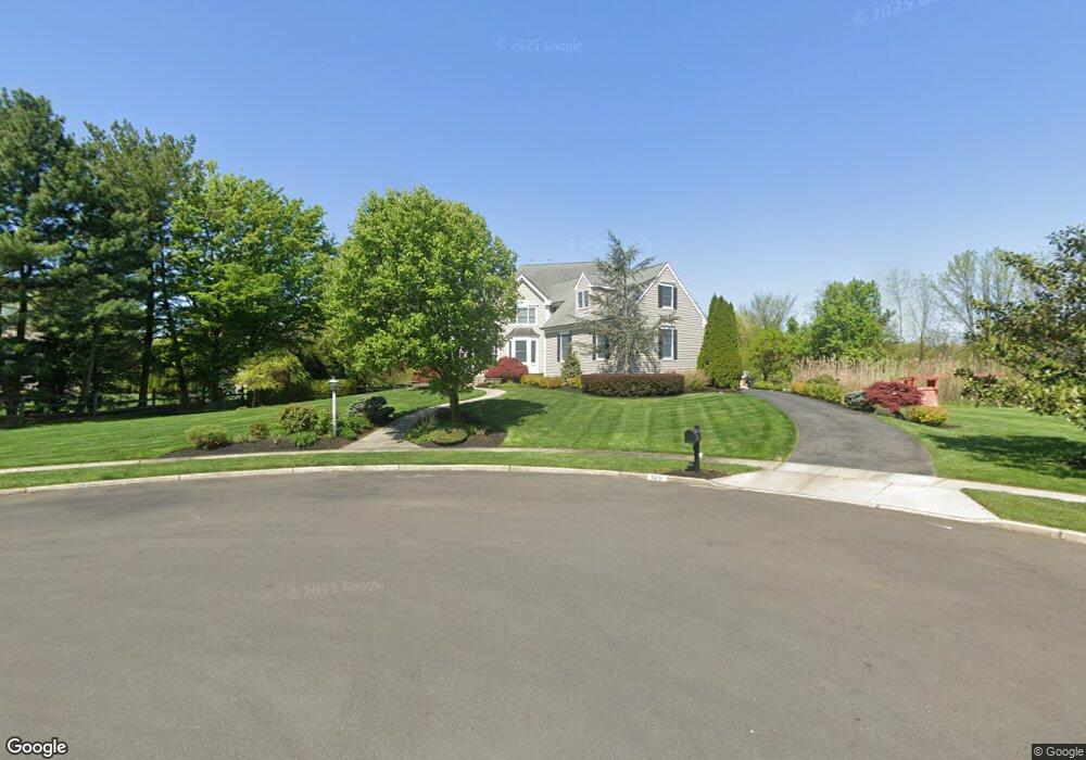
569 Bartram Rd Moorestown, NJ 08057
Estimated Value: $1,265,000 - $1,658,000
About This Home
This home is located at 569 Bartram Rd, Moorestown, NJ 08057 and is currently estimated at $1,433,168, approximately $353 per square foot. 569 Bartram Rd is a home located in Burlington County with nearby schools including George C. Baker Elementary School, Moorestown Upper Elementary School, and William Allen Middle School.
Ownership History
We collect this data history from publicly available records. To have your information removed, we recommend requesting removal directly through your county’s website.
Purchase Details
Home Financials for this Owner
Home Financials are based on the most recent Mortgage that was taken out on this home.Purchase Details
Purchase Details
Purchase Details
Home Values in the Area
Average Home Value in this Area
Purchase History
We collect this data history from publicly available records. To have your information removed, we recommend requesting removal directly through your county’s website.
| Date | Buyer | Sale Price | Title Company |
|---|---|---|---|
| $239,000 | -- | ||
| $235,000 | -- | ||
| $138,750 | -- | ||
| $10,000 | -- |
Mortgage History
We collect this data history from publicly available records. To have your information removed, we recommend requesting removal directly through your county’s website.
| Date | Status | Borrower | Loan Amount |
|---|---|---|---|
| Closed | $139,000 |
Tax History
We collect this data history from publicly available records. To have your information removed, we recommend requesting removal directly through your county’s website.
| Year | Tax Paid | Tax Assessment Tax Assessment Total Assessment is a certain percentage of the fair market value that is determined by local assessors to be the total taxable value of land and additions on the property. | Land | Improvement |
|---|---|---|---|---|
| 2025 | $21,689 | $764,500 | $169,700 | $594,800 |
| 2024 | $21,031 | $764,500 | $169,700 | $594,800 |
| 2023 | $21,031 | $764,500 | $169,700 | $594,800 |
| 2022 | $20,817 | $764,500 | $169,700 | $594,800 |
| 2021 | $20,542 | $764,500 | $169,700 | $594,800 |
| 2020 | $20,412 | $764,500 | $169,700 | $594,800 |
| 2019 | $20,053 | $764,500 | $169,700 | $594,800 |
| 2018 | $19,510 | $764,500 | $169,700 | $594,800 |
| 2017 | $19,678 | $764,500 | $169,700 | $594,800 |
| 2016 | $19,609 | $764,500 | $169,700 | $594,800 |
| 2015 | $19,372 | $764,500 | $169,700 | $594,800 |
| 2014 | $18,394 | $764,500 | $169,700 | $594,800 |
Map
- 728 Mill St
- 904 Heritage Rd
- 720 Maple Ct
- 302 Bridgeboro Rd
- 863 Golf View Rd
- 2801 Riverton Rd
- 1416 Georgian Dr
- 543 Bethel Ave
- 343 Tom Brown Rd
- 1445 Georgian Dr
- 500 Chester Ave
- 421 Irving Ave
- 347 Tom Brown Rd
- 331 Bridgeboro Rd
- 338 Clark Ave
- 8 Saratoga Springs Dr
- 201 E Oak Ave
- 205 E Central Ave
- 2801 Riverton Rd
- 140 E Central Ave
Ask me questions while you tour the home.