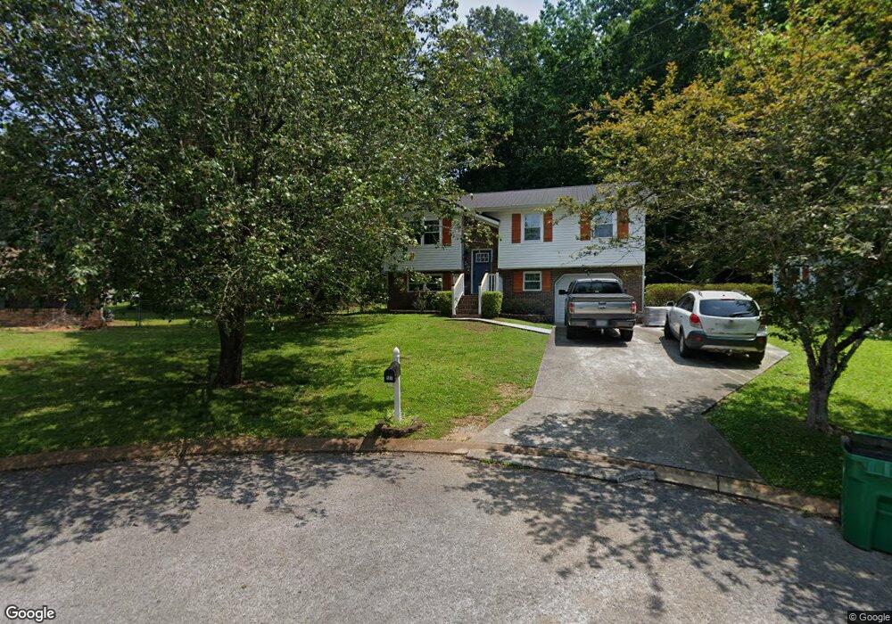
57 Brookside Dr Rossville, GA 30741
Estimated Value: $195,000 - $222,605
3
Beds
2
Baths
1,400
Sq Ft
$149/Sq Ft
Est. Value
About This Home
This home is located at 57 Brookside Dr, Rossville, GA 30741 and is currently estimated at $208,651, approximately $149 per square foot. 57 Brookside Dr is a home located in Walker County with nearby schools including Stone Creek Elementary School, Rossville Middle School, and Ridgeland High School.
Ownership History
Date
Name
Owned For
Owner Type
Purchase Details
Closed on
Jan 12, 2004
Sold by
Nickens David B and Nickens Diana L
Bought by
Bethune Terry L
Current Estimated Value
Purchase Details
Closed on
Dec 15, 1999
Sold by
Box Fritz P
Bought by
Nickens David B and Nickens Diana L
Purchase Details
Closed on
Mar 31, 1991
Sold by
Baker Baker and Baker Summers S
Bought by
Box Fritz P
Purchase Details
Closed on
Jan 1, 1972
Bought by
Baker Baker and Baker Summers S
Create a Home Valuation Report for This Property
The Home Valuation Report is an in-depth analysis detailing your home's value as well as a comparison with similar homes in the area
Purchase History
We collect this data history from publicly available records. To have your information removed, we recommend requesting removal directly through your county’s website.
| Date | Buyer | Sale Price | Title Company |
|---|---|---|---|
| Bethune Terry L | $79,500 | -- | |
| Nickens David B | $67,900 | -- | |
| Box Fritz P | $54,000 | -- | |
| Baker Baker | -- | -- |
Source: Public Records
Tax History
| Year | Tax Paid | Tax Assessment Tax Assessment Total Assessment is a certain percentage of the fair market value that is determined by local assessors to be the total taxable value of land and additions on the property. | Land | Improvement |
|---|---|---|---|---|
| 2025 | $2,213 | $79,159 | $6,000 | $73,159 |
| 2024 | $2,282 | $71,252 | $4,800 | $66,452 |
| 2023 | $2,188 | $67,624 | $4,800 | $62,824 |
| 2022 | $1,477 | $58,098 | $4,800 | $53,298 |
| 2021 | $1,091 | $39,144 | $4,800 | $34,344 |
| 2020 | $956 | $33,171 | $4,800 | $28,371 |
| 2019 | $957 | $33,171 | $4,800 | $28,371 |
| 2018 | $987 | $33,171 | $4,800 | $28,371 |
| 2017 | $1,043 | $33,171 | $4,800 | $28,371 |
| 2016 | $859 | $33,171 | $4,800 | $28,371 |
| 2015 | $922 | $33,849 | $4,800 | $29,049 |
| 2014 | $887 | $33,849 | $4,800 | $29,049 |
| 2013 | -- | $33,849 | $4,800 | $29,049 |
Source: Public Records
Map
Nearby Homes
- 112 Stegall St
- 98 Stegall St
- 5 E Wotring St
- 104 Ellis Dr
- 209 Hawks Dr
- 136 Summit St
- 164 S Mission Ridge Dr
- 1206 Logan Ave
- 105 Elm St
- 1204 Logan Ave
- 1426 Happy Valley Rd
- 1506 Happy Valley Rd
- 1432 Happy Valley Rd
- 1004 Mcfarland Ave
- 1006 Mcfarland Ave
- 111 E Peachtree St
- 1008 Mcfarland Ave
- 828 Henderson Ave
- 303 Cave St
- 806 Indian Ave
- 55 Brookside Dr
- 56 Brookside Dr
- 108 Stegall St
- 53 Brookside Dr
- 106 Stegall St Unit 1
- 106 Stegall St
- 54 Brookside Dr
- 48 2nd St
- 52 Brookside Dr
- 104 Stegall St
- 405 Watercress Dr
- 403 Watercress Dr
- 113 Stegall St
- 101 2nd St
- 409 Watercress Dr
- 413 Watercress Dr
- 100 Stegall St
- 115 Stegall St
- 411 Watercress Dr
- 107 Stegall St
Your Personal Tour Guide
Ask me questions while you tour the home.