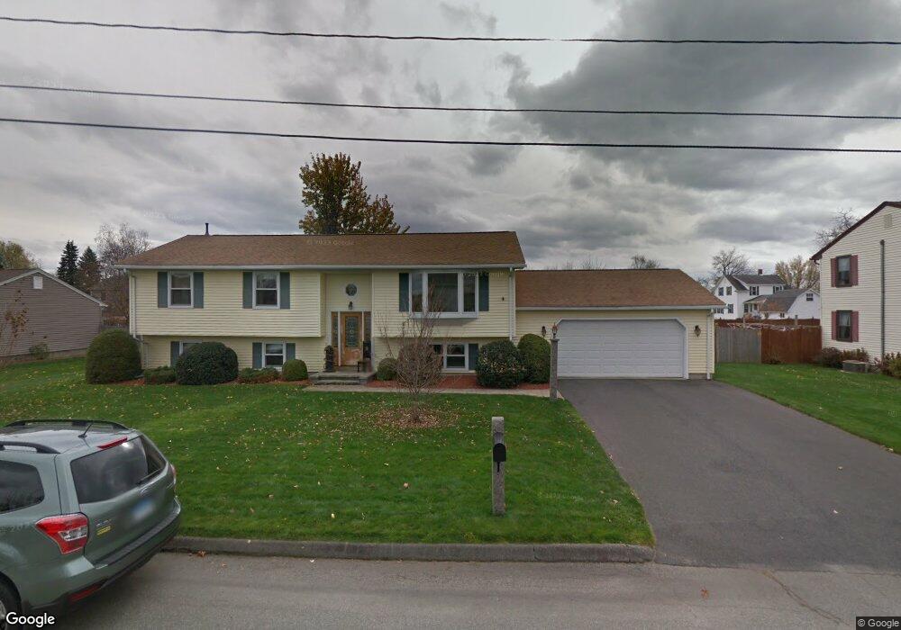
57 Lapa Farm Rd Chicopee, MA 01013
Willimansett NeighborhoodEstimated Value: $332,000 - $383,000
3
Beds
2
Baths
1,234
Sq Ft
$293/Sq Ft
Est. Value
About This Home
This home is located at 57 Lapa Farm Rd, Chicopee, MA 01013 and is currently estimated at $361,235, approximately $292 per square foot. 57 Lapa Farm Rd is a home located in Hampden County with nearby schools including Stefanik Elementary School, Bellamy Middle School, and Chicopee High School.
Ownership History
Date
Name
Owned For
Owner Type
Purchase Details
Closed on
Apr 15, 2025
Sold by
George Gerard A Est and George
Bought by
George Nancy A
Current Estimated Value
Purchase Details
Closed on
Jun 20, 1988
Sold by
Arclair Bldrs Inc
Bought by
George Gerard A
Home Financials for this Owner
Home Financials are based on the most recent Mortgage that was taken out on this home.
Original Mortgage
$95,000
Interest Rate
10.24%
Mortgage Type
Purchase Money Mortgage
Create a Home Valuation Report for This Property
The Home Valuation Report is an in-depth analysis detailing your home's value as well as a comparison with similar homes in the area
Home Values in the Area
Average Home Value in this Area
Purchase History
We collect this data history from publicly available records. To have your information removed, we recommend requesting removal directly through your county’s website.
| Date | Buyer | Sale Price | Title Company |
|---|---|---|---|
| George Nancy A | -- | None Available | |
| George Nancy A | -- | None Available | |
| George Gerard A | $135,000 | -- |
Source: Public Records
Mortgage History
We collect this data history from publicly available records. To have your information removed, we recommend requesting removal directly through your county’s website.
| Date | Status | Borrower | Loan Amount |
|---|---|---|---|
| Previous Owner | George Gerard A | $89,800 | |
| Previous Owner | George Gerard A | $95,000 |
Source: Public Records
Tax History
| Year | Tax Paid | Tax Assessment Tax Assessment Total Assessment is a certain percentage of the fair market value that is determined by local assessors to be the total taxable value of land and additions on the property. | Land | Improvement |
|---|---|---|---|---|
| 2025 | $5,257 | $346,800 | $103,000 | $243,800 |
| 2024 | $4,993 | $338,300 | $100,900 | $237,400 |
| 2023 | $4,745 | $313,200 | $91,800 | $221,400 |
| 2022 | $4,383 | $258,000 | $79,800 | $178,200 |
| 2021 | $4,304 | $244,400 | $72,500 | $171,900 |
| 2020 | $4,091 | $234,300 | $72,500 | $161,800 |
| 2019 | $4,001 | $222,800 | $72,500 | $150,300 |
| 2018 | $3,895 | $212,700 | $69,100 | $143,600 |
| 2017 | $3,706 | $214,100 | $69,000 | $145,100 |
| 2016 | $3,735 | $220,900 | $69,000 | $151,900 |
| 2015 | $3,611 | $205,900 | $69,000 | $136,900 |
| 2014 | $1,806 | $205,900 | $69,000 | $136,900 |
Source: Public Records
Map
Nearby Homes
- 86 Beaumont Ave
- 51 Beaumont Ave
- 57 America St
- 13 Florence St
- 44 Wilson Ave
- 54 Shaw Park Ave
- 90 Mckinstry Ave Unit 106
- 90 Mckinstry Ave Unit 303
- 2 Oscar St
- 80 Brush Hill Ave Unit 65
- 80 Brush Hill Ave Unit 51
- 80 Brush Hill Ave Unit 40
- 18 Highland Park Dr
- 53 Highland Ln
- 94 Cora Ave
- 44 Lower Westfield Rd
- 55 Hillview Dr
- 0 School St
- 3 John Dr
- 35 Lower Grape St
- 80 Beaumont Ave
- 77 Lapa Farm Rd
- 85 Beaumont Ave
- 87 Lapa Farm Rd
- 91 Beaumont Ave
- 79 Beaumont Ave
- 67 Lapa Farm Rd
- 100 Beaumont Ave
- 99 Beaumont Ave
- 70 Beaumont Ave
- 71 Beaumont Ave
- 97 Lapa Farm Rd
- 63 Beaumont Ave
- 109 Beaumont Ave
- 102 Freedom St
- 92 Freedom St
- 84 Freedom St
- 60 Beaumont Ave
- 76 Lapa Farm Rd
- 86 Lapa Farm Rd
Your Personal Tour Guide
Ask me questions while you tour the home.