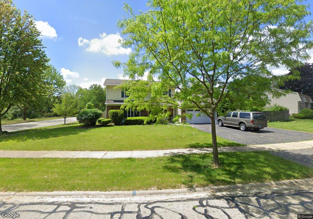
571 Miner Dr Bolingbrook, IL 60440
East Bolingbrook NeighborhoodEstimated Value: $365,000 - $383,000
4
Beds
3
Baths
2,055
Sq Ft
$181/Sq Ft
Est. Value
About This Home
This home is located at 571 Miner Dr, Bolingbrook, IL 60440 and is currently estimated at $372,225, approximately $181 per square foot. 571 Miner Dr is a home located in Will County with nearby schools including Jonas E Salk Elementary School, Hubert H Humphrey Middle School, and Brooks Middle School.
Ownership History
Date
Name
Owned For
Owner Type
Purchase Details
Closed on
Mar 26, 2024
Sold by
Tinaglia Janice R
Bought by
Denarius Holdings Llc
Current Estimated Value
Purchase Details
Closed on
Mar 19, 2004
Sold by
Village Of Bolingbrook
Bought by
Tinaglia Peter and Tinaglia Janice
Purchase Details
Closed on
Feb 15, 1996
Sold by
Firstar Bank Illinois
Bought by
Tinaglia Peter G and Tinaglia Janice R
Create a Home Valuation Report for This Property
The Home Valuation Report is an in-depth analysis detailing your home's value as well as a comparison with similar homes in the area
Home Values in the Area
Average Home Value in this Area
Purchase History
We collect this data history from publicly available records. To have your information removed, we recommend requesting removal directly through your county’s website.
| Date | Buyer | Sale Price | Title Company |
|---|---|---|---|
| Denarius Holdings Llc | $205,491 | None Listed On Document | |
| Tinaglia Peter | -- | -- | |
| Tinaglia Peter G | -- | -- |
Source: Public Records
Tax History
| Year | Tax Paid | Tax Assessment Tax Assessment Total Assessment is a certain percentage of the fair market value that is determined by local assessors to be the total taxable value of land and additions on the property. | Land | Improvement |
|---|---|---|---|---|
| 2024 | $10,277 | $115,695 | $21,548 | $94,147 |
| 2023 | $8,311 | $104,098 | $19,388 | $84,710 |
| 2022 | $8,189 | $93,849 | $17,479 | $76,370 |
| 2021 | $7,727 | $87,750 | $16,343 | $71,407 |
| 2020 | $7,471 | $84,865 | $15,806 | $69,059 |
| 2019 | $7,204 | $80,823 | $15,053 | $65,770 |
| 2018 | $6,892 | $77,358 | $14,408 | $62,950 |
| 2017 | $6,532 | $73,325 | $13,657 | $59,668 |
| 2016 | $6,314 | $69,800 | $13,000 | $56,800 |
| 2015 | $5,738 | $67,000 | $12,500 | $54,500 |
| 2014 | $5,738 | $67,000 | $12,500 | $54,500 |
| 2013 | $5,738 | $63,200 | $11,800 | $51,400 |
Source: Public Records
Map
Nearby Homes
- 598 Miner Dr
- 424 Assembly Dr
- 406 Assembly Dr
- 354 Aaron Ln
- 418 Charlestown Dr
- 3 Revere Ct
- 551 Falconridge Way
- 524 Monroe Rd
- 526 King Arthur Way
- 555 Monroe Rd
- 230 Douglass Way
- 458 Wyeth Cir
- 457 Wright Ct
- 437 Wright Ct
- 614 Feather Sound Dr
- 441 Sullivan Cir
- 168 Winston Dr
- 462 Ridge Ln
- 456 Ridge Ln
- 151 E Boughton Rd
- 575 Miner Dr
- 579 Miner Dr
- 570 Miner Dr
- 574 Miner Dr
- 578 Miner Dr
- 560 N Pinecrest Rd Unit 5
- 583 Miner Dr
- 579 Cades Ct Unit 5
- 583 Cades Ct
- 582 Miner Dr
- 564 N Pinecrest Rd
- 587 Cades Ct
- 587 Miner Dr
- 591 Cades Ct
- 545 Nassau Ave
- 430 Alcester Ct
- 594 Miner Dr
- 568 N Pinecrest Rd Unit 5
- 541 Nassau Ave
- 434 Alcester Ct
Your Personal Tour Guide
Ask me questions while you tour the home.