5718 Dearth Rd Springboro, OH 45066
Estimated Value: $545,000 - $607,000
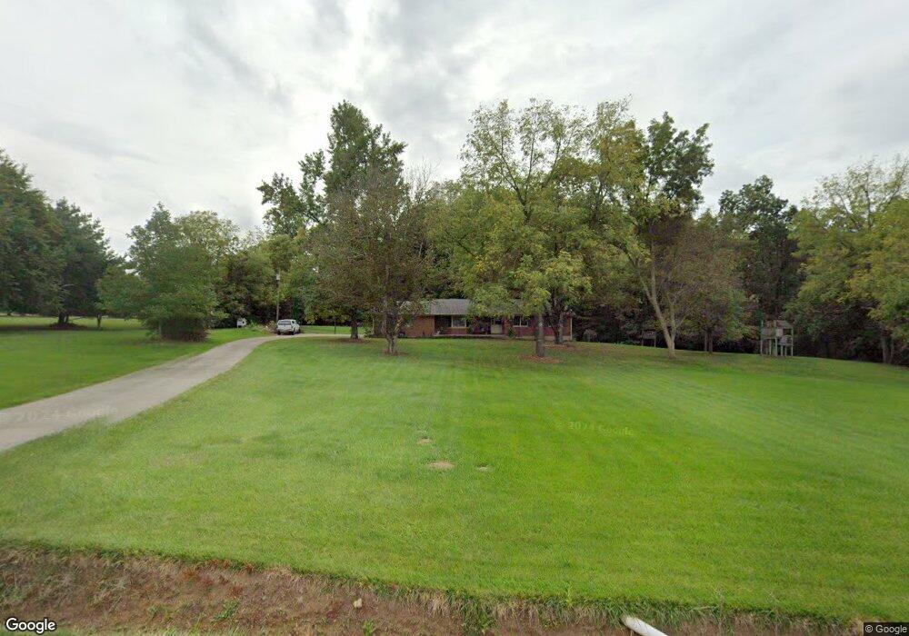
About This Home
This home is located at 5718 Dearth Rd, Springboro, OH 45066 and is currently estimated at $573,236, approximately $180 per square foot. 5718 Dearth Rd is a home located in Warren County with nearby schools including Clearcreek Elementary School, Dennis Elementary School, and Springboro Intermediate School.
Ownership History
We collect this data history from publicly available records. To have your information removed, we recommend requesting removal directly through your county’s website.
Purchase Details
Home Financials for this Owner
Home Financials are based on the most recent Mortgage that was taken out on this home.Purchase Details
Home Values in the Area
Average Home Value in this Area
Purchase History
We collect this data history from publicly available records. To have your information removed, we recommend requesting removal directly through your county’s website.
| Date | Buyer | Sale Price | Title Company |
|---|---|---|---|
| $200,000 | -- | ||
| -- | -- |
Mortgage History
We collect this data history from publicly available records. To have your information removed, we recommend requesting removal directly through your county’s website.
| Date | Status | Borrower | Loan Amount |
|---|---|---|---|
| Closed | $160,000 |
Tax History
We collect this data history from publicly available records. To have your information removed, we recommend requesting removal directly through your county’s website.
| Year | Tax Paid | Tax Assessment Tax Assessment Total Assessment is a certain percentage of the fair market value that is determined by local assessors to be the total taxable value of land and additions on the property. | Land | Improvement |
|---|---|---|---|---|
| 2025 | $6,088 | $148,870 | $43,130 | $105,740 |
| 2024 | $6,088 | $148,870 | $43,130 | $105,740 |
| 2023 | $5,388 | $120,092 | $26,600 | $93,492 |
| 2022 | $5,311 | $120,092 | $26,600 | $93,492 |
| 2021 | $4,962 | $120,092 | $26,600 | $93,492 |
| 2020 | $4,627 | $97,636 | $21,627 | $76,010 |
| 2019 | $4,289 | $97,636 | $21,627 | $76,010 |
| 2018 | $4,281 | $97,636 | $21,627 | $76,010 |
| 2017 | $4,259 | $87,238 | $18,904 | $68,334 |
| 2016 | $4,431 | $87,238 | $18,904 | $68,334 |
| 2015 | $4,275 | $87,238 | $18,904 | $68,334 |
| 2014 | $4,275 | $79,510 | $17,950 | $61,560 |
| 2013 | $4,273 | $94,260 | $19,770 | $74,490 |
Map
- 0 Weidner Rd
- 2182 Estates Ct
- 3101 Beal Rd
- 0 Dearth Rd
- 2729 Beal Rd
- 3151 Beal Rd
- 4 Beal Rd
- 2987 W Pekin Rd
- 2987 Pekin Rd
- 5874 Spinney Ct
- 5024 State Route 123
- 79 Glasgow St
- 79 Glasgow St Unit 40
- 4480 N St Rt 123
- 4480 State Route 123
- 39 Glasgow St Unit 35
- 39 Glasgow St
- 70 Martin Ln
- 30 Morris St
- 130 Morris St
- 5609 Weidner Rd
- 5709 Dearth Rd
- 5591 Weidner Rd
- 5693 Dearth Rd
- 5690 Dearth Rd
- 5677 Dearth Rd
- 5561 Weidner Rd
- 5661 Weidner Rd
- 5598 Weidner Rd
- 5666 Weidner Rd
- 5657 Weidner Rd
- 5535 Weidner Rd
- 5647 Dearth Rd
- 5703 Weidner Rd
- 5690 Weidner Rd
- 5529 Weidner Rd
- 5720 Weidner Rd
- 5707 Weidner Rd
- 5614 Dearth Rd
- 5497 Weidner Rd
Ask me questions while you tour the home.