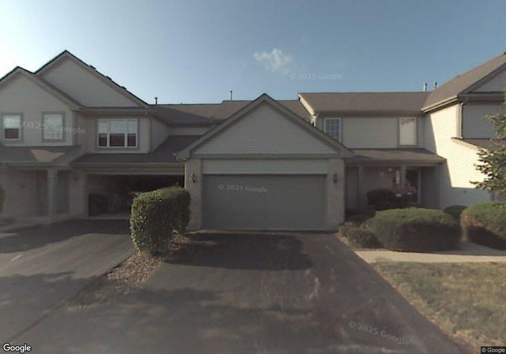
573 Willow Way Lindenhurst, IL 60046
Estimated Value: $261,000 - $275,000
3
Beds
2
Baths
1,696
Sq Ft
$158/Sq Ft
Est. Value
About This Home
This home is located at 573 Willow Way, Lindenhurst, IL 60046 and is currently estimated at $267,681, approximately $157 per square foot. 573 Willow Way is a home located in Lake County with nearby schools including Millburn Elementary School, Millburn Middle School, and Grayslake North High School.
Ownership History
Date
Name
Owned For
Owner Type
Purchase Details
Closed on
Aug 25, 2023
Sold by
David C Lippert Trust
Bought by
Archbold Robert J and Hernandez Juanita R
Current Estimated Value
Home Financials for this Owner
Home Financials are based on the most recent Mortgage that was taken out on this home.
Original Mortgage
$208,550
Outstanding Balance
$202,308
Interest Rate
6.78%
Mortgage Type
New Conventional
Estimated Equity
$65,373
Purchase Details
Closed on
Mar 6, 2019
Sold by
Lippert David C
Bought by
Lippert David C and David C Lippert Trust
Purchase Details
Closed on
Oct 21, 1996
Sold by
Westfield Homes Of Illinois Inc
Bought by
Lippert David C and Lippert Wanda M
Create a Home Valuation Report for This Property
The Home Valuation Report is an in-depth analysis detailing your home's value as well as a comparison with similar homes in the area
Home Values in the Area
Average Home Value in this Area
Purchase History
We collect this data history from publicly available records. To have your information removed, we recommend requesting removal directly through your county’s website.
| Date | Buyer | Sale Price | Title Company |
|---|---|---|---|
| Archbold Robert J | $215,000 | Chicago Title | |
| Lippert David C | -- | None Available | |
| Lippert David C | $162,000 | Chicago Title Insurance Co |
Source: Public Records
Mortgage History
We collect this data history from publicly available records. To have your information removed, we recommend requesting removal directly through your county’s website.
| Date | Status | Borrower | Loan Amount |
|---|---|---|---|
| Open | Archbold Robert J | $208,550 |
Source: Public Records
Tax History
| Year | Tax Paid | Tax Assessment Tax Assessment Total Assessment is a certain percentage of the fair market value that is determined by local assessors to be the total taxable value of land and additions on the property. | Land | Improvement |
|---|---|---|---|---|
| 2025 | $7,204 | $85,921 | $10,315 | $75,606 |
| 2024 | $6,407 | $80,098 | $9,616 | $70,482 |
| 2023 | $6,776 | $70,770 | $8,496 | $62,274 |
| 2022 | $6,776 | $59,475 | $7,834 | $51,641 |
| 2021 | $6,530 | $55,248 | $7,277 | $47,971 |
| 2020 | $7,132 | $57,631 | $7,044 | $50,587 |
| 2019 | $6,788 | $55,388 | $6,770 | $48,618 |
| 2018 | $4,492 | $50,774 | $5,678 | $45,096 |
| 2017 | $5,696 | $49,420 | $5,527 | $43,893 |
| 2016 | $5,657 | $47,419 | $5,303 | $42,116 |
| 2015 | $5,373 | $44,288 | $4,953 | $39,335 |
| 2014 | $4,531 | $40,855 | $4,926 | $35,929 |
| 2012 | $5,714 | $41,052 | $4,950 | $36,102 |
Source: Public Records
Map
Nearby Homes
- 563 Willow Way
- 3099 Falling Waters Ln
- 543 Sparrow Ct
- 416 Ptarmigan Place
- 2912 Falling Waters Ln
- 2904 Falling Waters Dr
- 3142 Falling Waters Ln
- 2888 Falling Waters Dr
- 710 Greenbriar Ln
- 2895 Briargate Dr
- 2496 Emerald Ln
- 2911 Briargate Dr
- 274 Jasmine Cir
- 2823 Autumn Ridge Ct
- 40 U S 45
- 2906 Glenarye Dr
- 2303 Neubauer Cir Unit 312
- 19414 W Grand Ave
- 2804 Neubauer Cir Unit 154
- 3210 Neubauer Cir
- 575 Willow Way
- 571 Willow Way
- 577 Willow Way
- 579 Willow Way
- 551 Willow Way
- 557 Willow Way
- 553 Willow Way
- 555 Willow Way
- 611 Arrowwood Ct
- 617 Arrowwood Ct
- 613 Arrowwood Ct
- 615 Arrowwood Ct
- 561 Willow Way
- 565 Willow Way
- 565 Willow Way Unit 565
- 511 Willow Way
- 517 Willow Way
- 513 Willow Way
- 515 Willow Way
- 517 Willow Way Unit 32-D1-317
Your Personal Tour Guide
Ask me questions while you tour the home.