Estimated Value: $873,150 - $982,000
3
Beds
5
Baths
5,130
Sq Ft
$180/Sq Ft
Est. Value
About This Home
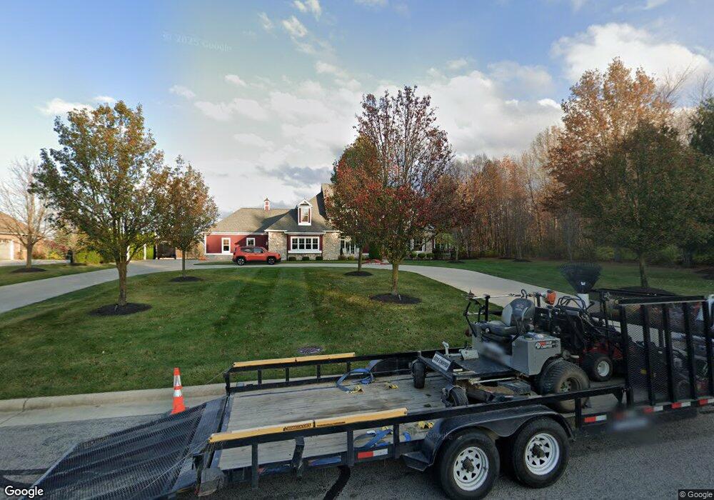
This home is located at 575 Homestead Dr, Lima, OH 45807 and is currently estimated at $923,383, approximately $179 per square foot. 575 Homestead Dr is a home located in Allen County with nearby schools including Maplewood Elementary School, Elmwood Elementary School, and Shawnee Middle School.
Ownership History
Date
Name
Owned For
Owner Type
Purchase Details
Closed on
Jun 27, 2019
Sold by
Ahl Andrea D and Ahl Thomas W
Bought by
Edgerton Michael Thomas and Edgerton Anne Rayn
Current Estimated Value
Home Financials for this Owner
Home Financials are based on the most recent Mortgage that was taken out on this home.
Original Mortgage
$435,000
Outstanding Balance
$376,008
Interest Rate
4%
Mortgage Type
New Conventional
Estimated Equity
$547,375
Create a Home Valuation Report for This Property
The Home Valuation Report is an in-depth analysis detailing your home's value as well as a comparison with similar homes in the area
Purchase History
We collect this data history from publicly available records. To have your information removed, we recommend requesting removal directly through your county’s website.
| Date | Buyer | Sale Price | Title Company |
|---|---|---|---|
| Edgerton Michael Thomas | $850,000 | None Available |
Source: Public Records
Mortgage History
We collect this data history from publicly available records. To have your information removed, we recommend requesting removal directly through your county’s website.
| Date | Status | Borrower | Loan Amount |
|---|---|---|---|
| Open | Edgerton Michael Thomas | $435,000 |
Source: Public Records
Tax History
| Year | Tax Paid | Tax Assessment Tax Assessment Total Assessment is a certain percentage of the fair market value that is determined by local assessors to be the total taxable value of land and additions on the property. | Land | Improvement |
|---|---|---|---|---|
| 2025 | $13,215 | $298,410 | $29,540 | $268,870 |
| 2024 | $13,210 | $298,410 | $29,540 | $268,870 |
| 2023 | $14,136 | $284,200 | $28,140 | $256,060 |
| 2022 | $14,253 | $284,200 | $28,140 | $256,060 |
| 2021 | $14,324 | $284,200 | $28,140 | $256,060 |
| 2020 | $9,992 | $200,340 | $26,670 | $173,670 |
| 2019 | $9,992 | $200,340 | $26,670 | $173,670 |
| 2018 | $10,117 | $200,340 | $26,670 | $173,670 |
| 2017 | $10,291 | $200,340 | $26,670 | $173,670 |
| 2016 | $10,199 | $200,340 | $26,670 | $173,670 |
| 2015 | $11,240 | $200,340 | $26,670 | $173,670 |
| 2014 | $11,240 | $217,390 | $34,690 | $182,700 |
| 2013 | $10,176 | $217,390 | $34,690 | $182,700 |
Source: Public Records
Map
Nearby Homes
- 00 Seriff
- 123 Eagles Point W
- 110 Eagles Point St W
- 616 Wildbrook Ln
- 3462 Makley Dr
- 4848 W Elm St
- 0 Springview Dr
- 4095 Spencerville Rd
- 4875 Wenatchi Trail
- 849 Yakima Trail
- 845 Atalan Trail
- 2910 Koop Rd
- 1455 Riverview Dr
- 3071 Canterbury Dr
- 3055 Clinton Way
- 2974 Autumn Leaves Ct
- 1515 Riverview Dr
- 1540 Adak Ave
- 000 N Stevick Rd
- 0000 N Stevick Rd
- 569 Homestead Dr
- 557 Homestead Dr
- 575 Honeysuckle Bend
- 545 Homestead Dr
- 564 Honeysuckle Bend
- 544 Homestead Dr
- 536 Homestead Dr
- 533 Homestead Dr
- 556 Honeysuckle Bend
- 501 Honeysuckle Bend
- 501 Honeysuckle Bend
- 548 Honeysuckle Bend
- 524 Honeysuckle Bend
- 499 Homestead Dr
- 0 Homestead Dr
- 508 Honeysuckle Bend
- 4167 Hickory Place
- 4179 Hickory Place
- 491 Homestead Dr
- 516 Honeysuckle Bend
Your Personal Tour Guide
Ask me questions while you tour the home.