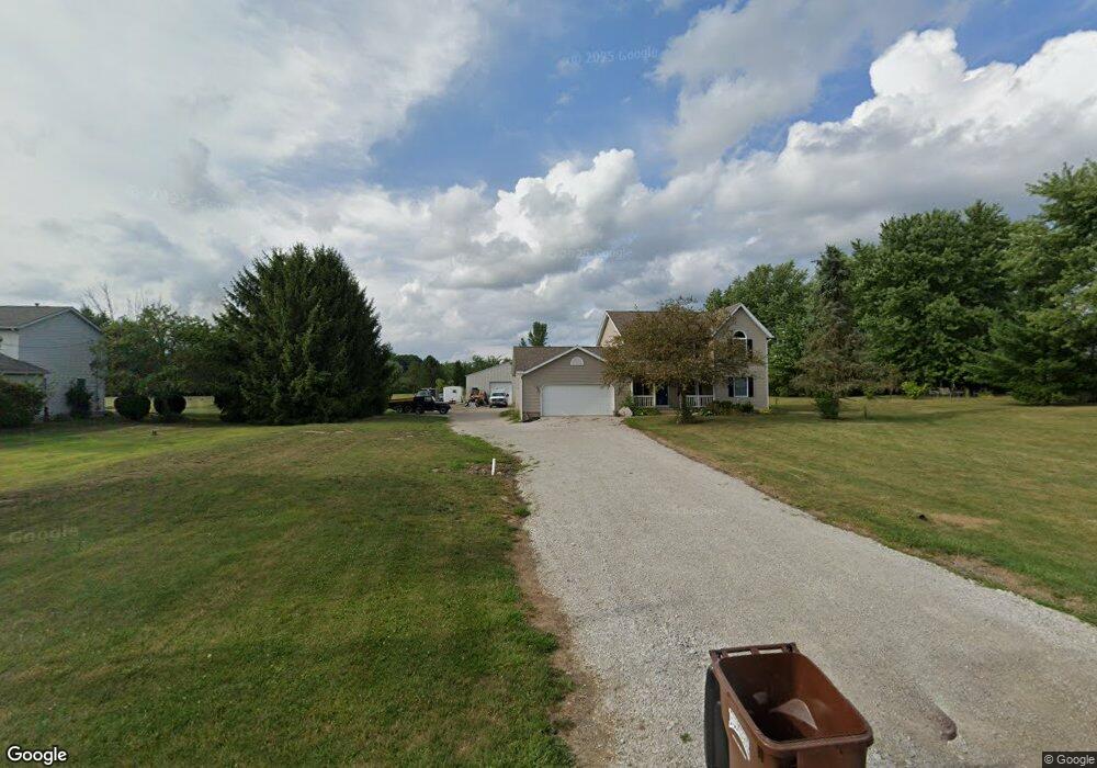
5772 Blacks Rd SW Pataskala, OH 43062
Harrison NeighborhoodEstimated Value: $397,000 - $441,000
3
Beds
3
Baths
1,800
Sq Ft
$233/Sq Ft
Est. Value
About This Home
This home is located at 5772 Blacks Rd SW, Pataskala, OH 43062 and is currently estimated at $420,085, approximately $233 per square foot. 5772 Blacks Rd SW is a home located in Licking County with nearby schools including Kirkersville Elementary School, Etna Elementary School, and Watkins Middle School.
Ownership History
Date
Name
Owned For
Owner Type
Purchase Details
Closed on
Apr 28, 2021
Sold by
Gang Justin
Bought by
Bowman Stephanie M and Bowman Steven G
Current Estimated Value
Home Financials for this Owner
Home Financials are based on the most recent Mortgage that was taken out on this home.
Original Mortgage
$165,862
Outstanding Balance
$148,055
Interest Rate
3.1%
Mortgage Type
FHA
Estimated Equity
$272,030
Purchase Details
Closed on
Jan 30, 2001
Sold by
Spicer Charles R
Bought by
Gang Justin
Home Financials for this Owner
Home Financials are based on the most recent Mortgage that was taken out on this home.
Original Mortgage
$149,981
Interest Rate
7.43%
Mortgage Type
FHA
Create a Home Valuation Report for This Property
The Home Valuation Report is an in-depth analysis detailing your home's value as well as a comparison with similar homes in the area
Home Values in the Area
Average Home Value in this Area
Purchase History
| Date | Buyer | Sale Price | Title Company |
|---|---|---|---|
| Bowman Stephanie M | $200,000 | None Available | |
| Gang Justin | $152,000 | -- |
Source: Public Records
Mortgage History
| Date | Status | Borrower | Loan Amount |
|---|---|---|---|
| Open | Bowman Stephanie M | $165,862 | |
| Closed | Gang Justin | $149,981 |
Source: Public Records
Tax History
| Year | Tax Paid | Tax Assessment Tax Assessment Total Assessment is a certain percentage of the fair market value that is determined by local assessors to be the total taxable value of land and additions on the property. | Land | Improvement |
|---|---|---|---|---|
| 2025 | $5,406 | $119,570 | $28,250 | $91,320 |
| 2024 | $5,102 | $119,290 | $28,250 | $91,040 |
| 2023 | $5,097 | $119,290 | $28,250 | $91,040 |
| 2022 | $4,151 | $82,640 | $19,740 | $62,900 |
| 2021 | $4,781 | $82,640 | $19,740 | $62,900 |
| 2020 | $5,227 | $82,640 | $19,740 | $62,900 |
| 2019 | $4,558 | $65,520 | $17,150 | $48,370 |
| 2018 | $4,571 | $0 | $0 | $0 |
| 2017 | $4,538 | $0 | $0 | $0 |
| 2016 | $4,126 | $0 | $0 | $0 |
| 2015 | $2,006 | $0 | $0 | $0 |
| 2014 | $4,887 | $0 | $0 | $0 |
| 2013 | $3,967 | $0 | $0 | $0 |
Source: Public Records
Map
Nearby Homes
- 20 Jeremy Ct
- 102 Warwood Dr
- 0 York Rd SW Unit 225014420
- 5706 Gale Rd SW
- 5131 Deeds Rd
- 0 Ashcraft Dr Unit Lot 27-A 225031190
- 28 Calumet Dr N
- 11 Joshua Ln
- 365 Virginia Ct Unit 365
- 377 Virginia Ct Unit 377
- 7945 Blacks Rd SW
- 103 Johnathan Dr
- 13300 E Broad St SW
- 124 Avery Place
- 6595 Watkins Rd SW
- 173 Mannaseh Dr E
- 215 Mannaseh Dr W
- 131 Natalie Ln
- 225 Stonegate Loop Unit 225
- 242 Mannaseh Dr W
- 5744 Blacks Rd SW
- 5800 Blacks Rd SW
- 5716 Blacks Rd SW
- 5789 Blacks Rd SW
- 5751 Blacks Rd SW
- 5831 Blacks Rd SW
- 83 Millstone Cir
- 5854 Blacks Rd SW
- 77 Millstone Cir
- 5688 Blacks Rd SW
- 71 Millstone Cir
- 5660 Blacks Rd SW
- 5882 Blacks Rd SW
- 65 Millstone Cir
- 5665 Blacks Rd SW
- 74 Millstone Cir
- 80 Millstone Cir
- 68 Millstone Cir
- 57 Millstone Cir
- 5663 Blacks Rd SW
Your Personal Tour Guide
Ask me questions while you tour the home.