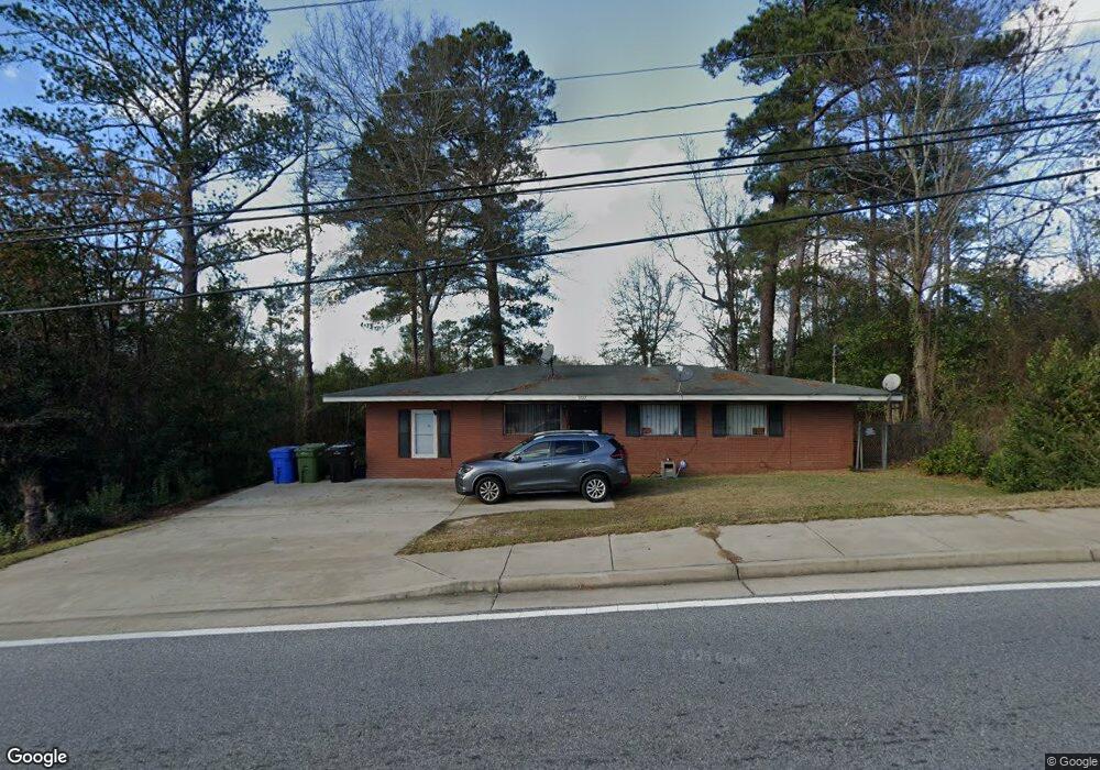
5777 Forrest Rd Columbus, GA 31907
East Columbus NeighborhoodEstimated Value: $92,581 - $141,000
4
Beds
2
Baths
1,200
Sq Ft
$97/Sq Ft
Est. Value
About This Home
This home is located at 5777 Forrest Rd, Columbus, GA 31907 and is currently estimated at $116,395, approximately $96 per square foot. 5777 Forrest Rd is a home located in Muscogee County with nearby schools including Forrest Road Elementary School, Fort Middle School, and Kendrick High School.
Ownership History
Date
Name
Owned For
Owner Type
Purchase Details
Closed on
Feb 24, 2014
Sold by
Biship William Samuel
Bought by
Columbus Consolidated Governme
Current Estimated Value
Purchase Details
Closed on
May 10, 2007
Sold by
R P Property Management Inc
Bought by
Bishop William Samuel
Purchase Details
Closed on
Jul 21, 2006
Sold by
Rp Property Managments
Bought by
Cb & T Bank Of Es
Create a Home Valuation Report for This Property
The Home Valuation Report is an in-depth analysis detailing your home's value as well as a comparison with similar homes in the area
Home Values in the Area
Average Home Value in this Area
Purchase History
| Date | Buyer | Sale Price | Title Company |
|---|---|---|---|
| Columbus Consolidated Governme | $20,000 | -- | |
| Bishop William Samuel | $69,500 | None Available | |
| Cb & T Bank Of Es | $249,000 | None Available |
Source: Public Records
Tax History
| Year | Tax Paid | Tax Assessment Tax Assessment Total Assessment is a certain percentage of the fair market value that is determined by local assessors to be the total taxable value of land and additions on the property. | Land | Improvement |
|---|---|---|---|---|
| 2025 | $1,197 | $30,568 | $6,940 | $23,628 |
| 2024 | $1,197 | $30,568 | $6,940 | $23,628 |
| 2023 | $1,204 | $30,568 | $6,940 | $23,628 |
| 2022 | $1,039 | $25,444 | $6,940 | $18,504 |
| 2021 | $938 | $22,984 | $6,940 | $16,044 |
| 2020 | $939 | $22,984 | $6,940 | $16,044 |
| 2019 | $942 | $22,984 | $6,940 | $16,044 |
| 2018 | $942 | $22,984 | $6,940 | $16,044 |
| 2017 | $945 | $22,984 | $6,940 | $16,044 |
| 2016 | $1,154 | $27,973 | $2,551 | $25,422 |
| 2015 | $1,155 | $27,973 | $2,551 | $25,422 |
| 2014 | $1,157 | $27,973 | $2,551 | $25,422 |
| 2013 | -- | $27,973 | $2,551 | $25,422 |
Source: Public Records
Map
Nearby Homes
- 2807 Doyle Ave
- 6059 Nassau Cir
- 2513 Lacey Oak Ct
- 3106 Urban Ave
- 5939 Norton St
- 1809 Cumbaa Ct
- 2222 Barnes Dr
- 2708 Skylake Dr
- 2672 Honeysuckle Dr
- 6319 Morning Dew Dr
- 6315 Morning Dew Dr
- 6311 Morning Dew Dr
- 3301 Musket Dr
- 6038 Creekside Dr
- 5725 Marlette Ct
- 2812 White Chapel Dr
- 3371 Flintlock Dr
- 6340 Lemongrass Dr
- 6334 Lemongrass Dr
- 6328 Lemongrass Dr
- 5783 Forrest Rd
- 2856 Doyle Ave
- 2860 Doyle Ave
- 5791 Forrest Rd
- 2861 Urban Ave
- 2864 Doyle Ave
- 2865 Urban Ave
- 2849 Doyle Ave
- 2843 Doyle Ave
- 2855 Doyle Ave
- 2868 Doyle Ave
- 2861 Doyle Ave
- 2869 Urban Ave
- 2865 Doyle Ave
- 5803 Forrest Rd
- 2872 Doyle Ave
- 5843 Windham Ct
- 2875 Urban Ave
- 2869 Doyle Ave
- 5837 Windham Ct
Your Personal Tour Guide
Ask me questions while you tour the home.