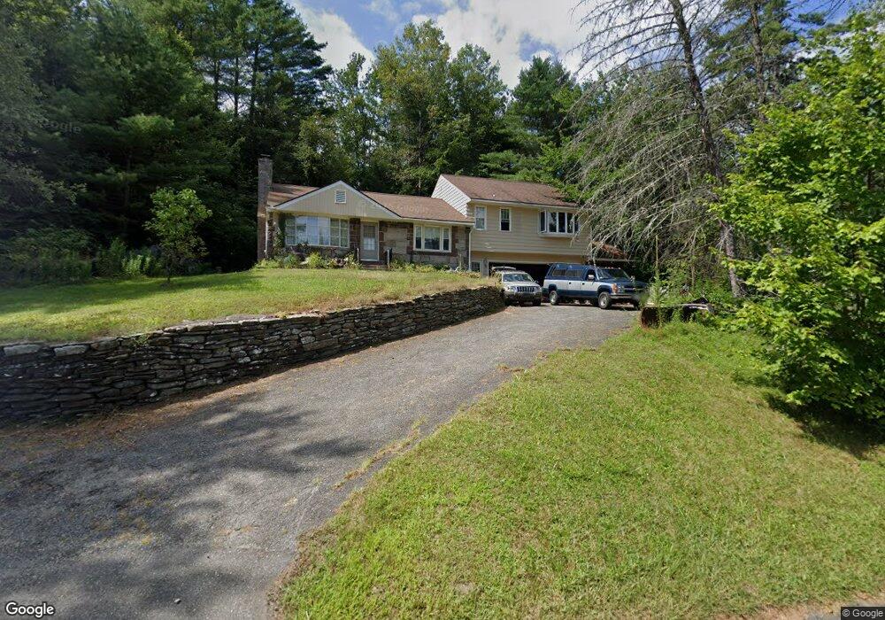
578 S Washington State Rd Washington, MA 01223
Estimated Value: $235,000 - $342,000
2
Beds
1
Bath
945
Sq Ft
$285/Sq Ft
Est. Value
About This Home
This home is located at 578 S Washington State Rd, Washington, MA 01223 and is currently estimated at $269,084, approximately $284 per square foot. 578 S Washington State Rd is a home located in Berkshire County with nearby schools including Wahconah Regional High School.
Ownership History
Date
Name
Owned For
Owner Type
Purchase Details
Closed on
Oct 8, 1992
Sold by
Macdonald David T and Macdonald Pauline E
Bought by
Roos Mark F
Current Estimated Value
Home Financials for this Owner
Home Financials are based on the most recent Mortgage that was taken out on this home.
Original Mortgage
$60,000
Interest Rate
7.99%
Mortgage Type
Purchase Money Mortgage
Create a Home Valuation Report for This Property
The Home Valuation Report is an in-depth analysis detailing your home's value as well as a comparison with similar homes in the area
Home Values in the Area
Average Home Value in this Area
Purchase History
We collect this data history from publicly available records. To have your information removed, we recommend requesting removal directly through your county’s website.
| Date | Buyer | Sale Price | Title Company |
|---|---|---|---|
| Roos Mark F | $75,000 | -- |
Source: Public Records
Mortgage History
We collect this data history from publicly available records. To have your information removed, we recommend requesting removal directly through your county’s website.
| Date | Status | Borrower | Loan Amount |
|---|---|---|---|
| Open | Roos Mark F | $30,000 | |
| Closed | Roos Mark F | $60,000 |
Source: Public Records
Tax History
| Year | Tax Paid | Tax Assessment Tax Assessment Total Assessment is a certain percentage of the fair market value that is determined by local assessors to be the total taxable value of land and additions on the property. | Land | Improvement |
|---|---|---|---|---|
| 2025 | $2,506 | $177,000 | $20,400 | $156,600 |
| 2024 | $2,451 | $160,100 | $20,400 | $139,700 |
| 2023 | $2,313 | $152,100 | $20,400 | $131,700 |
| 2022 | $2,036 | $137,200 | $20,400 | $116,800 |
| 2021 | $1,999 | $119,800 | $20,400 | $99,400 |
| 2019 | $1,704 | $114,900 | $20,400 | $94,500 |
| 2018 | $13 | $114,900 | $20,400 | $94,500 |
| 2017 | $1,672 | $119,100 | $20,400 | $98,700 |
| 2016 | $1,687 | $122,900 | $20,400 | $102,500 |
| 2015 | $1,607 | $119,800 | $20,400 | $99,400 |
| 2014 | $1,559 | $116,100 | $20,400 | $95,700 |
Source: Public Records
Map
Nearby Homes
- 3 Summit Hill Rd
- 88 Stonehouse Rd
- 885 Washington Mountain Rd
- 349 N Washington State Rd
- 1570 B Washington Mountain Rd
- 15 Stephanie Ln
- Lot 2B Leland Rd
- Lot 2 Leland Rd
- 3186 Main St
- 674 Benton Hill Rd
- 471 Benton Hill Rd
- 14 Blotz Rd
- 0 Yokum Pond Rd
- Lot 3 Yokum Pond Rd
- 411-51 &52 Skyline Trail
- 30 Leonhardt Rd
- 283 Benton Hill Rd
- 16 Garnet Mountain Ln
- Lots 34-36 Lake View Rd
- 15 Haskell Rd
- 554 S Washington State Rd
- 609 S Washington State Rd
- 616 S Washington State Rd
- 500 S Washington State Rd
- 503 S Washington State Rd
- 651 S Washington State Rd
- 489 S Washington State Rd
- 482 S Washington State Rd
- 677 S Washington State Rd
- 93 Lower Valley Rd
- 721 S Washington State Rd
- 732 S Washington State Rd
- 198 Lower Valley Rd
- 1378 Lovers Lane Rd
- 4 Upper Valley Rd
- 386 S Washington State Rd
- 386 S Washington State Rd
- 1226 Lovers Lane Rd
- 1308 Lovers Lane Rd
- 1422 Lovers Lane Rd
Your Personal Tour Guide
Ask me questions while you tour the home.