Estimated Value: $466,490 - $500,000
4
Beds
3
Baths
2,166
Sq Ft
$224/Sq Ft
Est. Value
About This Home
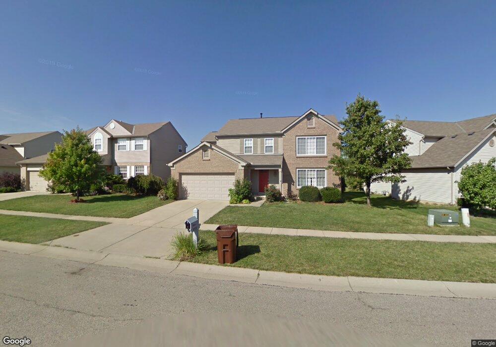
This home is located at 5781 Stone Trace Dr, Mason, OH 45040 and is currently estimated at $484,123, approximately $223 per square foot. 5781 Stone Trace Dr is a home located in Warren County with nearby schools including Mason Intermediate Elementary School, Mason Middle School, and William Mason High School.
Ownership History
Date
Name
Owned For
Owner Type
Purchase Details
Closed on
Jun 6, 2005
Sold by
Clark Mark D and Clark Mary A
Bought by
Ravishankar Dindagur N and Ravishankar Shobha
Current Estimated Value
Home Financials for this Owner
Home Financials are based on the most recent Mortgage that was taken out on this home.
Original Mortgage
$180,000
Outstanding Balance
$91,839
Interest Rate
5.91%
Mortgage Type
Fannie Mae Freddie Mac
Estimated Equity
$392,284
Purchase Details
Closed on
Aug 31, 1998
Sold by
Fischer Single Family Ho
Bought by
Clark Mark D and Clark Mary A
Home Financials for this Owner
Home Financials are based on the most recent Mortgage that was taken out on this home.
Original Mortgage
$169,300
Interest Rate
7.03%
Mortgage Type
New Conventional
Create a Home Valuation Report for This Property
The Home Valuation Report is an in-depth analysis detailing your home's value as well as a comparison with similar homes in the area
Home Values in the Area
Average Home Value in this Area
Purchase History
We collect this data history from publicly available records. To have your information removed, we recommend requesting removal directly through your county’s website.
| Date | Buyer | Sale Price | Title Company |
|---|---|---|---|
| Ravishankar Dindagur N | $225,000 | Stewart Advanced Land Title | |
| Clark Mark D | $178,225 | -- |
Source: Public Records
Mortgage History
We collect this data history from publicly available records. To have your information removed, we recommend requesting removal directly through your county’s website.
| Date | Status | Borrower | Loan Amount |
|---|---|---|---|
| Open | Ravishankar Dindagur N | $180,000 | |
| Previous Owner | Clark Mark D | $169,300 |
Source: Public Records
Tax History
| Year | Tax Paid | Tax Assessment Tax Assessment Total Assessment is a certain percentage of the fair market value that is determined by local assessors to be the total taxable value of land and additions on the property. | Land | Improvement |
|---|---|---|---|---|
| 2025 | $5,412 | $126,250 | $35,000 | $91,250 |
| 2024 | $5,412 | $126,250 | $35,000 | $91,250 |
| 2023 | $5,037 | $98,640 | $19,057 | $79,583 |
| 2022 | $5,037 | $98,641 | $19,058 | $79,583 |
| 2021 | $4,792 | $98,641 | $19,058 | $79,583 |
| 2020 | $4,664 | $81,522 | $15,750 | $65,772 |
| 2019 | $4,323 | $81,522 | $15,750 | $65,772 |
| 2018 | $4,305 | $81,522 | $15,750 | $65,772 |
| 2017 | $4,170 | $72,223 | $15,967 | $56,256 |
| 2016 | $4,286 | $72,223 | $15,967 | $56,256 |
| 2015 | $3,977 | $72,223 | $15,967 | $56,256 |
| 2014 | $3,977 | $62,260 | $13,770 | $48,500 |
| 2013 | $3,986 | $71,240 | $15,750 | $55,490 |
Source: Public Records
Map
Nearby Homes
- 8300 Cherrydale Ct
- 5661 Baywatch Way
- 5625 Baywatch Way
- 5625 Baywatch Way Unit 204
- 5562 Baywatch Way
- 5369 N Shore Place
- 5570 Harbourwatch Way
- 5576 Winding Cape Way
- 8678 Hampton Bay Place
- 9032 Nottingham Way
- 7648 Waterfront Way
- 7601 Waterfront Way
- 9071 Quincy Ct
- 9024 Beacon St
- 8810 Charleston Hill Ct
- 9285 Leland Ct
- 5686 Farm Field Dr
- 6716 Charleston Run Ct
- 9045 Fields Dr
- 7511 Somerset Rd
- 5775 Stone Trace Dr
- 5789 Stone Trace Dr
- 5767 Stone Trace Dr
- 5811 Stone Trace Dr
- 8385 Lee Ct
- 5757 Stone Trace Dr
- 8379 Lee Ct
- 5827 Stone Trace Dr
- 5766 Stone Trace Dr
- 8316 Cora Ct
- 5841 Stone Trace Dr
- 5749 Stone Trace Dr
- 8374 Lee Ct
- 5758 Stone Trace Dr
- 5849 Stone Trace Dr
- 8361 Lee Ct
- 8361 Lee Ct Unit 117
- 5826 Stone Trace Dr
- 8308 Cora Ct
- 5748 Stone Trace Dr
Your Personal Tour Guide
Ask me questions while you tour the home.