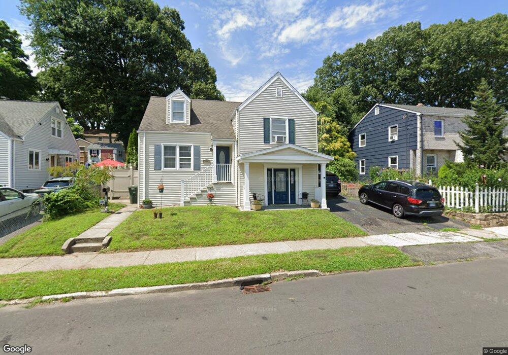
580 Ruth St Bridgeport, CT 06606
North End NeighborhoodEstimated Value: $395,000 - $434,000
3
Beds
2
Baths
1,431
Sq Ft
$288/Sq Ft
Est. Value
About This Home
This home is located at 580 Ruth St, Bridgeport, CT 06606 and is currently estimated at $412,813, approximately $288 per square foot. 580 Ruth St is a home located in Fairfield County with nearby schools including Blackham School, Central High School, and St Andrew School.
Ownership History
Date
Name
Owned For
Owner Type
Purchase Details
Closed on
Mar 22, 2010
Sold by
Jasko Kenneth J and Jasko Donna
Bought by
Mohammed Mousa M and Maturka Milagros
Current Estimated Value
Home Financials for this Owner
Home Financials are based on the most recent Mortgage that was taken out on this home.
Original Mortgage
$159,000
Outstanding Balance
$105,750
Interest Rate
5.05%
Estimated Equity
$307,063
Create a Home Valuation Report for This Property
The Home Valuation Report is an in-depth analysis detailing your home's value as well as a comparison with similar homes in the area
Home Values in the Area
Average Home Value in this Area
Purchase History
We collect this data history from publicly available records. To have your information removed, we recommend requesting removal directly through your county’s website.
| Date | Buyer | Sale Price | Title Company |
|---|---|---|---|
| Mohammed Mousa M | $199,000 | -- | |
| Mohammed Mousa M | $199,000 | -- |
Source: Public Records
Mortgage History
We collect this data history from publicly available records. To have your information removed, we recommend requesting removal directly through your county’s website.
| Date | Status | Borrower | Loan Amount |
|---|---|---|---|
| Open | Mohammed Mousa M | $159,000 | |
| Closed | Mohammed Mousa M | $159,000 |
Source: Public Records
Tax History
| Year | Tax Paid | Tax Assessment Tax Assessment Total Assessment is a certain percentage of the fair market value that is determined by local assessors to be the total taxable value of land and additions on the property. | Land | Improvement |
|---|---|---|---|---|
| 2025 | $7,288 | $167,730 | $76,310 | $91,420 |
| 2024 | $7,288 | $167,730 | $76,310 | $91,420 |
| 2023 | $7,288 | $167,730 | $76,310 | $91,420 |
| 2022 | $7,288 | $167,730 | $76,310 | $91,420 |
| 2021 | $7,288 | $167,730 | $76,310 | $91,420 |
| 2020 | $6,559 | $121,480 | $43,840 | $77,640 |
| 2019 | $6,559 | $121,480 | $43,840 | $77,640 |
| 2018 | $6,605 | $121,480 | $43,840 | $77,640 |
| 2017 | $6,605 | $121,480 | $43,840 | $77,640 |
| 2016 | $6,605 | $121,480 | $43,840 | $77,640 |
| 2015 | $6,216 | $147,290 | $50,650 | $96,640 |
| 2014 | $6,216 | $147,290 | $50,650 | $96,640 |
Source: Public Records
Map
Nearby Homes
- 669 Queen St
- 646 Merritt St
- 520 Goldenrod Ave
- 375 Ruth St
- 855 Burnsford Ave
- 900 Merritt St
- 838 Ruth St
- 300 Birmingham St
- 149 Ashton St
- 27 Plateau Ave
- 415 Jewett Ave
- 286 Ruth St
- 462 Glendale Ave Unit 11
- 255 Ruth St
- 56 Peet St
- 557 Glendale Ave
- 337 Jewett Ave
- 316 Goldenrod Ave
- 403 Clark St
- 345 Glendale Ave Unit A2
Your Personal Tour Guide
Ask me questions while you tour the home.