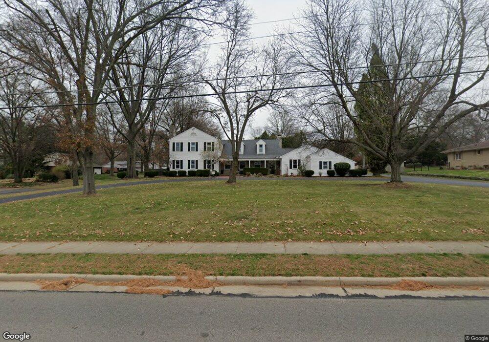
581 W Wayne Ave Wooster, OH 44691
Estimated Value: $439,000 - $594,000
About This Home
This home is located at 581 W Wayne Ave, Wooster, OH 44691 and is currently estimated at $535,541, approximately $169 per square foot. 581 W Wayne Ave is a home located in Wayne County with nearby schools including Parkview Elementary School, Edgewood Middle School, and Wooster High School.
Ownership History
We collect this data history from publicly available records. To have your information removed, we recommend requesting removal directly through your county’s website.
Purchase Details
Home Financials for this Owner
Home Financials are based on the most recent Mortgage that was taken out on this home.Purchase Details
Purchase Details
Home Values in the Area
Average Home Value in this Area
Purchase History
We collect this data history from publicly available records. To have your information removed, we recommend requesting removal directly through your county’s website.
| Date | Buyer | Sale Price | Title Company |
|---|---|---|---|
| $358,500 | Wayne County Title | ||
| -- | None Available | ||
| $265,000 | -- |
Mortgage History
We collect this data history from publicly available records. To have your information removed, we recommend requesting removal directly through your county’s website.
| Date | Status | Borrower | Loan Amount |
|---|---|---|---|
| Open | $286,800 |
Tax History
We collect this data history from publicly available records. To have your information removed, we recommend requesting removal directly through your county’s website.
| Year | Tax Paid | Tax Assessment Tax Assessment Total Assessment is a certain percentage of the fair market value that is determined by local assessors to be the total taxable value of land and additions on the property. | Land | Improvement |
|---|---|---|---|---|
| 2025 | $6,443 | $156,030 | $25,770 | $130,260 |
| 2024 | $6,443 | $155,420 | $25,770 | $129,650 |
| 2023 | $6,443 | $155,420 | $25,770 | $129,650 |
| 2022 | $6,127 | $117,740 | $19,520 | $98,220 |
| 2021 | $6,321 | $117,740 | $19,520 | $98,220 |
| 2020 | $5,992 | $117,740 | $19,520 | $98,220 |
| 2019 | $6,472 | $122,150 | $19,520 | $102,630 |
| 2018 | $5,764 | $108,470 | $19,520 | $88,950 |
| 2017 | $5,802 | $108,470 | $19,520 | $88,950 |
| 2016 | $5,982 | $104,230 | $19,520 | $84,710 |
| 2015 | $5,873 | $104,230 | $19,520 | $84,710 |
| 2014 | $5,876 | $104,230 | $19,520 | $84,710 |
| 2013 | $6,062 | $106,480 | $21,870 | $84,610 |
Map
- 254 W Wayne Ave
- 944 Northwestern Ave
- 851 Park Blvd
- 900 Quinby Ave
- 946 Douglas Dr
- 869 Meadow Ln
- 430 Bloomington Ave
- 982 Marilyn Dr
- 637 Quinby Ave
- 1407 Venture Blvd
- 1667 Carlin Trail
- 1090 Mindy Ln Unit 1090
- 487 Woodland Ave
- 411 Danberry Dr
- 1819 Saddle Brook Cir
- 1044 Patrick Place Unit 12
- 600 Sunrise View Dr
- 2140 Melanie Dr
- 00 Nelson Ave
- 421 McDonald St
- 1471 Saunders Dr
- 515 W Wayne Ave
- 615 W Wayne Ave
- 1470 Saunders Dr
- 1485 Saunders Dr
- 1470 Morgan St
- 1484 Saunders Dr
- 1497 Saunders Dr
- 1488 Morgan St
- 637 W Wayne Ave
- 1498 Saunders Dr
- 1479 Ruth Cir
- 435 W Wayne Ave
- 1511 Saunders Dr
- 1502 Morgan St
- 1449 Arthur Dr
- 1467 Morgan St
- 1512 Saunders Dr
- 1483 Morgan St
- 1485 Ruth Cir
Ask me questions while you tour the home.