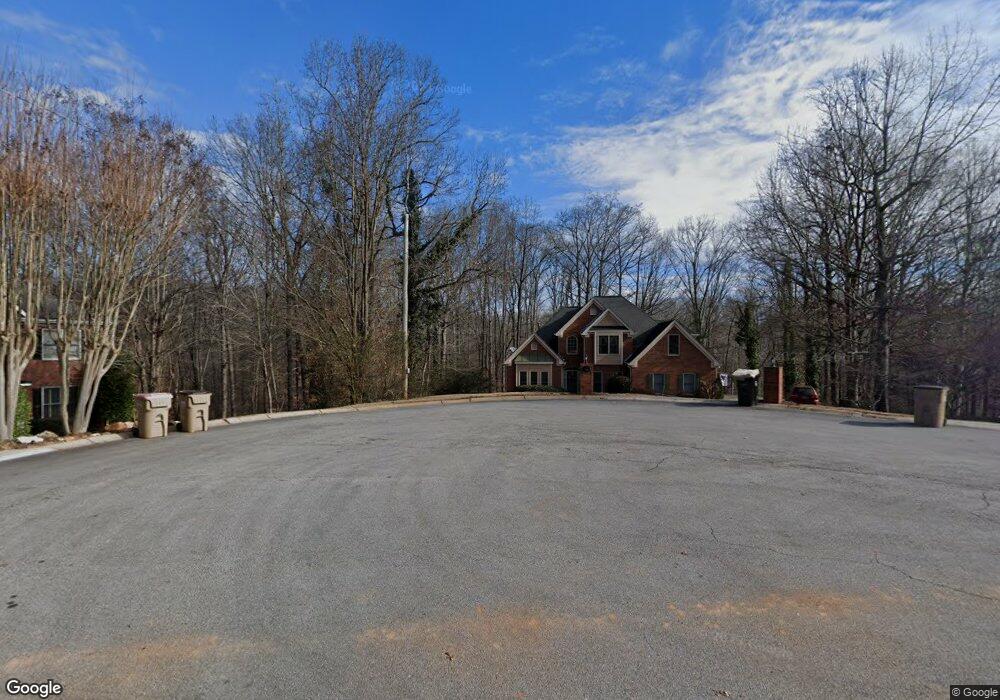
5846 Bayside Ct Buford, GA 30518
Estimated Value: $493,342 - $579,000
4
Beds
4
Baths
2,607
Sq Ft
$209/Sq Ft
Est. Value
About This Home
This home is located at 5846 Bayside Ct, Buford, GA 30518 and is currently estimated at $543,836, approximately $208 per square foot. 5846 Bayside Ct is a home located in Hall County with nearby schools including Friendship Elementary School, C.W. Davis Middle School, and Flowery Branch High School.
Ownership History
Date
Name
Owned For
Owner Type
Purchase Details
Closed on
Jul 27, 2001
Sold by
Hansard Keith B and Hansard Angela L
Bought by
Johndrow Edward J and Johndrow Rita K
Current Estimated Value
Home Financials for this Owner
Home Financials are based on the most recent Mortgage that was taken out on this home.
Original Mortgage
$180,000
Outstanding Balance
$67,560
Interest Rate
7.1%
Mortgage Type
New Conventional
Estimated Equity
$476,276
Purchase Details
Closed on
May 1, 1994
Create a Home Valuation Report for This Property
The Home Valuation Report is an in-depth analysis detailing your home's value as well as a comparison with similar homes in the area
Home Values in the Area
Average Home Value in this Area
Purchase History
We collect this data history from publicly available records. To have your information removed, we recommend requesting removal directly through your county’s website.
| Date | Buyer | Sale Price | Title Company |
|---|---|---|---|
| Johndrow Edward J | $270,000 | -- | |
| -- | $30,000 | -- |
Source: Public Records
Mortgage History
We collect this data history from publicly available records. To have your information removed, we recommend requesting removal directly through your county’s website.
| Date | Status | Borrower | Loan Amount |
|---|---|---|---|
| Open | Johndrow Edward J | $180,000 |
Source: Public Records
Tax History
| Year | Tax Paid | Tax Assessment Tax Assessment Total Assessment is a certain percentage of the fair market value that is determined by local assessors to be the total taxable value of land and additions on the property. | Land | Improvement |
|---|---|---|---|---|
| 2025 | $107 | $176,680 | $31,945 | $144,735 |
| 2024 | $1,540 | $176,680 | $31,030 | $145,650 |
| 2023 | $3,816 | $176,680 | $31,880 | $144,800 |
| 2022 | $3,940 | $148,560 | $31,880 | $116,680 |
| 2021 | $3,656 | $135,080 | $22,920 | $112,160 |
| 2020 | $3,864 | $138,880 | $15,360 | $123,520 |
| 2019 | $3,807 | $135,560 | $15,360 | $120,200 |
| 2018 | $3,451 | $118,520 | $11,720 | $106,800 |
| 2017 | $3,103 | $107,280 | $11,720 | $95,560 |
| 2016 | $2,693 | $94,880 | $7,840 | $87,040 |
| 2015 | $2,704 | $94,880 | $7,840 | $87,040 |
| 2014 | $2,704 | $94,880 | $7,840 | $87,040 |
Source: Public Records
Map
Nearby Homes
- 5832 Bay View Dr
- 5817 Bayside Ct
- 5885 Bay View Dr
- 6238 Cascade Falls Dr
- 6298 Lanier Harbor Landing
- 1900 Lanier Harbor Point
- 1930 Lanier Harbor Point
- 5574 Lanier Islands Pkwy
- 5033 Lanier Islands Pkwy
- 6142 Bethany View Trail
- 6119 Bethany View Trail
- 6093 Shadburn Ferry Rd
- 6172 New Bethany Rd
- 6146 Bethany View Trail
- 6225 Bridgewood Dr
- 6222 Bridgewood Dr
- 5602 Ivy Green Dr
- 6415 Rock Springs Cir
- 5697 Frontier Walk Ln
- 2608 Wendover Ct
- 5842 Bayside Ct
- 5850 Bayside Ct
- 5843 Bayside Ct
- 5838 Bayside Ct Unit 23
- 5838 Bayside Ct
- 6004 Island View Dr
- 5839 Bayside Ct
- 5835 Bayside Ct
- 5834 Bayside Ct
- 5997 Island View Dr
- 5820 County Ct
- 5831 Bayside Ct
- 5831 Bayside Ct
- 5831 Bayside Ct Unit 5831
- 0 Bay View Dr Unit 7167204
- 0 Bay View Dr Unit 5206631
- 6010 Island View Dr
- 5859 Bay View Dr
- 5816 County Ct
- 5844 Bay View Dr
Your Personal Tour Guide
Ask me questions while you tour the home.