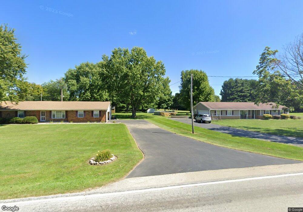
5890 Morris Rd Springfield, OH 45502
Estimated Value: $255,337 - $348,000
3
Beds
2
Baths
1,528
Sq Ft
$192/Sq Ft
Est. Value
About This Home
This home is located at 5890 Morris Rd, Springfield, OH 45502 and is currently estimated at $293,584, approximately $192 per square foot. 5890 Morris Rd is a home located in Clark County with nearby schools including Northridge Elementary School, Kenton Ridge Middle & High School, and Emmanuel Christian Academy.
Ownership History
Date
Name
Owned For
Owner Type
Purchase Details
Closed on
Mar 10, 2008
Sold by
Strickland Bonnie E
Bought by
Elliott Thomas E
Current Estimated Value
Home Financials for this Owner
Home Financials are based on the most recent Mortgage that was taken out on this home.
Original Mortgage
$136,923
Outstanding Balance
$84,171
Interest Rate
5.75%
Mortgage Type
FHA
Estimated Equity
$209,413
Purchase Details
Closed on
Dec 23, 1993
Sold by
Cook Lynn Adell
Bought by
Elliott Thomas E and Strickl Bonnie E
Create a Home Valuation Report for This Property
The Home Valuation Report is an in-depth analysis detailing your home's value as well as a comparison with similar homes in the area
Purchase History
We collect this data history from publicly available records. To have your information removed, we recommend requesting removal directly through your county’s website.
| Date | Buyer | Sale Price | Title Company |
|---|---|---|---|
| Elliott Thomas E | -- | Partners Land Title Agency | |
| Elliott Thomas E | $84,000 | -- |
Source: Public Records
Mortgage History
We collect this data history from publicly available records. To have your information removed, we recommend requesting removal directly through your county’s website.
| Date | Status | Borrower | Loan Amount |
|---|---|---|---|
| Open | Elliott Thomas E | $136,923 |
Source: Public Records
Tax History
| Year | Tax Paid | Tax Assessment Tax Assessment Total Assessment is a certain percentage of the fair market value that is determined by local assessors to be the total taxable value of land and additions on the property. | Land | Improvement |
|---|---|---|---|---|
| 2025 | $1,932 | $66,010 | $15,770 | $50,240 |
| 2024 | $1,895 | $53,970 | $12,240 | $41,730 |
| 2023 | $1,895 | $53,970 | $12,240 | $41,730 |
| 2022 | $1,920 | $53,970 | $12,240 | $41,730 |
| 2021 | $2,217 | $44,260 | $10,030 | $34,230 |
| 2020 | $2,219 | $44,260 | $10,030 | $34,230 |
| 2019 | $2,261 | $44,260 | $10,030 | $34,230 |
| 2018 | $2,036 | $38,260 | $9,290 | $28,970 |
| 2017 | $1,745 | $38,252 | $9,286 | $28,966 |
| 2016 | $1,733 | $38,252 | $9,286 | $28,966 |
| 2015 | $1,677 | $35,652 | $9,286 | $26,366 |
| 2014 | $1,677 | $35,652 | $9,286 | $26,366 |
| 2013 | $1,638 | $35,652 | $9,286 | $26,366 |
Source: Public Records
Map
Nearby Homes
- 6055 Prairie Rd
- 4401 Mumper Rd
- 5029 Old Mechanicsburg Rd
- 4931 Bosart Rd
- 4898 Brannan Dr E
- 5235 Middle Urbana Rd
- 4917 Auston St
- 5195 Burton Dr
- 4954 E County Line Rd
- 1788 Berwick Dr
- 1738 Berwick Dr Unit 107
- 1602 Oldham Dr Unit 15
- 1524 New Castle Ln
- 5866 Oldham Dr
- 5866 Oldham Dr Unit 4
- 4642 Laredo St
- 4732 Lehigh Dr
- 4008 Bosart Rd
- 5831 Ridgewood Rd W
- 1473 Knight Rd
Your Personal Tour Guide
Ask me questions while you tour the home.