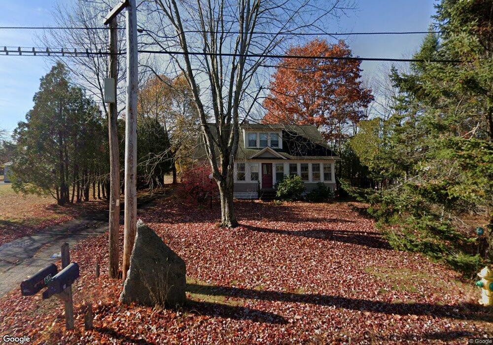
59 Kennebunk Rd Alfred, ME 04002
Estimated Value: $388,000 - $556,000
4
Beds
2
Baths
2,911
Sq Ft
$163/Sq Ft
Est. Value
About This Home
This home is located at 59 Kennebunk Rd, Alfred, ME 04002 and is currently estimated at $473,365, approximately $162 per square foot. 59 Kennebunk Rd is a home located in York County with nearby schools including Massabesic High School, St Thomas Consolidated School, and Sanford Christian Academy.
Ownership History
Date
Name
Owned For
Owner Type
Purchase Details
Closed on
Dec 12, 2012
Sold by
Cope Julie A
Bought by
Cope Frederick C
Current Estimated Value
Home Financials for this Owner
Home Financials are based on the most recent Mortgage that was taken out on this home.
Original Mortgage
$187,682
Interest Rate
3.44%
Mortgage Type
Unknown
Create a Home Valuation Report for This Property
The Home Valuation Report is an in-depth analysis detailing your home's value as well as a comparison with similar homes in the area
Home Values in the Area
Average Home Value in this Area
Purchase History
| Date | Buyer | Sale Price | Title Company |
|---|---|---|---|
| Cope Frederick C | -- | -- |
Source: Public Records
Mortgage History
| Date | Status | Borrower | Loan Amount |
|---|---|---|---|
| Closed | Cope Frederick C | $187,682 |
Source: Public Records
Tax History
| Year | Tax Paid | Tax Assessment Tax Assessment Total Assessment is a certain percentage of the fair market value that is determined by local assessors to be the total taxable value of land and additions on the property. | Land | Improvement |
|---|---|---|---|---|
| 2025 | $4,300 | $445,634 | $114,970 | $330,664 |
| 2024 | $4,211 | $445,634 | $114,970 | $330,664 |
| 2023 | $4,365 | $232,200 | $95,400 | $136,800 |
| 2022 | $4,180 | $232,200 | $95,400 | $136,800 |
| 2021 | $4,005 | $232,200 | $95,400 | $136,800 |
| 2020 | $1,696 | $232,200 | $95,400 | $136,800 |
| 2019 | $4,314 | $232,200 | $95,400 | $136,800 |
| 2018 | $3,692 | $232,200 | $95,400 | $136,800 |
| 2017 | $3,372 | $232,200 | $95,400 | $136,800 |
| 2016 | $3,518 | $232,200 | $95,400 | $136,800 |
| 2015 | $3,367 | $232,200 | $95,400 | $136,800 |
| 2014 | $3,309 | $232,200 | $95,400 | $136,800 |
| 2013 | $3,193 | $232,200 | $95,400 | $136,800 |
Source: Public Records
Map
Nearby Homes
- 40 Saco Rd
- 58 Sanford Rd
- 87 Drown Rd
- TBD Kennebunk Rd
- Lot 35 Bennett Rd
- 232 Waterboro Rd
- TBD Bernier Rd
- TBD1 Bernier Rd
- 0 Sanford Rd
- 85 Branch View Terrace N
- 13 Federal St
- TBD Branch View Terrace Unit Lot 5
- TBD Branch View Terrace Unit Lot 4
- Lot B Bernier Rd
- Lot A Bernier Rd
- 8 Hummingbird Ln
- 65 Old County Rd
- 8 Jesse Cir
- Lot 650 Gebung Rd
- Lot 3 Kennebunk Rd
- 0 Rt 111 Unit 149492
- 0 Rt 111 Unit 219926
- 0 Rt 111 Unit 228769
- 0 Rt 111 Unit 644239
- 0 Rt 111 Unit 938094
- 1480 Route 111 (Alfred Rd)
- 57 Kennebunk
- 79 Biddeford Rd
- 60 Kennebunk Rd
- 62 Kennebunk Rd
- 66 Kennebunk Rd
- 70 Kennebunk Rd
- 10 School St
- 71 Biddeford Rd
- 36 Court St
- 35 Court St
- 77 Kennebunk Rd
- 65 Biddeford Rd
- 38 Kennebunk Rd
- 0 Court St
Your Personal Tour Guide
Ask me questions while you tour the home.