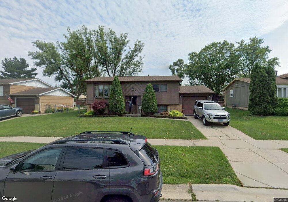
5901 Edward Dr Oak Forest, IL 60452
Estimated Value: $231,000 - $291,000
3
Beds
3
Baths
936
Sq Ft
$288/Sq Ft
Est. Value
About This Home
This home is located at 5901 Edward Dr, Oak Forest, IL 60452 and is currently estimated at $269,190, approximately $287 per square foot. 5901 Edward Dr is a home located in Cook County with nearby schools including Kimberly Heights Elementary School, Scarlet Oak Elementary School, and Arbor Park Middle School.
Ownership History
Date
Name
Owned For
Owner Type
Purchase Details
Closed on
Oct 17, 2006
Sold by
Porter Kenneth J and Porter Jamie L
Bought by
Oehrlein David M and Fennessey Kelly A
Current Estimated Value
Home Financials for this Owner
Home Financials are based on the most recent Mortgage that was taken out on this home.
Original Mortgage
$216,601
Outstanding Balance
$126,520
Interest Rate
6.36%
Mortgage Type
FHA
Estimated Equity
$142,670
Purchase Details
Closed on
Jul 18, 2003
Sold by
Podraza James M and Podraza Janet D
Bought by
Porter Kenneth J and Porter Jamie L
Home Financials for this Owner
Home Financials are based on the most recent Mortgage that was taken out on this home.
Original Mortgage
$177,900
Interest Rate
6.33%
Mortgage Type
Unknown
Create a Home Valuation Report for This Property
The Home Valuation Report is an in-depth analysis detailing your home's value as well as a comparison with similar homes in the area
Home Values in the Area
Average Home Value in this Area
Purchase History
| Date | Buyer | Sale Price | Title Company |
|---|---|---|---|
| Oehrlein David M | $220,000 | Pntn | |
| Porter Kenneth J | $183,500 | Multiple |
Source: Public Records
Mortgage History
| Date | Status | Borrower | Loan Amount |
|---|---|---|---|
| Open | Oehrlein David M | $216,601 | |
| Previous Owner | Porter Kenneth J | $177,900 |
Source: Public Records
Tax History
| Year | Tax Paid | Tax Assessment Tax Assessment Total Assessment is a certain percentage of the fair market value that is determined by local assessors to be the total taxable value of land and additions on the property. | Land | Improvement |
|---|---|---|---|---|
| 2025 | $6,757 | $22,000 | $2,970 | $19,030 |
| 2024 | $6,757 | $22,000 | $2,970 | $19,030 |
| 2023 | $6,189 | $22,000 | $2,970 | $19,030 |
| 2022 | $6,189 | $16,708 | $2,640 | $14,068 |
| 2021 | $6,078 | $16,707 | $2,640 | $14,067 |
| 2020 | $5,959 | $16,707 | $2,640 | $14,067 |
| 2019 | $5,795 | $16,343 | $2,475 | $13,868 |
| 2018 | $5,665 | $16,343 | $2,475 | $13,868 |
| 2017 | $5,665 | $16,343 | $2,475 | $13,868 |
| 2016 | $5,541 | $14,707 | $2,310 | $12,397 |
| 2015 | $5,327 | $14,707 | $2,310 | $12,397 |
| 2014 | $5,219 | $14,707 | $2,310 | $12,397 |
| 2013 | $5,169 | $16,125 | $2,310 | $13,815 |
Source: Public Records
Map
Nearby Homes
- 15414 Las Flores Ln
- 15804 Terrace Dr Unit R03
- 15705 Peggy Ln
- 15818 Terrace Dr Unit R3
- 15822 Terrace Dr Unit R02
- 6151 Victoria Dr
- 15723 Peggy Ln Unit 11
- 15723 Peggy Ln Unit 12
- 15257 Rob Roy Dr
- 15805 Peggy Ln Unit 6
- 6252 157th St
- 5535 Adeline Place
- 15201 Geoffrey Rd Unit 1
- 15118 Hillside Ave
- 16352 169 Lot #13 Place
- 16917 W Thackeray Lot #10 St
- 16352 169 Lot #15 Place
- 14901 S Cicero Ave
- 16913 Thackeray Lot 9 St
- 16352 169 Lot #7 Place
Your Personal Tour Guide
Ask me questions while you tour the home.