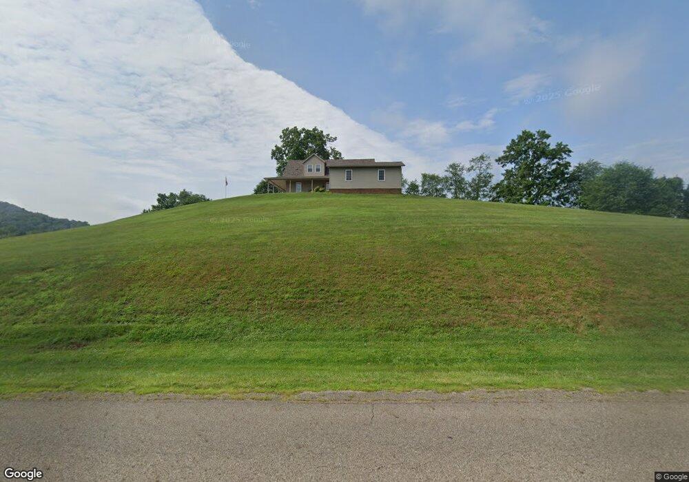
5914 Wolf Run Rd SE Dennison, OH 44621
Estimated Value: $179,000 - $348,000
2
Beds
1
Bath
3,056
Sq Ft
$90/Sq Ft
Est. Value
About This Home
This home is located at 5914 Wolf Run Rd SE, Dennison, OH 44621 and is currently estimated at $274,587, approximately $89 per square foot. 5914 Wolf Run Rd SE is a home located in Tuscarawas County with nearby schools including Claymont High School and Immaculate Conception School.
Ownership History
Date
Name
Owned For
Owner Type
Purchase Details
Closed on
Feb 4, 2005
Sold by
Fogle Abigail K
Bought by
Randolph Ralph R and Randolph Laura D
Current Estimated Value
Purchase Details
Closed on
Jun 16, 2003
Sold by
Mccollam Joan M and Scott Margaret J Mccollam
Bought by
Fogle Abigail K
Home Financials for this Owner
Home Financials are based on the most recent Mortgage that was taken out on this home.
Original Mortgage
$64,600
Outstanding Balance
$28,298
Interest Rate
5.78%
Mortgage Type
Purchase Money Mortgage
Estimated Equity
$246,289
Create a Home Valuation Report for This Property
The Home Valuation Report is an in-depth analysis detailing your home's value as well as a comparison with similar homes in the area
Home Values in the Area
Average Home Value in this Area
Purchase History
| Date | Buyer | Sale Price | Title Company |
|---|---|---|---|
| Randolph Ralph R | $100,000 | -- | |
| Fogle Abigail K | $80,750 | -- |
Source: Public Records
Mortgage History
| Date | Status | Borrower | Loan Amount |
|---|---|---|---|
| Open | Fogle Abigail K | $64,600 |
Source: Public Records
Tax History
| Year | Tax Paid | Tax Assessment Tax Assessment Total Assessment is a certain percentage of the fair market value that is determined by local assessors to be the total taxable value of land and additions on the property. | Land | Improvement |
|---|---|---|---|---|
| 2024 | $2,489 | $223,510 | $45,000 | $178,510 |
| 2023 | $2,489 | $223,510 | $45,000 | $178,510 |
| 2022 | $2,563 | $78,229 | $15,750 | $62,479 |
| 2021 | $2,475 | $69,444 | $18,456 | $50,988 |
| 2020 | $2,450 | $67,288 | $18,456 | $48,832 |
| 2019 | $2,265 | $67,288 | $18,456 | $48,832 |
| 2018 | $1,045 | $59,970 | $16,450 | $43,520 |
| 2017 | $2,088 | $59,970 | $16,450 | $43,520 |
| 2016 | $2,079 | $59,970 | $16,450 | $43,520 |
| 2014 | $1,971 | $56,040 | $11,700 | $44,340 |
| 2013 | $1,977 | $56,040 | $11,700 | $44,340 |
Source: Public Records
Map
Nearby Homes
- 3515 Eastport Rd SE
- 5665 Innkeeper St SE
- 0 Indian Hill Rd SE Unit 5190160
- 0 Canary Rd SE
- 1305 Eastport Ave
- 0 Vernon St Unit 5009296
- 223 E 9th St
- 0 Royal St
- 911 N Water St
- 2993 Brightwood Rd SE
- 4768 Fette Rd
- 4707 E State St
- 4848 Fette Rd SE
- 717 N Dawson St
- 0 Ford Dr
- 2215 Hilliard Dr
- 4747 Indian Hill Rd SE
- 316 N 2nd St
- 11 Sherman St
- 319 E 5th St
- 3897 Clay Ct SE
- 3883 Clay Ct SE
- 3911 Clay Ct SE
- 3869 Clay Ct SE
- 3853 Clay Ct SE
- 3927 Clay Ct SE
- 5925 Wolf Run Rd SE
- 355 Clay Ct
- 353 Clay Ct
- 351 Clay Ct
- 349 Clay Ct
- 347 Clay Ct
- 347 SE Clay Court Ct SE
- 3841 Clay Ct SE
- 3882 Clay Ct SE
- 3898 Clay Ct SE
- 3945 Clay Ct SE
- 3868 Clay Ct SE
- 356 Clay Ct
- 354 Clay Ct
Your Personal Tour Guide
Ask me questions while you tour the home.