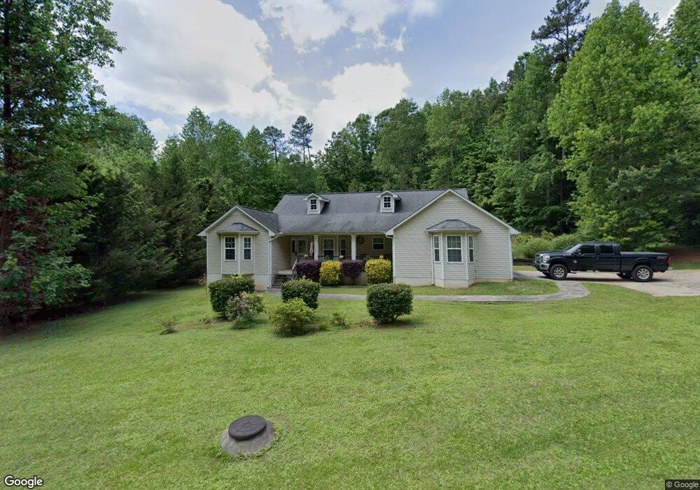
592 Fernside Dr Toccoa, GA 30577
Toccoa AreaEstimated Value: $291,000 - $312,000
About This Home
This home is located at 592 Fernside Dr, Toccoa, GA 30577 and is currently estimated at $300,926, approximately $172 per square foot. 592 Fernside Dr is a home located in Stephens County with nearby schools including Stephens County High School.
Ownership History
We collect this data history from publicly available records. To have your information removed, we recommend requesting removal directly through your county’s website.
Purchase Details
Home Financials for this Owner
Home Financials are based on the most recent Mortgage that was taken out on this home.Purchase Details
Home Financials for this Owner
Home Financials are based on the most recent Mortgage that was taken out on this home.Purchase Details
Home Financials for this Owner
Home Financials are based on the most recent Mortgage that was taken out on this home.Purchase Details
Purchase History
We collect this data history from publicly available records. To have your information removed, we recommend requesting removal directly through your county’s website.
| Date | Buyer | Sale Price | Title Company |
|---|---|---|---|
| $284,000 | -- | ||
| $138,900 | -- | ||
| $122,500 | -- | ||
| $22,000 | -- |
Mortgage History
We collect this data history from publicly available records. To have your information removed, we recommend requesting removal directly through your county’s website.
| Date | Status | Borrower | Loan Amount |
|---|---|---|---|
| Open | $270,197 | ||
| Previous Owner | $70,000 | ||
| Previous Owner | $132,849 |
Tax History
We collect this data history from publicly available records. To have your information removed, we recommend requesting removal directly through your county’s website.
| Year | Tax Paid | Tax Assessment Tax Assessment Total Assessment is a certain percentage of the fair market value that is determined by local assessors to be the total taxable value of land and additions on the property. | Land | Improvement |
|---|---|---|---|---|
| 2025 | $3,195 | $110,422 | $3,790 | $106,632 |
| 2024 | $2,618 | $73,448 | $3,790 | $69,658 |
| 2023 | $2,417 | $68,346 | $3,790 | $64,556 |
| 2022 | $1,917 | $64,395 | $3,790 | $60,605 |
| 2021 | $1,865 | $59,648 | $3,790 | $55,858 |
| 2020 | $1,862 | $58,967 | $3,790 | $55,177 |
| 2019 | $1,647 | $51,943 | $3,790 | $48,153 |
| 2018 | $1,647 | $51,943 | $3,790 | $48,153 |
| 2017 | $1,609 | $51,943 | $3,790 | $48,153 |
| 2016 | $1,584 | $51,942 | $3,789 | $48,153 |
| 2015 | $1,659 | $51,942 | $3,789 | $48,153 |
| 2014 | $1,686 | $51,943 | $3,790 | $48,153 |
| 2013 | -- | $51,942 | $3,789 | $48,153 |
Map
- 579 Wesley Cir
- 324 Fern Valley Dr
- 156 Crestwood Dr
- 637 Brookdale Rd
- 18 Foxdale Cir
- 425 Ayers Creek Dr
- 110 Valley Rd
- 104 Boulder Dr
- 134 Boulder Dr
- 119 Boulder Dr
- 155 Boulder Dr
- 137 Boulder Dr
- 400 Harris St
- LOT 15 Cross Creek Dr
- 148 Moreland Dr
- 59 Lucille Ln
- 261 Oak Valley Rd
- 47 Cherokee Blvd
- 199 Harris St
- 1186 E Tugalo St
- 18 Wesley Cir
- 640 Fernside Dr
- 63 Collier Mill Rd
- 41 Wesley Dr
- 0 Collier Mill Rd Unit LOT7 7296376
- 0 Collier Mill Rd Unit LOT5 7296384
- 0 Collier Mill Rd Unit LOT8 7296375
- 0 Collier Mill Rd Unit 7,8 8168439
- 0 Collier Mill Rd Unit 5 8168403
- 100 Wesley Dr
- 662 Fernside Dr
- 33 Wesley Cir
- 38 Collier Mill Rd
- 78 Collier Mill Rd
- 54 Collier Mill Rd
- 711 Wesley Cir
- 725 Wesley Cir
- 40 Wesley Dr
- 667 Wesley Cir
- 495 Fernside Dr
Ask me questions while you tour the home.