Estimated Value: $395,000 - $438,000
4
Beds
2
Baths
2,385
Sq Ft
$174/Sq Ft
Est. Value
About This Home
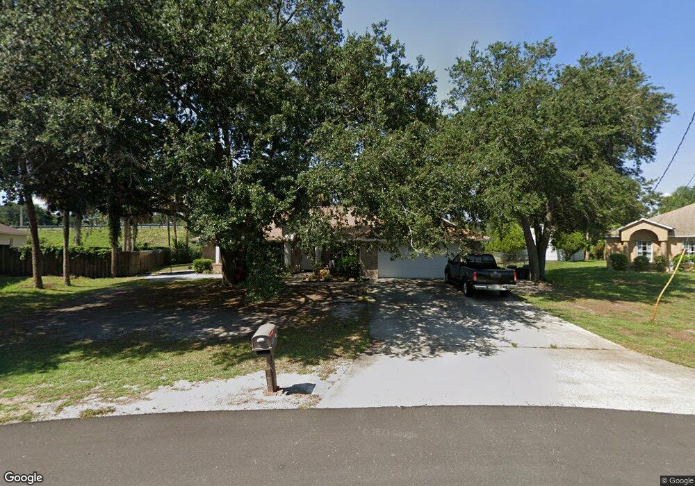
This home is located at 5920 Chapman St, Cocoa, FL 32927 and is currently estimated at $414,005, approximately $173 per square foot. 5920 Chapman St is a home located in Brevard County with nearby schools including Enterprise Elementary School, Space Coast Junior/Senior High School, and East Atlantic Prep of Brevard County.
Ownership History
Date
Name
Owned For
Owner Type
Purchase Details
Closed on
Mar 9, 2023
Sold by
Cook Rose M
Bought by
Gernot Debrah M and Gernot David A
Current Estimated Value
Home Financials for this Owner
Home Financials are based on the most recent Mortgage that was taken out on this home.
Original Mortgage
$311,000
Outstanding Balance
$301,236
Interest Rate
6.13%
Mortgage Type
New Conventional
Estimated Equity
$112,769
Purchase Details
Closed on
Oct 4, 1993
Sold by
Tran Nga T
Bought by
Cook Robert S and Cook Rose M
Create a Home Valuation Report for This Property
The Home Valuation Report is an in-depth analysis detailing your home's value as well as a comparison with similar homes in the area
Home Values in the Area
Average Home Value in this Area
Purchase History
| Date | Buyer | Sale Price | Title Company |
|---|---|---|---|
| Gernot Debrah M | $400,000 | International Title & Escrow | |
| Cook Robert S | $9,900 | -- |
Source: Public Records
Mortgage History
| Date | Status | Borrower | Loan Amount |
|---|---|---|---|
| Open | Gernot Debrah M | $311,000 |
Source: Public Records
Tax History
| Year | Tax Paid | Tax Assessment Tax Assessment Total Assessment is a certain percentage of the fair market value that is determined by local assessors to be the total taxable value of land and additions on the property. | Land | Improvement |
|---|---|---|---|---|
| 2025 | $4,900 | $363,550 | -- | -- |
| 2024 | $746 | $367,410 | -- | -- |
| 2023 | $746 | $130,290 | $0 | $0 |
| 2022 | $724 | $126,500 | $0 | $0 |
| 2021 | $702 | $122,820 | $0 | $0 |
| 2020 | $610 | $121,130 | $0 | $0 |
| 2019 | $550 | $118,410 | $0 | $0 |
| 2018 | $541 | $116,210 | $0 | $0 |
| 2017 | $522 | $113,820 | $0 | $0 |
| 2016 | $516 | $111,480 | $16,200 | $95,280 |
| 2015 | $504 | $110,710 | $13,500 | $97,210 |
| 2014 | $504 | $109,840 | $9,900 | $99,940 |
Source: Public Records
Map
Nearby Homes
- 6250 Ainsworth Rd
- 6085 Edison St
- 23-35-21-JX-B-2 Aruin St
- 6230 Balsam St
- 0 Aruin St Unit 1222557
- 5601 Banos Ave
- 5680 Banos Ave
- 6460 Ainsworth Rd
- 6215 Balboa St
- 6460 Homestead Ave
- 5721 Beaverbrook St
- 6150 Baltimore Ave
- 5946 Deer Ln
- 6438 Hudson Rd
- 6545 Addie Ave
- 6481 La Brea Ave
- 00000 Golfview Ave
- 5945 Coker Ave
- 6220 Golfview Ave
- 000 Port Saint John Pkwy
- 6033 Logan Ave
- 5930 Chapman St
- 000 Balsam St
- 5940 Chapman St
- 6021 Logan Ave
- 6030 Logan Ave
- 0 Chapman St Unit 214986
- 0 Chapman St Unit 500524
- 6018 Logan Ave
- 5950 Chapman St
- 6009 Logan Ave
- 6025 Keystone Ave
- 6006 Logan Ave
- 5997 Logan Ave
- 5960 Chapman St
- 6005 Keystone Ave
- 5994 Logan Ave
- 5985 Logan Ave
- 5970 Chapman St
- 6020 Keystone Ave
Your Personal Tour Guide
Ask me questions while you tour the home.