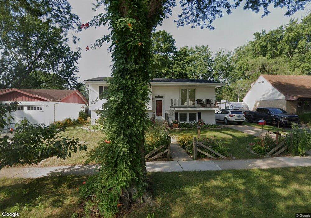
593 Maple Dr Buffalo Grove, IL 60089
South Buffalo Grove NeighborhoodEstimated Value: $335,000 - $405,000
3
Beds
1
Bath
1,129
Sq Ft
$331/Sq Ft
Est. Value
About This Home
This home is located at 593 Maple Dr, Buffalo Grove, IL 60089 and is currently estimated at $373,970, approximately $331 per square foot. 593 Maple Dr is a home located in Cook County with nearby schools including Henry W Longfellow Elementary School, Cooper Middle School, and Buffalo Grove High School.
Ownership History
Date
Name
Owned For
Owner Type
Purchase Details
Closed on
May 19, 2009
Sold by
Czosnyka Mike
Bought by
Mueller Lynda M and Mueller Eric H
Current Estimated Value
Home Financials for this Owner
Home Financials are based on the most recent Mortgage that was taken out on this home.
Original Mortgage
$218,700
Interest Rate
5.21%
Mortgage Type
New Conventional
Purchase Details
Closed on
Jul 11, 2003
Sold by
Czosnyka Bernadine
Bought by
Czosnyka Berandine and Bernadine Czosnyka Living Trust
Create a Home Valuation Report for This Property
The Home Valuation Report is an in-depth analysis detailing your home's value as well as a comparison with similar homes in the area
Home Values in the Area
Average Home Value in this Area
Purchase History
| Date | Buyer | Sale Price | Title Company |
|---|---|---|---|
| Mueller Lynda M | $243,000 | Ticor Title Insurance Co | |
| Czosnyka Berandine | -- | -- |
Source: Public Records
Mortgage History
| Date | Status | Borrower | Loan Amount |
|---|---|---|---|
| Previous Owner | Mueller Lynda M | $218,700 |
Source: Public Records
Tax History
| Year | Tax Paid | Tax Assessment Tax Assessment Total Assessment is a certain percentage of the fair market value that is determined by local assessors to be the total taxable value of land and additions on the property. | Land | Improvement |
|---|---|---|---|---|
| 2025 | $6,751 | $32,000 | $7,560 | $24,440 |
| 2024 | $6,751 | $24,409 | $6,480 | $17,929 |
| 2023 | $7,137 | $24,409 | $6,480 | $17,929 |
| 2022 | $7,137 | $26,599 | $6,480 | $20,119 |
| 2021 | $6,029 | $20,394 | $4,140 | $16,254 |
| 2020 | $5,945 | $20,394 | $4,140 | $16,254 |
| 2019 | $5,939 | $22,610 | $4,140 | $18,470 |
| 2018 | $6,837 | $23,287 | $3,600 | $19,687 |
| 2017 | $6,731 | $23,287 | $3,600 | $19,687 |
| 2016 | $6,529 | $23,287 | $3,600 | $19,687 |
| 2015 | $6,297 | $21,159 | $3,060 | $18,099 |
| 2014 | $6,211 | $21,159 | $3,060 | $18,099 |
| 2013 | $5,723 | $21,159 | $3,060 | $18,099 |
Source: Public Records
Map
Nearby Homes
- 170 Cherrywood Rd
- 267 Timber Hill Rd
- 334 Stillwell Dr
- 222 Saint Marys Pkwy
- 496 Raupp Blvd
- 393 Indian Hill Dr
- 517 Longwood Dr
- 535 Weidner Rd
- 140 Manchester Dr Unit 408
- 170 Manchester Dr Unit 306
- 462 Longwood Dr
- 141 Manchester Ct
- 808 Old Checker Rd Unit C2
- 125 N Buffalo Grove Rd Unit 407
- 671 Hapsfield Ln Unit 105
- 800 Weidner Rd Unit 208
- 621 Hapsfield Ln Unit 103
- 820 Weidner Rd Unit 4013
- 820 Weidner Rd Unit 409
- 631 Hapsfield Ln Unit 631106
Your Personal Tour Guide
Ask me questions while you tour the home.