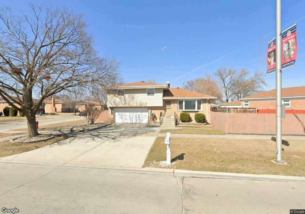
5938 W 83rd St Burbank, IL 60459
Estimated Value: $320,461 - $349,000
3
Beds
2
Baths
1,217
Sq Ft
$275/Sq Ft
Est. Value
About This Home
This home is located at 5938 W 83rd St, Burbank, IL 60459 and is currently estimated at $334,115, approximately $274 per square foot. 5938 W 83rd St is a home located in Cook County with nearby schools including Edward J Tobin Elementary School, Reavis High School, and St Albert the Great Catholic School.
Ownership History
Date
Name
Owned For
Owner Type
Purchase Details
Closed on
Aug 20, 2013
Sold by
Makropoulos Theodore and Makropoulos Paulina
Bought by
Midland Federal Savings And Loan Assn and Trust Number 1441
Current Estimated Value
Purchase Details
Closed on
Jan 18, 2013
Sold by
Chicago Title Land Trust Co
Bought by
Makropoulos Theodore and Makropoulos Paulina
Home Financials for this Owner
Home Financials are based on the most recent Mortgage that was taken out on this home.
Original Mortgage
$60,000
Interest Rate
3.3%
Mortgage Type
Credit Line Revolving
Create a Home Valuation Report for This Property
The Home Valuation Report is an in-depth analysis detailing your home's value as well as a comparison with similar homes in the area
Home Values in the Area
Average Home Value in this Area
Purchase History
We collect this data history from publicly available records. To have your information removed, we recommend requesting removal directly through your county’s website.
| Date | Buyer | Sale Price | Title Company |
|---|---|---|---|
| Midland Federal Savings And Loan Assn | -- | None Available | |
| Makropoulos Theodore | -- | Fidelity National Title |
Source: Public Records
Mortgage History
We collect this data history from publicly available records. To have your information removed, we recommend requesting removal directly through your county’s website.
| Date | Status | Borrower | Loan Amount |
|---|---|---|---|
| Previous Owner | Makropoulos Theodore | $60,000 |
Source: Public Records
Tax History
| Year | Tax Paid | Tax Assessment Tax Assessment Total Assessment is a certain percentage of the fair market value that is determined by local assessors to be the total taxable value of land and additions on the property. | Land | Improvement |
|---|---|---|---|---|
| 2025 | $2,066 | $24,322 | $2,726 | $21,596 |
| 2024 | $2,066 | $24,322 | $2,726 | $21,596 |
| 2023 | $2,648 | $24,322 | $2,726 | $21,596 |
| 2022 | $2,648 | $20,550 | $2,399 | $18,151 |
| 2021 | $2,468 | $20,549 | $2,398 | $18,151 |
| 2020 | $2,218 | $20,549 | $2,398 | $18,151 |
| 2019 | $2,467 | $18,336 | $2,180 | $16,156 |
| 2018 | $2,401 | $18,336 | $2,180 | $16,156 |
| 2017 | $2,281 | $18,336 | $2,180 | $16,156 |
| 2016 | $3,278 | $14,270 | $1,853 | $12,417 |
| 2015 | $3,315 | $14,270 | $1,853 | $12,417 |
| 2014 | $3,246 | $14,270 | $1,853 | $12,417 |
| 2013 | $3,906 | $17,503 | $1,853 | $15,650 |
Source: Public Records
Map
Nearby Homes
- 8215 Austin Ave
- 8416 Mansfield Ave
- 5852 W 81st Place
- 6117 W 83rd St
- 5733 W 83rd Place
- 5831 W 81st Place
- 8037 Mcvicker Ave
- 8516 Austin Ave
- 8405 Melvina Ave
- 8500 Parkside Ave
- 6127 W 79th Place
- 5940 W 87th St Unit 301
- 6040 W 79th St
- 5517 W 83rd Place
- 6328 W 85th St
- 6124 W 79th St
- 7945 Mobile Ave
- 7848 Meade Ave
- 7827 Meade Ave
- 7843 Massasoit Ave
- 5936 W 83rd St
- 8241 Mason Ave
- 8258 State Rd
- 8254 State Rd
- 8258 Mason Ave
- 8254 Mason Ave
- 8228 Mason Ave
- 8235 Mason Ave
- 8228 S Mason Ave
- 8224 Mayfield Ave
- 8226 Mason Ave
- 8222 Mayfield Ave
- 8300 Mayfield Ave
- 8233 Mason Ave
- 8220 Mayfield Ave
- 8224 Mason Ave
- 8226 Mayfield Ave
- 8229 Mason Ave
- 8222 Mason Ave
- 8257 Austin Ave
Your Personal Tour Guide
Ask me questions while you tour the home.