Estimated Value: $271,000 - $334,000
3
Beds
2
Baths
1,782
Sq Ft
$162/Sq Ft
Est. Value
About This Home
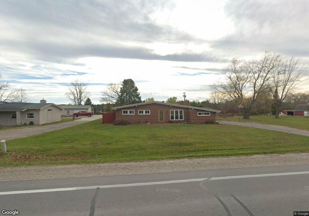
This home is located at 5951 Beard Rd, Clyde, MI 48049 and is currently estimated at $289,277, approximately $162 per square foot. 5951 Beard Rd is a home located in St. Clair County with nearby schools including Edison Elementary School, Fort Gratiot Middle School, and Port Huron Northern High School.
Ownership History
Date
Name
Owned For
Owner Type
Purchase Details
Closed on
Jun 13, 2023
Sold by
Morley Vern
Bought by
Vern Morley Revocable Living Trust
Current Estimated Value
Purchase Details
Closed on
Nov 30, 2010
Sold by
Bac Home Loans Servicing Lp
Bought by
Federal National Mortgage Association
Purchase Details
Closed on
May 6, 2010
Sold by
Samson Allen W and Samson Deborah J
Bought by
Bac Home Loans Servicing Lp and Countrywide Home Loans Servicing Lp
Create a Home Valuation Report for This Property
The Home Valuation Report is an in-depth analysis detailing your home's value as well as a comparison with similar homes in the area
Home Values in the Area
Average Home Value in this Area
Purchase History
| Date | Buyer | Sale Price | Title Company |
|---|---|---|---|
| Vern Morley Revocable Living Trust | -- | None Listed On Document | |
| Federal National Mortgage Association | -- | None Available | |
| Bac Home Loans Servicing Lp | $145,063 | None Available |
Source: Public Records
Tax History
| Year | Tax Paid | Tax Assessment Tax Assessment Total Assessment is a certain percentage of the fair market value that is determined by local assessors to be the total taxable value of land and additions on the property. | Land | Improvement |
|---|---|---|---|---|
| 2025 | $2,264 | $139,400 | $0 | $0 |
| 2024 | $2,196 | $135,500 | $0 | $0 |
| 2023 | $2,059 | $116,300 | $0 | $0 |
| 2022 | $2,375 | $106,700 | $0 | $0 |
| 2020 | $2,233 | $87,600 | $10,800 | $76,800 |
| 2019 | $2,192 | $83,600 | $0 | $0 |
| 2018 | $2,141 | $73,100 | $0 | $0 |
| 2017 | $2,098 | $68,700 | $0 | $0 |
| 2016 | $1,716 | $68,700 | $0 | $0 |
| 2015 | -- | $63,100 | $10,800 | $52,300 |
| 2014 | -- | $59,300 | $10,800 | $48,500 |
| 2013 | -- | $49,000 | $0 | $0 |
Source: Public Records
Map
Nearby Homes
- 0 Metcalf Rd Unit 20250029560
- 5575 River Ridge Trail
- 000 Metcalf Rd
- 00 Metcalf Rd
- 3780 Abbottsford Rd
- 7187 Phillips Rd
- VL North Rd
- 0 Mcintyre Unit 50191499
- 0 Rynn Rd Unit 50202174
- Lot 2 Beard Rd
- Lot 1 Beard Rd
- Lot 3 Beard Rd
- Lot 4 Beard Rd
- 4452 Cole Rd
- 0 Mcintyre Rd Unit 50193698
- 7560 Metcalf Rd
- 3559 Lightle Rd
- 3518 Lightle Rd
- Lot #9 Thornton Dr
- 5230 State Rd
- 5951 Beard Rd
- 5941 Beard Rd
- 5931 Beard Rd
- 5971 Beard Rd
- 4974 Wildcat Rd
- V/L Wildcat Rd
- 5989 Beard Rd
- 5011 Wildcat Rd
- 5897 Beard Rd
- 4936 Galbraith Ln
- 5887 Beard Rd
- 5021 Wildcat Rd
- 5870 Beard Rd
- 5889 Beard Rd
- 5820 Beard Rd
- 0 Galbraith Unit 4445667
- 0 Galbraith Unit 4724828
- 0 Galbraith Unit 31098737
- 0 Galbraith Unit R215076260
- 0 Galbraith Unit G31260439
Your Personal Tour Guide
Ask me questions while you tour the home.