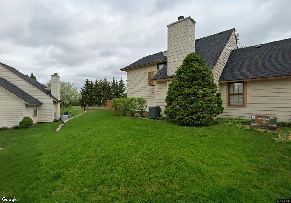
597 Dunham Rd Unit U320 Gurnee, IL 60031
Estimated Value: $219,000 - $243,000
About This Home
This home is located at 597 Dunham Rd Unit U320, Gurnee, IL 60031 and is currently estimated at $227,608, approximately $195 per square foot. 597 Dunham Rd Unit U320 is a home located in Lake County with nearby schools including Woodland Primary School, Woodland Elementary School, and Woodland Intermediate School.
Ownership History
We collect this data history from publicly available records. To have your information removed, we recommend requesting removal directly through your county’s website.
Purchase Details
Home Financials for this Owner
Home Financials are based on the most recent Mortgage that was taken out on this home.Purchase Details
Home Financials for this Owner
Home Financials are based on the most recent Mortgage that was taken out on this home.Purchase Details
Home Financials for this Owner
Home Financials are based on the most recent Mortgage that was taken out on this home.Home Values in the Area
Average Home Value in this Area
Purchase History
We collect this data history from publicly available records. To have your information removed, we recommend requesting removal directly through your county’s website.
| Date | Buyer | Sale Price | Title Company |
|---|---|---|---|
| $148,500 | Cti | ||
| $131,000 | Multiple | ||
| $57,666 | -- |
Mortgage History
We collect this data history from publicly available records. To have your information removed, we recommend requesting removal directly through your county’s website.
| Date | Status | Borrower | Loan Amount |
|---|---|---|---|
| Previous Owner | $118,800 | ||
| Previous Owner | $117,900 | ||
| Previous Owner | $61,500 |
Tax History
We collect this data history from publicly available records. To have your information removed, we recommend requesting removal directly through your county’s website.
| Year | Tax Paid | Tax Assessment Tax Assessment Total Assessment is a certain percentage of the fair market value that is determined by local assessors to be the total taxable value of land and additions on the property. | Land | Improvement |
|---|---|---|---|---|
| 2025 | $4,559 | $65,210 | $9,366 | $55,844 |
| 2024 | $4,413 | $56,983 | $8,185 | $48,798 |
| 2023 | $3,736 | $52,904 | $7,599 | $45,305 |
| 2022 | $3,736 | $44,333 | $5,929 | $38,404 |
| 2021 | $3,141 | $40,146 | $5,369 | $34,777 |
| 2020 | $3,031 | $39,159 | $5,237 | $33,922 |
| 2019 | $2,939 | $38,022 | $5,085 | $32,937 |
| 2018 | $2,434 | $32,973 | $2,676 | $30,297 |
| 2017 | $2,403 | $32,028 | $2,599 | $29,429 |
| 2016 | $2,365 | $30,602 | $2,483 | $28,119 |
| 2015 | $2,281 | $29,023 | $2,355 | $26,668 |
| 2014 | $2,118 | $27,502 | $2,323 | $25,179 |
| 2012 | $3,075 | $27,713 | $2,341 | $25,372 |
Map
- 661 Mitchell Ct Unit U235
- 648 Mitchell Ct
- 6131 Oakmont Ln
- 707 Chelsey Ct Unit 36
- 638 Sandwedge Place
- 6275 Doral Dr
- 845 Brian Ct Unit 6
- 917 Vose Dr Unit 411
- 930 Taylor Dr Unit 104
- 324 S Fork Dr
- 920 Vose Dr Unit 304
- 341 Hickory Haven Dr E
- 703 Owl Creek Ln
- 16820 W Serranda Dr Unit 17
- 228 Southridge Dr
- 913 Campbell Dr Unit U486
- 129 Knobb Hill Ln
- 17150 W Washington St
- 17080 W Cunningham Ct Unit 2AL
- 76 Foxboro Ln
- 593 Dunham Rd
- 591 Dunham Rd Unit U313
- 589 Dunham Rd Unit U312
- 595 Dunham Rd Unit 319
- 587 Dunham Rd
- 599 Dunham Rd
- 586 Dunham Rd Unit 302
- 594 Dunham Rd Unit U301
- 601 Dunham Rd
- 581 Dunham Rd Unit U306
- 588 Dunham Rd
- 596 Dunham Rd Unit U299
- 579 Dunham Rd Unit U305
- 590 Dunham Rd Unit U298
- 602 Dunham Rd Unit U310
- 577 Dunham Rd
- 604 Dunham Rd Unit U309
- 583 Dunham Rd Unit U308
- 575 Dunham Rd Unit U303
- 600 Dunham Rd Unit U295
Ask me questions while you tour the home.