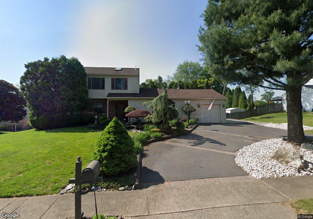
6 Alscot Cir Langhorne, PA 19047
Estimated Value: $536,000 - $635,000
3
Beds
2
Baths
1,892
Sq Ft
$311/Sq Ft
Est. Value
About This Home
This home is located at 6 Alscot Cir, Langhorne, PA 19047 and is currently estimated at $587,977, approximately $310 per square foot. 6 Alscot Cir is a home located in Bucks County with nearby schools including Tawanka Elementary School, Maple Point Middle School, and Neshaminy High School.
Ownership History
Date
Name
Owned For
Owner Type
Purchase Details
Closed on
Aug 15, 2000
Sold by
Smith Joseph M and Smith Sharon
Bought by
Yanovskiy Igor and Yanovskaya Irina
Current Estimated Value
Home Financials for this Owner
Home Financials are based on the most recent Mortgage that was taken out on this home.
Original Mortgage
$212,300
Interest Rate
7.69%
Mortgage Type
Stand Alone First
Purchase Details
Closed on
Jul 23, 1991
Bought by
Smith Joseph M and Smith Sharon
Create a Home Valuation Report for This Property
The Home Valuation Report is an in-depth analysis detailing your home's value as well as a comparison with similar homes in the area
Home Values in the Area
Average Home Value in this Area
Purchase History
| Date | Buyer | Sale Price | Title Company |
|---|---|---|---|
| Yanovskiy Igor | $212,300 | -- | |
| Smith Joseph M | $165,000 | -- |
Source: Public Records
Mortgage History
| Date | Status | Borrower | Loan Amount |
|---|---|---|---|
| Previous Owner | Yanovskiy Igor | $212,300 | |
| Closed | Yanovskiy Igor | $31,845 |
Source: Public Records
Tax History
| Year | Tax Paid | Tax Assessment Tax Assessment Total Assessment is a certain percentage of the fair market value that is determined by local assessors to be the total taxable value of land and additions on the property. | Land | Improvement |
|---|---|---|---|---|
| 2025 | $6,969 | $32,010 | $8,170 | $23,840 |
| 2024 | $6,969 | $32,010 | $8,170 | $23,840 |
| 2023 | $6,858 | $32,010 | $8,170 | $23,840 |
| 2022 | $6,678 | $32,010 | $8,170 | $23,840 |
| 2021 | $6,678 | $32,010 | $8,170 | $23,840 |
| 2020 | $6,598 | $32,010 | $8,170 | $23,840 |
| 2019 | $6,451 | $32,010 | $8,170 | $23,840 |
| 2018 | $6,332 | $32,010 | $8,170 | $23,840 |
| 2017 | $6,171 | $32,010 | $8,170 | $23,840 |
| 2016 | $6,302 | $32,010 | $8,170 | $23,840 |
| 2015 | $6,360 | $32,010 | $8,170 | $23,840 |
| 2014 | $6,360 | $32,010 | $8,170 | $23,840 |
Source: Public Records
Map
Nearby Homes
- 1 Costa Ct
- 166 N Hawthorne Ave
- 320 N Elmwood Ave
- 230 Playwicki St
- 346 Deer Dr
- 429 Grand Ave
- 527 E Ravine Ave
- 8 Quartermaster Rd
- 743 Bridgeview Rd
- 35 Golf Club Dr
- 2523 Arrowhead Dr
- 706 Fox Ct
- 879 Bridgetown Pike
- 8 Mill Creek Rd
- 1420 Super Hwy
- 565 Hulmeville Rd
- 737 Lynwood Dr
- 975 Woodvale Ave
- 914 Avenue D
- 0 Prospect Ave
Your Personal Tour Guide
Ask me questions while you tour the home.