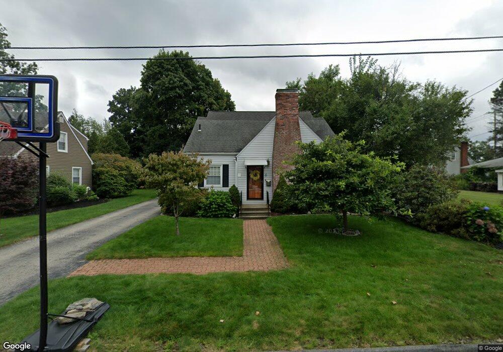
6 Birmingham Rd Worcester, MA 01606
Burncoat NeighborhoodEstimated Value: $446,000 - $604,000
4
Beds
2
Baths
2,100
Sq Ft
$239/Sq Ft
Est. Value
About This Home
This home is located at 6 Birmingham Rd, Worcester, MA 01606 and is currently estimated at $501,611, approximately $238 per square foot. 6 Birmingham Rd is a home located in Worcester County with nearby schools including Belmont Street Community School, Jacob Hiatt Magnet School, and Chandler Magnet.
Ownership History
Date
Name
Owned For
Owner Type
Purchase Details
Closed on
Jun 17, 2010
Sold by
Nordahl Erik and Nordahl Stephanie M
Bought by
Simpson Christopher J and Simpson Shauna M
Current Estimated Value
Home Financials for this Owner
Home Financials are based on the most recent Mortgage that was taken out on this home.
Original Mortgage
$242,250
Outstanding Balance
$162,834
Interest Rate
5.03%
Mortgage Type
Purchase Money Mortgage
Estimated Equity
$338,777
Purchase Details
Closed on
Feb 27, 2002
Sold by
Est Cranston Wilfred and Gabriel Robert R
Bought by
Nordahl Erik and Favulli Stephanie M
Home Financials for this Owner
Home Financials are based on the most recent Mortgage that was taken out on this home.
Original Mortgage
$144,608
Interest Rate
6.85%
Mortgage Type
Purchase Money Mortgage
Create a Home Valuation Report for This Property
The Home Valuation Report is an in-depth analysis detailing your home's value as well as a comparison with similar homes in the area
Home Values in the Area
Average Home Value in this Area
Purchase History
We collect this data history from publicly available records. To have your information removed, we recommend requesting removal directly through your county’s website.
| Date | Buyer | Sale Price | Title Company |
|---|---|---|---|
| Simpson Christopher J | $255,000 | -- | |
| Nordahl Erik | $145,000 | -- |
Source: Public Records
Mortgage History
We collect this data history from publicly available records. To have your information removed, we recommend requesting removal directly through your county’s website.
| Date | Status | Borrower | Loan Amount |
|---|---|---|---|
| Open | Simpson Christopher J | $242,250 | |
| Previous Owner | Nordahl Erik | $185,000 | |
| Previous Owner | Nordahl Erik | $144,608 |
Source: Public Records
Tax History
| Year | Tax Paid | Tax Assessment Tax Assessment Total Assessment is a certain percentage of the fair market value that is determined by local assessors to be the total taxable value of land and additions on the property. | Land | Improvement |
|---|---|---|---|---|
| 2025 | $5,612 | $425,500 | $107,900 | $317,600 |
| 2024 | $5,475 | $398,200 | $107,900 | $290,300 |
| 2023 | $5,277 | $368,000 | $93,800 | $274,200 |
| 2022 | $4,873 | $320,400 | $75,100 | $245,300 |
| 2021 | $4,762 | $292,500 | $60,100 | $232,400 |
| 2020 | $4,621 | $271,800 | $60,100 | $211,700 |
| 2019 | $4,396 | $244,200 | $54,000 | $190,200 |
| 2018 | $4,391 | $232,200 | $54,000 | $178,200 |
| 2017 | $4,186 | $217,800 | $54,000 | $163,800 |
| 2016 | $4,219 | $204,700 | $40,900 | $163,800 |
| 2015 | $4,108 | $204,700 | $40,900 | $163,800 |
| 2014 | $4,000 | $204,700 | $40,900 | $163,800 |
Source: Public Records
Map
Nearby Homes
- 435 Burncoat St
- 7 Hartford Rd
- 5 Hartford Rd
- 3 Hartford Rd
- 9 Hartford Rd
- 429 Burncoat St
- 5 Birmingham Rd
- 3 Birmingham Rd
- 7 Birmingham Rd
- 11 Hartford Rd
- 441 Burncoat St
- 12 Birmingham Rd
- 9 Birmingham Rd
- 15 Hartford Rd
- 11 Birmingham Rd
- 6 Michigan Rd
- 8 Hartford Rd
- 427 Burncoat St
- 6 Hartford Rd
- 14 Birmingham Rd
Your Personal Tour Guide
Ask me questions while you tour the home.