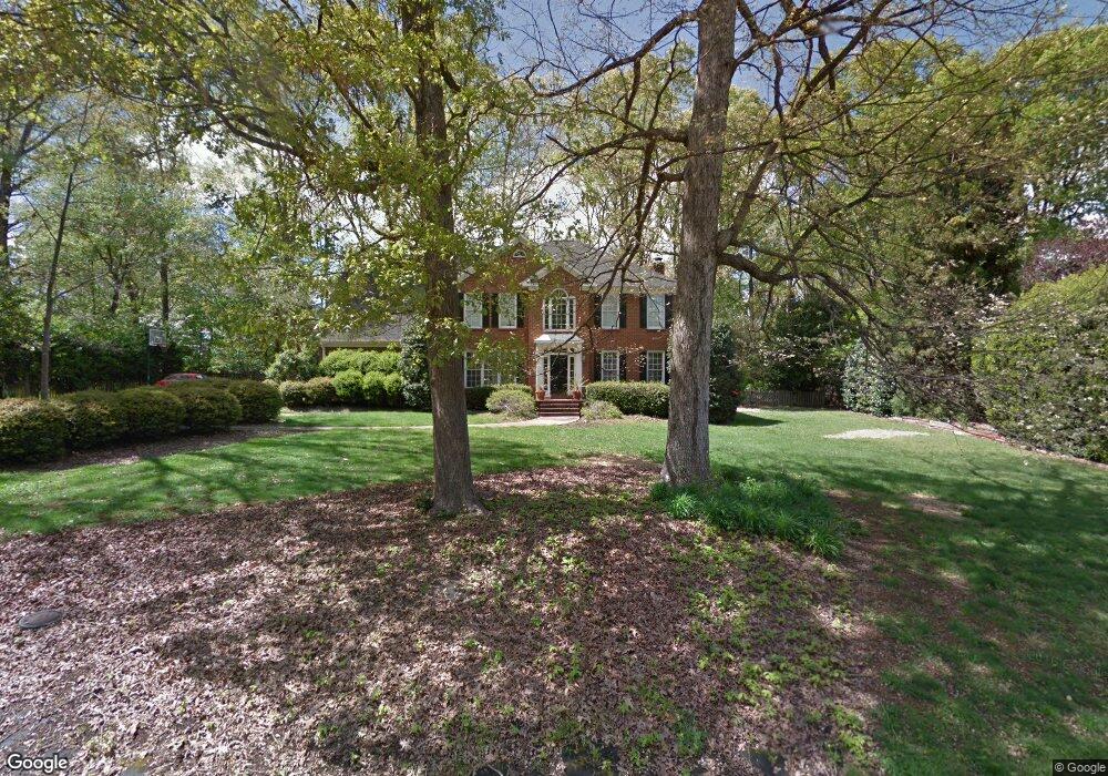
6 Bobcat Trail Simpsonville, SC 29681
Estimated Value: $642,000 - $687,000
4
Beds
3
Baths
3,192
Sq Ft
$205/Sq Ft
Est. Value
About This Home
This home is located at 6 Bobcat Trail, Simpsonville, SC 29681 and is currently estimated at $654,713, approximately $205 per square foot. 6 Bobcat Trail is a home located in Greenville County with nearby schools including Monarch Elementary, Mauldin Middle School, and Mauldin High School.
Ownership History
Date
Name
Owned For
Owner Type
Purchase Details
Closed on
Apr 15, 2021
Sold by
Meacham Diane P and Meacham Keith G
Bought by
Volz Daniel and Volz Lindsay
Current Estimated Value
Home Financials for this Owner
Home Financials are based on the most recent Mortgage that was taken out on this home.
Original Mortgage
$363,760
Outstanding Balance
$326,131
Interest Rate
3.1%
Mortgage Type
New Conventional
Estimated Equity
$328,582
Create a Home Valuation Report for This Property
The Home Valuation Report is an in-depth analysis detailing your home's value as well as a comparison with similar homes in the area
Home Values in the Area
Average Home Value in this Area
Purchase History
| Date | Buyer | Sale Price | Title Company |
|---|---|---|---|
| Volz Daniel | $454,700 | None Available |
Source: Public Records
Mortgage History
| Date | Status | Borrower | Loan Amount |
|---|---|---|---|
| Open | Volz Daniel | $363,760 |
Source: Public Records
Tax History
| Year | Tax Paid | Tax Assessment Tax Assessment Total Assessment is a certain percentage of the fair market value that is determined by local assessors to be the total taxable value of land and additions on the property. | Land | Improvement |
|---|---|---|---|---|
| 2025 | $2,768 | $20,570 | $4,850 | $15,720 |
| 2024 | $2,768 | $17,890 | $2,600 | $15,290 |
| 2023 | $2,641 | $17,890 | $2,600 | $15,290 |
| 2022 | $2,559 | $17,890 | $2,600 | $15,290 |
| 2021 | $2,326 | $16,350 | $2,600 | $13,750 |
| 2020 | $2,163 | $14,460 | $2,400 | $12,060 |
| 2019 | $2,165 | $14,460 | $2,400 | $12,060 |
| 2018 | $2,302 | $14,460 | $2,400 | $12,060 |
| 2017 | $2,289 | $14,460 | $2,400 | $12,060 |
| 2016 | $2,198 | $361,550 | $60,000 | $301,550 |
| 2015 | $2,190 | $361,550 | $60,000 | $301,550 |
| 2014 | $2,259 | $374,470 | $62,000 | $312,470 |
Source: Public Records
Map
Nearby Homes
- 312 English Oak Rd
- 305 Stone Dale Dr
- 5 Thurlow Ct
- 3 Thurlow Ct
- 200 Polo Dr
- 304 Woodruff Lake Way
- 11 Lake Valley Ct
- 3 Cedarhill Ct
- 119 Birch Hill Way
- 200 Birch Hill Way
- 223 Woodruff Park Ln
- 219 Woodruff Park Ln
- 301 Cypress Hill Ct Unit (Cypresshill)
- 103 Oak Meadow Dr
- 109 Woodglen Dr
- 100 Wolf Run Dr
- 12 Moss Wood Cir
- 313 Squires Creek Rd
- 107 Fernbank Ct
- 108 Mineral Ct
- 2 Woodstone Dr
- 19 Somerleaf Way
- 2 Bobcat Trail
- 14 Somerleaf Way
- 244 English Oak Rd
- 6 Woodstone Dr
- 304 English Oak Rd
- 9 Bobcat Trail
- 15 Somerleaf Way
- 240 English Oak Rd
- 308 English Oak Rd
- 100 Bobcat Trail
- 101 Bobcat Trail
- 10 Somerleaf Way
- 10 Woodstone Dr
- 247 English Oak Rd
- 9 Somerleaf Way
- 6 Somerleaf Way
- 241 English Oak Rd
- 5 Woodstone Dr
Your Personal Tour Guide
Ask me questions while you tour the home.