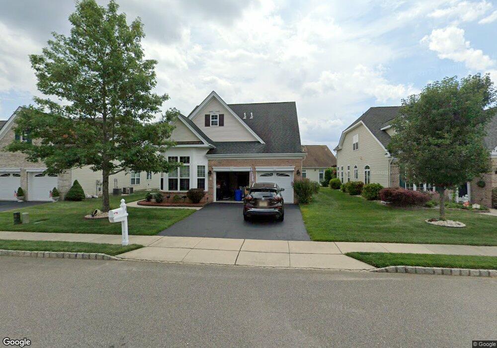
6 Hingham Ln Barnegat, NJ 08005
Barnegat Township NeighborhoodEstimated Value: $489,000 - $509,000
3
Beds
3
Baths
2,170
Sq Ft
$230/Sq Ft
Est. Value
About This Home
This home is located at 6 Hingham Ln, Barnegat, NJ 08005 and is currently estimated at $498,390, approximately $229 per square foot. 6 Hingham Ln is a home located in Ocean County with nearby schools including Barnegat High School.
Ownership History
Date
Name
Owned For
Owner Type
Purchase Details
Closed on
Mar 2, 2011
Sold by
Pizzo Patrick and Pizzo Ronnie
Bought by
Pizzo Patrick and Pizzo Ronnie
Current Estimated Value
Purchase Details
Closed on
Aug 27, 2008
Sold by
Dorsi Jonathan and Dorsi Tara
Bought by
Pizzo Patrick and Pizzo Ronnie
Home Financials for this Owner
Home Financials are based on the most recent Mortgage that was taken out on this home.
Original Mortgage
$230,000
Outstanding Balance
$154,221
Interest Rate
6.69%
Mortgage Type
Purchase Money Mortgage
Estimated Equity
$344,169
Create a Home Valuation Report for This Property
The Home Valuation Report is an in-depth analysis detailing your home's value as well as a comparison with similar homes in the area
Home Values in the Area
Average Home Value in this Area
Purchase History
We collect this data history from publicly available records. To have your information removed, we recommend requesting removal directly through your county’s website.
| Date | Buyer | Sale Price | Title Company |
|---|---|---|---|
| Pizzo Patrick | -- | Chicago Title Insurance Co | |
| Pizzo Patrick | $275,000 | Chicago Title Insurance Co |
Source: Public Records
Mortgage History
We collect this data history from publicly available records. To have your information removed, we recommend requesting removal directly through your county’s website.
| Date | Status | Borrower | Loan Amount |
|---|---|---|---|
| Open | Pizzo Patrick | $230,000 |
Source: Public Records
Tax History
| Year | Tax Paid | Tax Assessment Tax Assessment Total Assessment is a certain percentage of the fair market value that is determined by local assessors to be the total taxable value of land and additions on the property. | Land | Improvement |
|---|---|---|---|---|
| 2025 | $7,603 | $246,600 | $66,200 | $180,400 |
| 2024 | $7,179 | $246,600 | $66,200 | $180,400 |
| 2023 | $6,947 | $246,600 | $66,200 | $180,400 |
| 2022 | $6,947 | $246,600 | $66,200 | $180,400 |
| 2021 | $6,295 | $246,600 | $66,200 | $180,400 |
| 2020 | $6,883 | $246,600 | $66,200 | $180,400 |
| 2019 | $6,782 | $246,600 | $66,200 | $180,400 |
| 2018 | $6,730 | $246,600 | $66,200 | $180,400 |
| 2017 | $6,619 | $246,600 | $66,200 | $180,400 |
| 2016 | $6,483 | $246,600 | $66,200 | $180,400 |
| 2015 | $6,278 | $246,600 | $66,200 | $180,400 |
| 2014 | $6,118 | $246,600 | $66,200 | $180,400 |
Source: Public Records
Map
Nearby Homes
- 3 Weymouth Ct
- 16 Plymouth Way
- 52 Plymouth Way
- 56 Woodchuck Dr
- 54 Woodchuck Dr
- 24 Norwalk Ln
- 14 Raccoon Ln
- 16 Raccoon Ln
- 18 Raccoon Ln
- 6 Wadsworth Place
- 41 Black Bear Dr
- 46 Hatteras Way
- 53 Hatteras Way
- 76 Portland St
- 2 Mayport Ln
- 6 Jolly Roger Rd
- 4 Jolly Roger Rd
- 8 Jolly Roger Rd
- 1999 Breakers Dr
- 39 Newport St
Your Personal Tour Guide
Ask me questions while you tour the home.