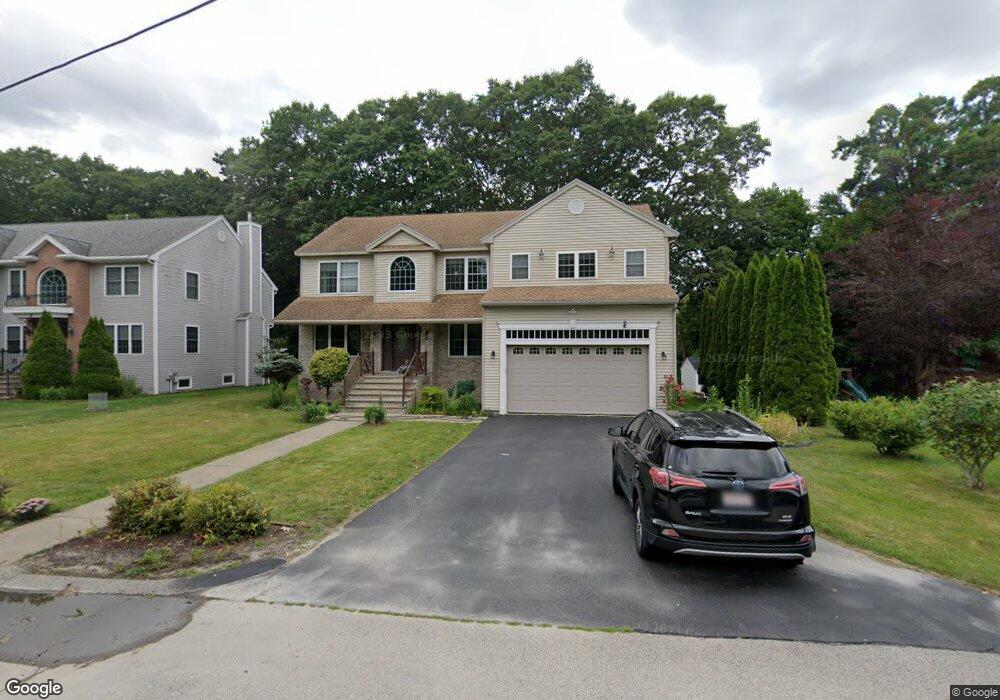
6 Mcclintock Ave Worcester, MA 01604
Broadmeadow Brook NeighborhoodEstimated Value: $664,000 - $777,000
4
Beds
3
Baths
3,000
Sq Ft
$239/Sq Ft
Est. Value
About This Home
This home is located at 6 Mcclintock Ave, Worcester, MA 01604 and is currently estimated at $717,678, approximately $239 per square foot. 6 Mcclintock Ave is a home located in Worcester County with nearby schools including Jacob Hiatt Magnet School, Chandler Magnet, and Rice Square Elementary School.
Ownership History
Date
Name
Owned For
Owner Type
Purchase Details
Closed on
Jun 10, 2025
Sold by
Porras Raul I and Deporras Maria C
Bought by
Porras Alfredo R and Porras Maria C
Current Estimated Value
Purchase Details
Closed on
Mar 22, 2005
Sold by
Digioia Luigi
Bought by
Porras Raul I and Deporras Titina
Home Financials for this Owner
Home Financials are based on the most recent Mortgage that was taken out on this home.
Original Mortgage
$200,000
Interest Rate
5.64%
Mortgage Type
Purchase Money Mortgage
Create a Home Valuation Report for This Property
The Home Valuation Report is an in-depth analysis detailing your home's value as well as a comparison with similar homes in the area
Home Values in the Area
Average Home Value in this Area
Purchase History
We collect this data history from publicly available records. To have your information removed, we recommend requesting removal directly through your county’s website.
| Date | Buyer | Sale Price | Title Company |
|---|---|---|---|
| Porras Alfredo R | -- | None Available | |
| Porras Alfredo R | -- | None Available | |
| Porras Raul I | $470,000 | -- | |
| Porras Raul I | $470,000 | -- |
Source: Public Records
Mortgage History
We collect this data history from publicly available records. To have your information removed, we recommend requesting removal directly through your county’s website.
| Date | Status | Borrower | Loan Amount |
|---|---|---|---|
| Previous Owner | Porras Raul I | $200,000 |
Source: Public Records
Tax History
| Year | Tax Paid | Tax Assessment Tax Assessment Total Assessment is a certain percentage of the fair market value that is determined by local assessors to be the total taxable value of land and additions on the property. | Land | Improvement |
|---|---|---|---|---|
| 2025 | $8,440 | $639,900 | $118,300 | $521,600 |
| 2024 | $8,275 | $601,800 | $118,300 | $483,500 |
| 2023 | $8,015 | $558,900 | $102,900 | $456,000 |
| 2022 | $7,546 | $496,100 | $82,300 | $413,800 |
| 2021 | $7,538 | $463,000 | $65,900 | $397,100 |
| 2020 | $7,560 | $444,700 | $65,900 | $378,800 |
| 2019 | $7,610 | $422,800 | $59,300 | $363,500 |
| 2018 | $7,492 | $396,200 | $59,300 | $336,900 |
| 2017 | $7,331 | $381,400 | $59,300 | $322,100 |
| 2016 | $7,514 | $364,600 | $43,300 | $321,300 |
| 2015 | $7,318 | $364,600 | $43,300 | $321,300 |
| 2014 | $7,124 | $364,600 | $43,300 | $321,300 |
Source: Public Records
Map
Nearby Homes
- 31 Blithewood Ave Unit 701
- 31 Blithewood Ave Unit 1201
- 7 Miscoe Rd
- 1260 Grafton St
- 4 Ellen St
- 32 Dolly Dr
- 37 Dupuis Ave
- 22 Duluth St
- 259 Massasoit Rd
- 20 Duluth St
- 2 Woodcliffe Ave
- 15 Primrose St
- 13 Pocasset St
- 41 Westview Ave
- 44 Pine Hill Rd
- 27 A-B Grafton St
- 11 Whitla Dr
- 16 Svenson Ave
- 76 Valmor St
- 469 Lake Ave
- 8 Mcclintock Ave
- 50 Blithewood Ave
- 30 Mcclintock Ave
- 20 Mcclintock Ave
- 44 Blithewood Ave
- 36 Brierway Dr
- 54R Blithewood Ave
- 56 Blithewood Ave
- 0 Mcclintock Ave
- 54 Blithewood Ave
- 54 Blithewood Ave Unit 1
- 34 + 36 Mcclintock Ave
- 40 Brierway Dr
- 32 Brierway Dr
- 64 Blithewood Ave
- 51 Blithewood Ave
- 33 Mcclintock Ave
- 34 Mcclintock Ave
- 55 Blithewood Ave
- 55 Blithewood Ave Unit Basement
Your Personal Tour Guide
Ask me questions while you tour the home.