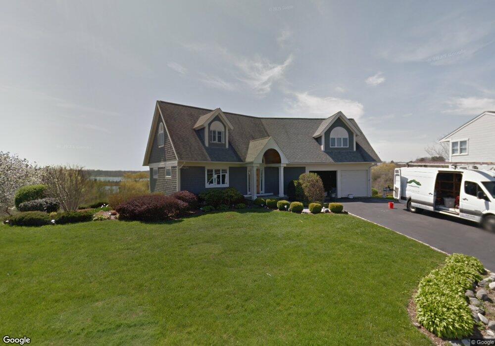
6 Overlook Dr Bristol, RI 02809
Mount Hope High School NeighborhoodEstimated Value: $1,397,787 - $1,888,000
About This Home
This home is located at 6 Overlook Dr, Bristol, RI 02809 and is currently estimated at $1,623,697, approximately $456 per square foot. 6 Overlook Dr is a home located in Bristol County with nearby schools including Mt. Hope High School, Highlander Charter Middle and High School, and Our Lady of Mt. Carmel School.
Ownership History
We collect this data history from publicly available records. To have your information removed, we recommend requesting removal directly through your county’s website.
Purchase Details
Purchase Details
Home Values in the Area
Average Home Value in this Area
Purchase History
We collect this data history from publicly available records. To have your information removed, we recommend requesting removal directly through your county’s website.
| Date | Buyer | Sale Price | Title Company |
|---|---|---|---|
| -- | -- | ||
| $1,075,000 | -- |
Mortgage History
We collect this data history from publicly available records. To have your information removed, we recommend requesting removal directly through your county’s website.
| Date | Status | Borrower | Loan Amount |
|---|---|---|---|
| Previous Owner | $400,000 | ||
| Previous Owner | $136,000 |
Tax History
We collect this data history from publicly available records. To have your information removed, we recommend requesting removal directly through your county’s website.
| Year | Tax Paid | Tax Assessment Tax Assessment Total Assessment is a certain percentage of the fair market value that is determined by local assessors to be the total taxable value of land and additions on the property. | Land | Improvement |
|---|---|---|---|---|
| 2025 | $13,191 | $954,500 | $507,900 | $446,600 |
| 2024 | $13,191 | $954,500 | $507,900 | $446,600 |
| 2023 | $12,752 | $954,500 | $507,900 | $446,600 |
| 2022 | $12,409 | $954,500 | $507,900 | $446,600 |
| 2021 | $12,666 | $880,800 | $524,000 | $356,800 |
| 2020 | $12,393 | $880,800 | $524,000 | $356,800 |
| 2019 | $12,085 | $880,800 | $524,000 | $356,800 |
| 2018 | $12,768 | $830,200 | $521,200 | $309,000 |
| 2017 | $10,783 | $722,700 | $446,700 | $276,000 |
| 2016 | $10,674 | $722,700 | $446,700 | $276,000 |
| 2015 | $10,139 | $722,700 | $446,700 | $276,000 |
| 2014 | $9,123 | $698,580 | $356,600 | $341,980 |
Map
- 117 Fales Rd
- 6 Varnum Ave
- 9 Doran Ave
- 2 King St
- 3 King St
- 32 Ridge Rd
- 19 Waterman St
- 18 Waterman St
- 28 Eveready Ave
- 37 Lincoln Ave
- 6 Wilson St
- 2 Wilson St
- 3 Knowlton Ct
- 6 Murphy Ave
- 44 Bradford St Unit 49
- 341 Thames St Unit 104
- 341 Thames St Unit 302
- 40 Congregational St
- 18 State St Unit 5
- 423 Hope St Unit D
- 4 Overlook Dr
- 13 Vantage Point Dr
- 5 Overlook Dr
- 1 Overlook Dr
- 12 Vantage Point Dr
- 11 Vantage Point Dr
- 15 Fort Hill Rd
- 19 Sunnyside Ave
- 13 Fort Hill Rd
- 10 Vantage Point Dr
- 28 Sunnyside Ave
- 22 Fort Hill Rd
- 9 Vantage Point Dr
- 20 Sunnyside Ave
- 16 Fort Hill Rd
- 17 Sunnyside Ave
- 26 Sunnyside Ave
- 14 Fort Hill Rd
- 11 Fort Hill Rd
- 15 Adelaide Ave
Ask me questions while you tour the home.